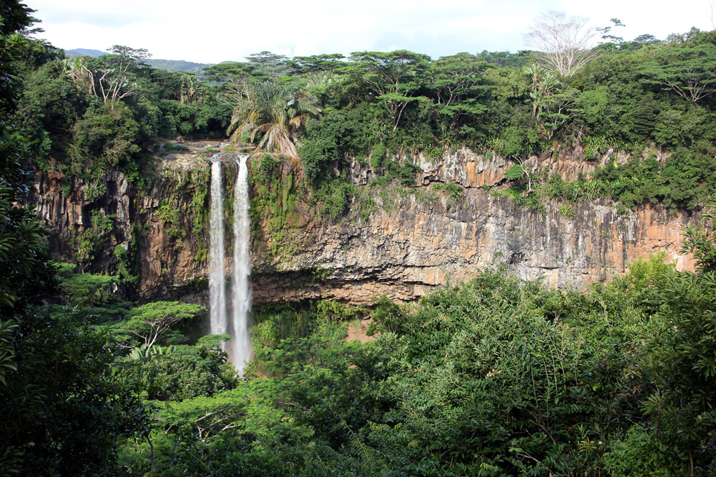
Chamarel Waterfall located near Chamarel village ( Chamarel is a small town in the southwest of Mauritius with about 700 inhabitants, which is known for the natural beauties in its surroundings ) in Riviere Noire County and partly (to the east) in Savan County, Mauritius.
This waterfall is fed by the Saint-Denis and Viande-Salée rivers and is about 100 meters high. The period when the flow is the most important is between December and April, because of the heavy summer rains and the cyclonic period. A promontory offers an overhanging point of view it is also possible to go down and swim there.
The Chamarel falls are definitely the most famous and recognized waterfalls in Mauritius
Access : Coordinates: -20.425094, 57.391686 /The Waterfall located in the Black River District, in the southwestern part of the country, 30 km south of Port Louis is the capital of the country.
Highlights :
- Chamarel Adventure Park : There : A 12 hectare leisure and discovery park in Chamarel nestled in the heart of a tropical forest. It is home to endemic plants.
- Best time to visit : The period between May to December is preferable to plan your visit to the Chamarel Waterfalls as the weather remains pleasant in Mauritius.
- Entrance fees: 200 MUR / opening hours : N/A.
Go next : Chamarel village / Seven Colored Earth / Black River Gorges National Park / Trou Aux Cerfs – Also known as the Murr’s Volcano / Rochester Falls / The nearest larger town is Vacoas, 17.0 km northeast of Chamarel.