Graskop is a small tourist town in Thaba Chweu Municipality in Ehlanzeni District , in the South African province of Mpumalanga.
The village originated in 1880 as a gold mining camp, but has since developed into a significant center of the forest industry. There are quite a few plantations and also sawmills in the area. The diggings were on the farm Graskop of Abel Erasmus. Today all the gold mines are closed and the village renowned as a high altitude tourist resort, ideally located on the panoramic road allowing to reach several tourist sites in the east of the province.
Access : Coordinates: -24.931667, 30.841667 / Graskop located in Mpumalanga province, South Africa.
Highlights :
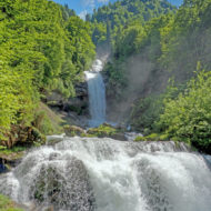
- Graskop is a renowned high altitude tourist resort, ideally located on the panorama route allowing to reach several tourist sites in the east of the province such as: Mac Mac pools. Approximately 15 km on the R532 towards Sabie. / Mac Mac Falls. Approximately 12km on the R532 towards Sabie / Pilgrim’s rest / Kowyn Pass. 2 km on the R 533 towards Hazyview / pinnacle. Free-standing rock needle at the edge of the cliff. / God’s Window. Impressive view from a small ledge down into the depths and, with good visibility, well over the Lowveld 700 m below. / Wonder View. Viewpoint similar to God’s Window, but far less touristy and free. Access via the R534. / Lisbon Falls. Approximately 10 km on the R532 towards Blyde River / Berlin Falls. Approximately 13 km on the R532 towards Blyde River.
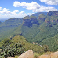
- Blyde River Canyon. The third largest canyon in the world.
- A special feature are macadamia nuts, which are offered here on the side of the road by informal traders.
- Graskop is located on the Drakensberg escarpment and is also known as the “edge of the Lowveld”.
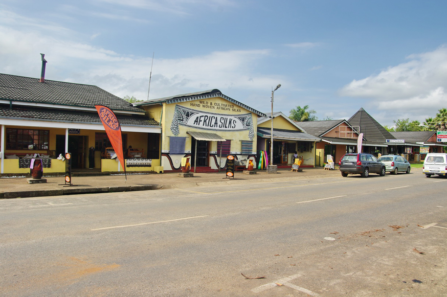
- In the Africa Silks shop on the main street you can watch the silk weavers at work. The associated silkworm farm is halfway between Graskop and Buschbuckridge.
Go next : Graskop is on the R532 trunk road, which links the village to Sabie to the south and is part of the Panorama Route, and the R533, which runs west to Pilgrim’s Rest.