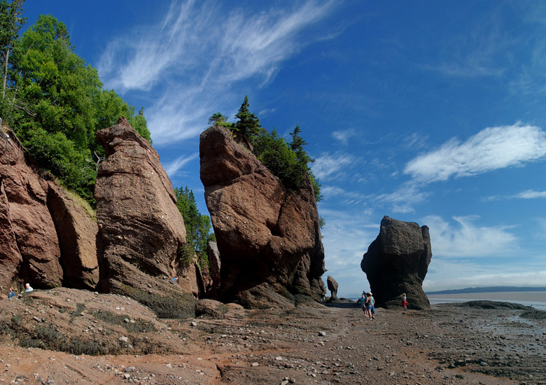
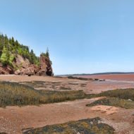
The Hopewell Rocks, also called the Flowerpots Rocks or simply The Rocks, are rock formations caused by tidal erosion in The Hopewell Rocks Ocean Tidal Exploration Site in New Brunswick.- Canada.
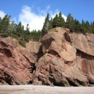
They stand 40–70 feet tall. They are located on the shores of the upper reaches of the Bay of Fundy at Hopewell Cape near the end of a series of Fundy coastal tourism hubs including Fundy National Park and the Fundy Trail.
Due to the extreme tidal range of the Bay of Fundy, the base of the formations are covered in water twice a day. However, it is possible to view the formations from ground level at low tide.
The formations consist of dark sedimentary conglomerate and sandstone rock. The large volume of water flowing in to and out of the Bay of Fundy modifies the landscape surrounding it. After the retreat of the glaciers in the region following the last ice age, surface water filtering through cracks in the cliff has eroded and separated the formations from the rest of the cliff face. Meanwhile, advancing and retreating tides and the associated waves have eroded the base of the rocks at a faster rate than the tops, resulting in their unusual shapes.
The vast sediment planes in the basin in Fundy supports a variety of biological productivity. Various shorebirds are often seen flocking to nest and feed in the area. Visitors are advised to stay for a full tidal cycle to get a full appreciation of the tides and formations. Although the tides vary from day to day, the high tide can be as high as 16 metres (52 ft) giving the Hopewell Rocks one of the highest average tides in the world.
On March 14, 2016, a part of one of the Hopewell Rocks, Elephant Rock, collapsed. Park officials said approximately 100 to 200 tonnes of rock fell to the ground. “Sometime after the tide went out this morning, a significant piece of Elephant Rock calved off, closing off a whole section or a whole passageway where we used to walk,” said Kevin Snair, supervisor of interpretive services at the Hopewell Rocks.

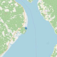
Access : Coordinates: 45.823333, -64.573333 / From Halifax, Nova Scotia take Route#102 north to Truro, then Route #104 west (TCH) to the New Brunswick border, where it becomes Route #2. At Exit 467 east of Moncton, take Route #15 and follow the signs for Fundy National Park. At Riverview, turn south on Route #114.
Distance/Time: 340 km; 3 to 4 hours / From Sussex, take highway #1, to Exit 211, then Route#114 through Fundy National Park to Hopewell Cape. Distance/Time: 100 km 1 1/4 hour .
Facilities / Services : Families & Pets – The Hopewell Rocks park is family-oriented / Park Shuttle Service , The main parking area and entrance kiosk for the Hopewell Rocks park are situated on the upper level of a bluff to provide our visitors with access to a spectacular vista of the Bay of Fundy before they walk via wide graveled pathways to various viewing decks, our lower site and the beach area / Food & Picnics : The Hopewell Rocks park has two options for food service on site. / Picnic areas: A number of covered picnic shelters and picnic tables are located throughout the park / Group Tours