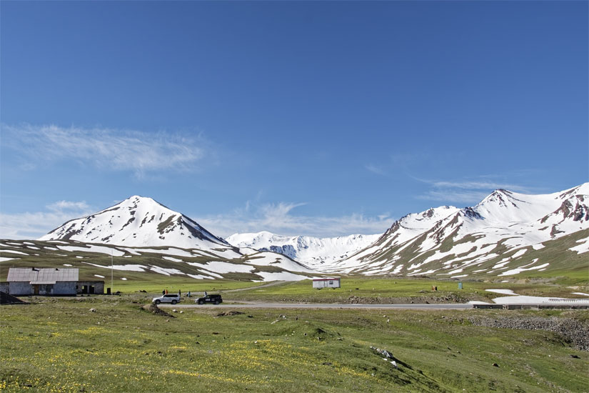
Ala-Bel pass is one of the main “control points” on the Bishkek-Osh highway. It is located at an altitude of 3175 m above sea level on Talas Oblast, in the northwestern part of the country, 140 km southwest of the capital Bishkek. ( Kyrgyzstan ).
The pass connects the Suusamyr Valley and the Chychkan Valley. Ascent and descent from the pass are quite gentle.
The M41 highway, an important road link between the two largest cities of Kyrgyzstan – Bishkek and Osh – leads over the 3184 m high Alabel Pass. The Suusamyr ridge range stretches south of the mountain pass, and Talas-Alatau rises to the north. To the west of the Alabel pass, the Chychkan river valley leads south to the Toktogul reservoir. To the east, the trunk road leads down into the Suusamyr valley, after 18 km the road branches off to the left over the Otmok pass to Talas.
Access : Coordinates: 42.245559, 73.053461 /
Highlights :
- Ala-Bel is 3 175 meters above sea level
- The Chychkan and Suusamyr rivers start from the south-west and north-east of the pass, respectively.
- The highest point nearby is 3,653 meters above sea level, 1.9 km north of Pereval Ala-Bel.
- Ala-Bel pass is a bridge between the Suusamyr valley and the Chychkan gorge.
Note : Snow falls early in the fall and avalanches thicken in the winter, blocking parts of the road and making traffic difficult.
Activities : sightseeing / photo opportunities / trekking
Go next : Too-Ashuu pass (3800 m above sea level), the Suusamyr valley, the Ala-Bel pass (3200 m), the Chychkan conservation zone, the Toktogul reservoir, the Kek-Bel pass (2700 m) and access to the Ferghana valley