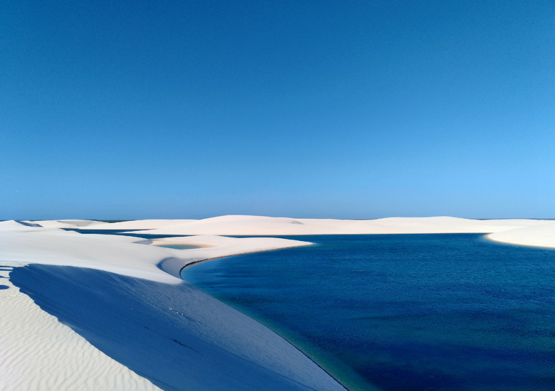
National Park (Parque Nacional dos Lencois Maranhenses) is a national park located in Maranhao state, in northeastern Brazil, just east of the Baia de Sao Jose, between 02?19’—02?45’ S and 42?44’—43?29’ W. It is an area of low, flat, occasionally flooded land, overlaid with large, discrete sand dunes. It encompasses roughly 1,500 km2 (580 sq mi), and despite abundant rain, supports almost no vegetation. The area became a National Park on June 2, 1981.
The Lencois Maranhenses : Composed of large, white, sweeping dunes, at first glance Lencois Maranhenses looks like an archetypal desert, but in fact it is not an actual one. Lying just outside the Amazon Basin, the region is subject to a regular rain season during the beginning of the year. The rains cause a peculiar phenomenon: fresh water collects in the valleys between sand dunes and is prevented from percolating down by a layer of impermeable rock which lies underneath the sand. The resulting blue, green and black “lagoons” are surrounded by the desert-like sand, and reach their fullest between July and September.
The lagoons have large numbers of fish that arrive when the lagoons are at their fullest after July, when they are interconnected to rivers such as the Rio Negro. One species of fish, the wolf fish or tiger fish (Hoplias malabaricus) stays dormant in the mud and moist areas after the majority of the water has evaporated, re-emerging during the next rainy season.
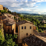
Visiting : Located on the northeastern coast of the state of Maranhao by the banks of the Preguicas River, the park embraces the municipalities of Humberto de Campos, Primeira Cruz, Santo Amaro do Maranhao and Barreirinhas, the latest serving as the main jumping off point into the protected park. There are several regular bus/truck routes between Barreirinhas and Sao Luis, Brazil (Maranhao’s capital), a distance of about 260 km (160 mi). There are also air taxis from Sao Luis to Barreirinhas. The Rio Preguicas river connects the park to Atins, a small town at the southern edge of the park. The most important access roads near the park are BR-135, BR-222, MA-404, and MA-225. Lencois Maranhenses National Park : Location Northeastern Maranhao, Brazil .Coordinates: 02°32S 43°07W
Area 1550 km² , Designation National park , Established 1981 Governing body IBAMA
(Parque Nacional dos Lencois Maranhenses) is a national park located in Maranhao state, in northeastern Brazil, just east of the Baia de Sao
the Lencois Maranhenses from Rio, but no matter where you originate, you’ll need to fly to Sao Luis (SLZ). There, you’ll take a Denilson Viagens van to the town of Sangue, then transfer to a 4×4 truck, which will take you two hours into the dunes—the town of Santo Amaro. Check into a local pousada (I recommend booking one, such as Pousada Agua Doce, in advance), then relax for the night before taking an adventure like the one I describe above.
The National Park is quite extensive and has no direct access roads. Because of the nature of the park’s protected status, most vehicles are not permitted access. Entrance to the park is made exclusively by 4wheel drive trucks.
Go next : Baia de Sao /