Phang Nga Bay is a 400 km² bay in the Andaman Sea between the island of Phuket and the mainland of the Malay Peninsula in southern Thailand. Since 1981, a wide section of the bay has been protected as the Ao Phang Nga National Park. The Park is located in Phang Nga province.
The beauty of Phang Nga Bay is amazing. Among the glistening emerald green waters scattered limestone malts with bizarre shapes. Some look like camel humps, others look like overgrown turnips. Some of the rocks rise hundreds of meters above the water. The limestone rocks are perforated by countless caves and tunnels. The walls of many of them are covered with ancient paintings of people, animals and fish, from the ceilings hang huge stalactites that resemble columns of temples.
The bay area is popular with tourists. The bay is a national park, as well as a Phang Nga Marine National Park was declared a protected Ramsar site (No. 1185) of international ecological importance on August 14, 2002.
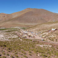
Access : Coordinates: / Pang Nga Bay is close to Phuket and Krabi, but the easiest and easiest way to get there is from the city of Pang Nga. The city is about half the distance between Phuket and Krabi, about an hour from the tourist city of Khao Lak and the Khao Sok Nature Reserve. There are many marinas near the city where you can rent a longtail boat for a trip to the bay.
Highlights :
- In 1981, most of the bay was declared a protected area by Ao Phang Nga National Park. Mangrove forests, which encircle a significant part of the bay, are rich in animals – monkeys, otters, dolphins, sea turtles, many species of birds and fish.
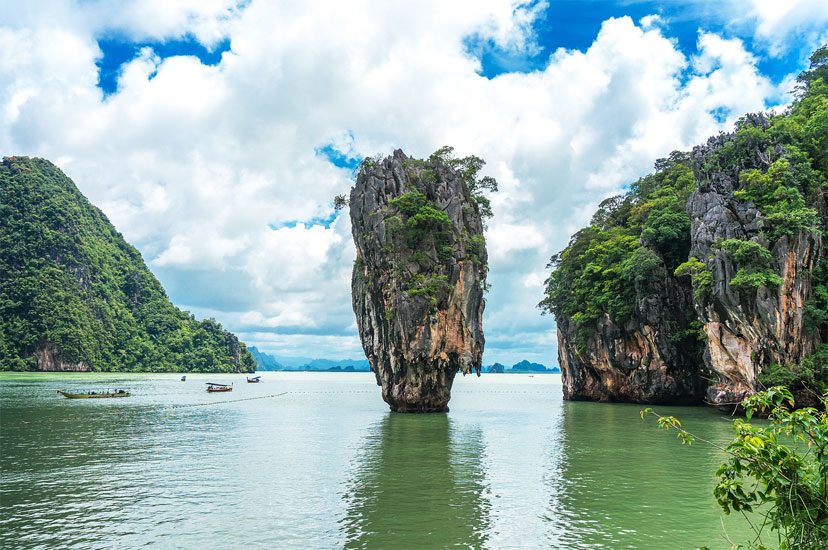
- There are dozens of islands in the bay, large and small, many of which are worthy of the Guinness Book of Records because of their beauty or because of their strange shape. These islands have Thai names that describe their shape: dog mount (Khao Mah Ju), female breasts (Ko Nom Sao), nail island (Ko Tapu), better known as James Bond Island.
- Ko Ping Gan and Ko Tapu. The literal translation of Ko Ping Gan is “islands supporting each other” and Ko Tapu means “nail island”.These are the most famous islands in the Phang Nga Bay, they came to popularity along with the film “The Man with the Golden Gun” from the James Bond series of films.
- Ko Panyee (Muslim Village) is another attraction near the James Bond Island. The place was inhabited at the end of the 18th century by Malay fishermen who found a comfortable living space in a sheltered bay.
- Ko Talu Nok – the meaning of the word Talu is “hole” or “through hole”. And in fact, he lives up to his name. This is an island with many caves and lagoons.
- Next to Koh Panai (Flag Island) is a small pile fishing village with a temple attached to the rocks.
Fees and permits : Entry to the park is 300 baht for an adult and 100 baht for a child
Activities : sightseeing / photo opportunities / Sea-canoeing / kayaking around Hong Island, rest on the beach of Naka Island.
Go next : Phang Nga , a town on the Northern Andaman Coast in Thailand. / Krabi , the capital of Krabi Province,