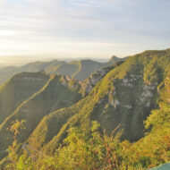
SC-390 is the name of the steep climb of a steep and narrow zigzag road in the Serra do Rio do Rastro, a mountain range in the southeast of the state of Santa Catarina, Southern Brazil.
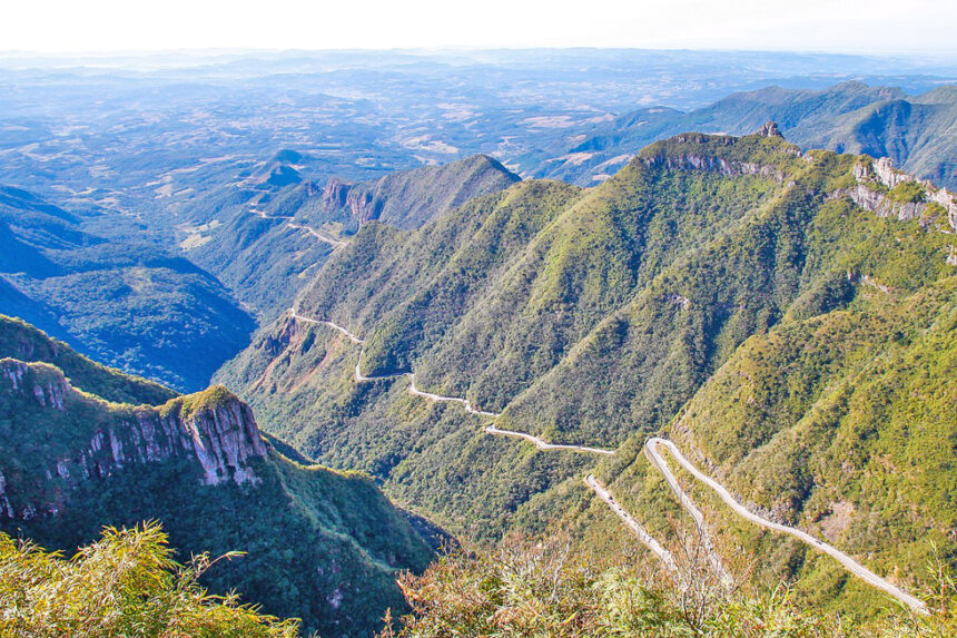
The route of the SC-390 highway is characterized by steep climbs and sharp curves, as well as its kiosks.The road is 8 miles long and has a total of 250 curves, taking you from 4,500 feet to sea level in minutes… Starting in Santa Catarina, the climb is 7 km. Over this distance, the positive difference is 646 meters. The average percentage is 9.2%.
Serra do Rio do Rastro is the most famous road in Brazil and one of the most impressive roads in the world. The SC-390 highway recently won the title of “Carretera Asombrosa” – Spectacular Road- from a Spanish magazine poll.
Access : Coordinates: / The Serra do Rio do Rastro is located in the state of Santa Catarina, in the extreme south of the country.
Highlights :
- At the viewpoint – mirante you can enjoy a panoramic view from the road to the mountain range, located in the city of Bom Jardim da Serra. In the same area, there is a cafe and restaurant , where travelers stop for lunch, as well as some shops selling local products.
Go next : The coldest city in Brazil is Sao Joaquim da Serra, about 20 miles away from the Serra do Rio do Rastro.