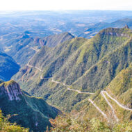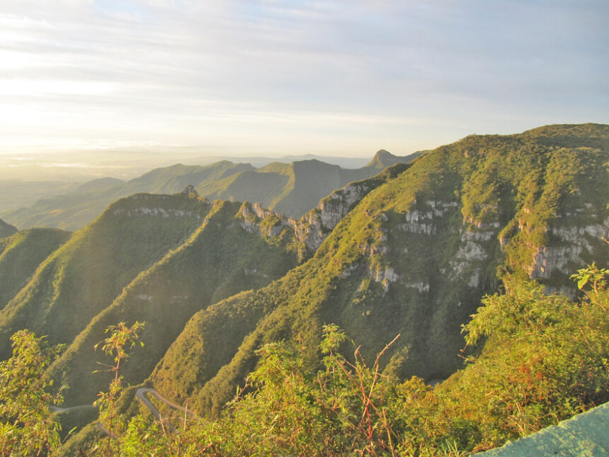
The Serra do Rio do Rastro is a mountain range in the south of the state of Santa Catarina, Brazil.
The Rio do Rastro mountain range is part of a classic stratigraphic column of the ancient Gondwana supercontinent in Brazil, the White Column, having been classified as one of the Brazilian geological sites by the Brazilian Commission of Geological and Paleobiological Sites.
This mountain range is located between the municipalities of Lauro Müller and Bom Jardim da Serra and its highest point is located 1,460 meters above sea level.
The Serra do Rio do Rastro road offers spectacular bends, surrounded by forests and waterfalls. This region constitutes one of the tourist hotspots of the State.
Access : Coordinates: -28.407222, -49.546111 / Serra do Rio do Rastro located in the southeast of the state of Santa Catarina.
Highlights :
- The SC-390 highway passes through this mountain range / An observatory located at its summit offers a panoramic view.
- At the top of the mountain, be sure to also visit the Ronda Canyon. The place offers beautiful landscapes and also has a wind farm.
- Cascata da Barrinha is a small but beautiful waterfall, easily accessible, just 7.6 km from the Serra viewpoint.
- Serra do Rio do Rastro is located in the south of the state of Santa Catarina. The main accesses are: Through São Joaquim and Urubici, following Bom Jardim da Serra (over the Serra). Via Criciúma or Tubarão, following Lauro Müller (under the mountains).The viewpoint at the top of the mountain is 11 km from Bom Jardim, 20 km from Lauro Müller, and 200 km from Florianópolis. The accesses are all paved
Go next : The Funil canyon is close to Serra do Rio do Rastro. / The Laranjeiras canyon, which is a little further away and is , a spectacular gorge.