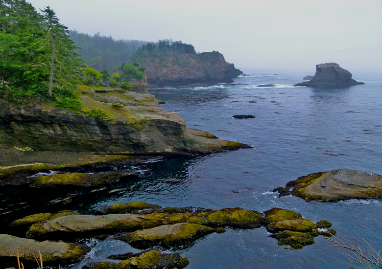
Cape Flattery is the northwestern most point of the contiguous United States.
It is in Clallam County, Washington on the Olympic Peninsula, where the Strait of Juan de Fuca joins the Pacific Ocean. It is also part of the Makah Reservation, and is the northern boundary of the Olympic Coast National Marine Sanctuary. Cape Flattery can be reached from a short hike, most of which is boardwalked. The westernmost point in the contiguous United States is at Cape Alava, south of Cape Flattery in Olympic National Park. However, the westernmost tip of Cape Flattery is almost exactly as far west as Cape Alava, the difference being approximately 5 seconds of longitude, about 360 feet (110 m), at high tide and somewhat more at low tide.
The Cape Flattery Lighthouse is on Tatoosh Island, just off the cape. Makah Bay and Neah Bay are on either side of the cape. Neah Bay, Washington is the closest town to the cape.
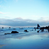
Cape Flattery is the northwestern most point of the contiguous US, where the Strait of Juan de Fuca joins the Pacific Ocean. Cape Flattery is a good 2 1/2 hours from Sequim. The 1.5 mile out and back boardwalk trail weaves through coastal forests and provides spectacular views of the rugged rocks, birds, and jade waters of the Pacific Ocean.
History : Cape Flattery is the oldest permanently named feature in Washington state, being described and named by James Cook on March 22, 1778. Cook wrote: “… there appeared to be a small opening which flattered us with the hopes of finding an harbour … On this account I called the point of land to the north of it Cape Flattery.
In 1834, the first Japanese known to have arrived in what is now Washington state arrived in a dismasted, rudderless ship that ran aground near Cape Flattery. The three survivors of the broken ship were held as slaves by the local Makah people before being taken to Fort Vancouver by William H. McNeill under orders from John McLoughlin.

Features: Birding — Swimming — Views — Wildlife Family Friendly: Easy to follow wide trails.
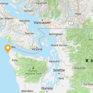
LOCATION : Olympic Peninsula (Olympic National Park)- Pacific Coast Cape Flattery OLYMPIC PENINSULA
Access : Cape Flattery is located on the Makah Reservation and is the most northwest point in the contiguous United States. From Port Angeles: Follow WA-113/WA-112 west to Cape Flattery Road Follow Cape Flattery Road approximately 7 miles. Look for signs for the Cape Flattery Trail on the right side of the road.
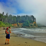
Activities: Photography, Backpacking, Hiking
Regulations, etc. : Dogs on leash: Dobermans, Rottweilers, pit bulls not permitted on the Makah Reservation , $10 Makah Recreation Permit required: available at various outlets in Neah Bay Restrooms at trailhead picnic area at Cape Flattery more questions? Olympic National Visitor Information: (360) 565-3130 Makah Cultural and Research Center: (360) 645-2711
Nearby Attractions : Cape Flattery Distance: 0.31 mi , Shi Shi Beach Road Outdoors,Hiking and Nature,Beach Distance: 7.0 mi , Makah Cultural & Research Center Sights and Museums,History Museum Distance: 5.72 mi , Shi Shi Beach Outdoors,Beaches and Watersports,Beach Distance: 7.79 mi , ruby beach washington.