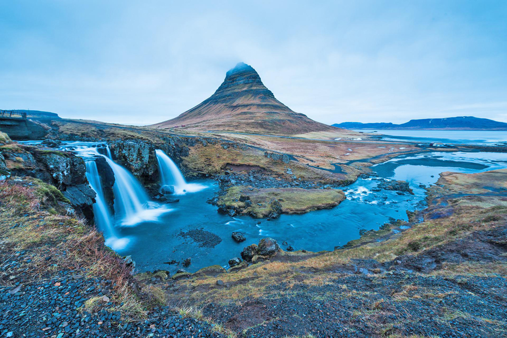
Kirkjufell is a 463 m high mountain on the northern coast of Iceland’s Snæfellsnes peninsula, near the town of Grundarfjörður. It is also called the Sugar Peak.
Kirkjufell has steep slopes on all sides, abraded by glaciers during the glaciations.
Due to its peculiar shape and the beautiful scenery around, Kirkjufell is popular with tourists, many of whom make the ascent to the top of the mountain.The ascent of the mountain is only recommended for those with a head for heights in stable, dry weather conditions and can be undertaken from the southwest end. The trail is sometimes hard to find. In the upper area there are ropes with knots in three places as a climbing aid.
It is said to be the most photographed mountain in the country.
Access : Coordinates:64.941036, -23.30569 / Mount Kirkjufell (463 m) is located in western Iceland.
Highlights :
- Besides being a mountain, Kirkjufell also has two waterfalls.
- Three abandoned farms were located to the northeast at the base of the mountain on the peninsula. The last of these farms was abandoned in 1945.
- The mountain and its surroundings were sometimes used as a film location for the series production of Game of Thrones.
- The Kirkjufell also adorns the album cover of German metalcore band Heaven Shall Burn’s eighth studio album Wanderer from 2016.
Go next : Grundarfjörður , a town in the north of the Snæfellsnes peninsula in the west of Iceland.