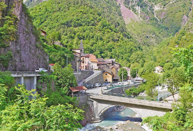
Saint-Sauveur-sur-Tinee is a small mountain town – center of the Vallee de Tinee ( The Tinée valley is the longest in the Alpes-Maritimes department ) located in the department of Alpes-Maritimes, in the region Provence-Alpes Cote d’Azur. in canton of Saint-Sauveur-sur-Tinée in southeastern France.
the site of Saint Sauveur is probably occupied since prehistory, but it is the Roman period which, first, left us evidence of a permanent occupation,The Roman road that connected Cemenelum -Cimiez to Ebrodunum – Embrun crossed the Tinee at Saint-Sauveur.
A priory founded in the 6th century by Benedictine monks would be at the origin of the village , It is mentioned as fortified habitat in the first half of the thirteenth century.The parish is mentioned in the twelfth century in the cartulary of the cathedral of Nice , a castle was on the rocky spur overlooking the current village, 300 meters to the east where we see some traces.
Saint-Sauveur-sur-Tinee is located At the end of the spectacular Mescla gorges in the Alpes-Maritimes, in the middle of the mountain at the gateway to the Mercantour National Park, and nestled in a loop of the river of the Tinee.
Thanks to the creation of the college in 1961, the establishment of the Gendarmerie platoon of Haute Montagne in 1971, the increase of tourism, and the many subsequent achievements, the village was able to preserve all its vitality while preserving its identity.
Access : Coordinates: 44.0847, 7.1056 / In Nice-ouest take the direction of Digne-Grenoble. At the Mescla, confluence of the Var and Tinee, take the Metropolitan 2205 direction Saint Sauveur Sur Tinee, Auron, Isola 2000./
Get around : there is bus service between Nice and the Tinee valley. a Nice-Auron bus (by the Santa Azur company) passing through St. Sauveur.
Attractions :
- the gorges of Valabres after St-Sauveur-sur-Tinee / Chapel of the White Penitents, early 17th century
- the Saint-Michel church (15th century), with a classified Romanesque bell tower, houses an altarpiece by G. Planeta (1583), one of the last painters of the Gothic period.The building is registered as a historical monument on December 12, 1939
- the chapel of the Saint-Blaise of the cemetery, 1785 / Saint Roch Chapel , Located to the south-east of the village was built in the 16th or the first half of the 17th century.
- hiking trails : You can discover them through the marked hiking trails, including the famous GR5 and GR 52A hiking trails that run through the town.
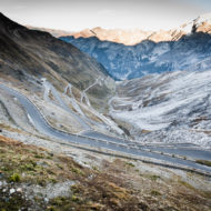
- The route : The road through St. Sauveur continues up the Upper Tinee Valley, via Isola, Auron, St. Etienne-de-Tinee and over the Col de la Bonette pass 54 km north,( the highest of Europe)
- flour mill , The town had two flour mills in the rue du Giegn, called “the small” and “the big”, fed by a channel drifting the water of the Tinee.It is set in motion by a horizontal turbine was rebuilt in 1874.
Activities : Camping, Municipal Camping ,15 jun – 15 Sept / Fitness trail / Hiking: hiking to Mt St Sauveur at 2.711 m, the hamlet of Mollieres and the hamlet of Abeliera / Fishing / Scenic Driving- Auto Touring.
Go next : Roure / Roubion / Rimplas / Isola / Ilonse / Valdeblore / Tournefort / Clans / La Colmiane / Bairols / Massoins / Beuil / Pierlas