Seattle, Washington sits at one of the most beautiful spots in the United States.
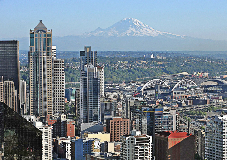
Occupying a narrow isthmus between the Puget Sound and Lake Washington, it is the biggest city in the Pacific Northwest, with four million people calling the area home. Seen from above, carpets of evergreen trees, pristine blue waters, and snowy white mountains surround the downtown’s metallic skyscrapers, earning the city its nickname The Emerald City.
On the ground, you will find a vibrant and cosmopolitan city. Next to the progressive downtown and the freewheeling feel of Capitol Hill, you can find a laid-back atmosphere in the districts to the north and ethnically diverse neighborhoods to the south. The many restaurants, coffee shops and microbreweries are worth indulging in after a day spent strolling through the city’s many parks and beaches or admiring the arts and architecture. And just outside the hectic city are snow-covered mountains, evergreen forests, and stunning coastline to explore. Even for the bold and the adventurous, it’s hard to get enough of Seattle.
Districts
Most visitors to Seattle tend not to venture beyond Downtown, the International District, and the Seattle Center. That’s a shame, since neighborhoods like Capitol Hill, West Seattle, and those north of the ship canal are where much of the fun actually is!
Seattleites usually divide the town by districts roughly divided as listed below. Although there are formally 30 neighborhoods and their boundaries are not always clear, there’s usually a proud feature that represents each neighborhood.:
Downtown and surrounding neighborhoods.
Downtown
Seattle’s commercial and financial core, home to the waterfront, the Pike Place Market, and some of the most stunning architecture in the city. The northern area of Belltown has a collection of many of the city’s best, if not most expensive, restaurants and bars.
Pioneer Square and International District
The oldest neighborhoods of Seattle, containing classic buildings, art galleries, innumerable restaurants, and the Chinatown.
Queen Anne and South Lake Union
Perched on the hills northwest of Downtown, here you will find wealthy neighborhoods peppered with panoramic parks. On the area’s south is the newly developed commercial center of South Lake Union (home of the rapidly growing Amazon headquarters), and the Seattle Center with its Space Needle.
Capitol Hill and Central District
The nightlife and retail core of Pike-Pine at the west meets the quiet, diverse residences of Madison Park at the east. This area is also the gay capital of Seattle.
North of the Lake Washington Ship Canal
Ballard
A mostly residential area, home to the canal locks. The area is known for its Scandinavian heritage, chic boutiques, and the thriving historic Downtown Ballard.
Fremont and Wallingford
The self-proclaimed “center of the universe”, a bohemian (though rapidly gentrifying) area noted for its public art.
University District (commonly called the “U District”)
Home to the sprawling University of Washington campus, numerous inexpensive eateries, and plenty of entertainment.
North Seattle
The city’s mostly residential and gently gentrifying northernmost tier, bordering Shoreline. It contains many of the largest and prettiest parks of Seattle. Noticeable commercial activity is present in the Northgate, Aurora, and Lake City neighborhoods.
South of Downtown and I-90
SoDo and Georgetown
Continuing south of Downtown past the sports stadiums, this industrial district contains the well-hidden but thriving Georgetown neighborhood.
South Seattle
A mostly residential area bordering Lake Washington, served by light rail and home to Jefferson and Seward Parks.
West Seattle
A scenic residential area with great parks, ample beaches and wonderful vistas over the harbor and Downtown.
While in Seattle you will likely hear reference to the “Eastside”, which refers to the region east of Lake Washington comprising the suburbs of Bellevue, Kirkland, and Redmond.
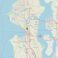
Access : Coordinates: 47.609722, -122.333056 / By plane : 1 Seattle-Tacoma International Airport (SEA IATA), nicknamed “Sea-Tac”, is located in the city’s southern suburbs 14mi/22.5 km south of downtown Seattle. It’s a major domestic hub for Alaska, Northwest and West Coast destinations, and also handles many international trans-Pacific routes, as well as some flights to major European airports and Dubai. In addition, the airport is well-connected to virtually every part of the US, with multiple daily flights to many major US cities, as well as to Alaska and Hawaii. Alaska Airlines uses this airport as its primary hub and is by far the biggest carrier here, with Delta catching up with an international hub here and an increasing number of domestic destinations.
The reliable Central Link light rail connects the University of Washington, Capitol Hill, the downtown area, and South Seattle to Sea-Tac. Bus route 560 provides direct service from Sea-Tac to West Seattle.
Alternate airports
2 Paine Field (PAE IATA), also known as Snohomish County Airport, about 30 miles away from downtown Seattle, will serve limited commercial flights from September 2018 from Alaska, United, and Southwest Airlines. With plans for only two gates and operation at full capacity, don’t expect much in the way of relaxation here.
The much-smaller Bellingham International Airport, located about 90 minutes (94mi/150km) north of Seattle in Bellingham, can be used as a cheaper alternative to fly into Seattle, despite the scarcity of flights. Low-cost carrier Allegiant Air flies to its West Coast hubs year-round from Bellingham (and not from Sea-Tac), in addition to seasonal flights by Alaska Airlines. The Bellair Airporter shuttle offers scheduled services from Bellingham International Airport to the Washington State Convention Center in downtown Seattle and to Sea-Tac.
Portland International Airport, about 3 hr (160mi/256km) south of Seattle in Portland, is a major airport, but smaller than Sea-Tac, and is another alternative to fly into Seattle, especially with low-cost carriers Spirit Airlines and Volaris (flights from Mexico). There are no direct shuttle services from Portland International Airport to Seattle, but there are Greyhound, Bolt Bus and Amtrak services from downtown Portland to downtown Seattle.
Private aircraft and seaplane
Private aircraft can use 3 King County International Airport (BFI IATA), universally known as Boeing Field. It’s also south of the city, but much closer to town than Sea-Tac airport.
Seaplane service is available between Seattle and various island destinations throughout Washington state and British Columbia. Kenmore Air operates year-round scheduled floatplane services from their terminal on Lake Union to the San Juan Islands and Victoria, and summer flights from their base at Kenmore on Lake Washington’s north end to Nanaimo, Campbell River and many other destinations in northern British Columbia. Wheeled plane service is also offered from Boeing Field to Friday Harbor and Eastsound airports. A ground shuttle service is available from the Lake Union and Boeing Field terminals to Sea-Tac.
Air charter companies such as Monarch Air Group and Mercury Jets fly a variety of private charter aircraft and jets, from charter luxury Gulfstreams down to economical piston twins for small groups and individuals.
By train : Amtrak provides service from the 4 King Street Station, located south of downtown near CenturyLink Field. The Amtrak Cascades runs four trains daily between Seattle and Portland (two of which continue to Eugene, Oregon) and two a day to Vancouver, British Columbia. Additional service from Portland to Eugene and from Seattle to Vancouver is offered on the Amtrak Thruway Motorcoach. These trains are more reliable schedule-wise than the long distance trains and offer certain amenities not available on regular Amtrak trains, such as more space for bikes, more laptop outlets, a “Bistro Car” which serves local foods and wine, and the occasional movie.
Seattle is also served by two long-distance sleeper trains, the Coast Starlight which runs daily between Seattle and Los Angeles via Portland and Emeryville (San Francisco), and the Empire Builder which also runs daily between Seattle and Chicago via Spokane, Glacier National Park, Minneapolis, and Milwaukee.
From the Puget Sound area, Sounder commuter trains might be an option, if you can work with their commuter-oriented schedules. They also run special services such as for sports events. Sounder trains run to Seattle on weekday mornings, and from Seattle back to the suburbs in the evenings, although there are a limited number of reverse-commute runs. Trains connect north to Everett, Mukilteo, and Edmonds, and south to Lakewood, Tacoma, Puyallup, Sumner, Auburn, Kent, and Tukwila.
By car : Interstate 5 (I-5) is the major north-south roadway entering the City Center and the most direct way to drive to or from Vancouver and Portland. This roadway is notably congested (even during non-commuting hours), see other options in the sections “by Bus” and “by Train” above. Interstate 405 (I-405) runs parallel to I-5, bypassing the City Center on the opposite side of Lake Washington.
Interstate 90 (I-90) is the only long-distance route to access Seattle from the east, and is the easiest way to reach Spokane and Eastern Washington. During the Winter months, drivers must be mindful of the weather conditions over Snoqualmie Pass, located 52 miles east of the city, when the roadway can close unexpectedly due to weather conditions.
By bus : Except for Greyhound Lines, there is no designated long-distance bus terminal in Seattle, so all bus services have their own stops scattered around the city. A number of them do have stops at the Greyhound Terminal (503 S Royal Brougham Way), in front of the King Street Station at 303 S King St and/or at Door 00 (south end at lower level of the terminal) at the Sea-Tac airport. See below:
5 BellAir Airporter, (bus stops) Washington State Convention Center, Convention Place (prior reservations only) (Enter tunnel under the upper floors of the Convention Center building from 9th & Pike.). Goes up to Stanwood, Burlington/Mt Vernon, Bellingham & Blaine on one route, a separate route to Anacortes in the San Juan Islands, and from Sea-Tac to Cle Elum, Ellensburg & Yakima on another route.
6 BoltBus, (bus stop) 5th Ave S and S King St next to the International District/Chinatown transit station. Service from Eugene, Albany, and Portland, OR, Bellingham, WA, and Vancouver, BC. $1 if lucky up to $30.
Cantrail/Amtrak Cascades Thruway, (bus stop) King Street Station. Operates Seattle to Vancouver, BC $40 for one-way, $75 round trip discounts for students, military, seniors & children ages 4-11.
7 Greyhound, (Depot) 503 S Royal Brougham Way, SoDo (Along Royal Brougham between 6th Ave & the “Stadium” Light Rail Station. A right turn at Royal Brougham from the light rail station, opposite side of the tracks.). Greyhound travels primarily on I-5 (Seattle-Vancouver & Seattle-Portland on two separate routes. Some southbound buses continue to Los Angeles contiguously), 90/82 (Seattle-Ellensburg-Yakima-Pasco-Stanfield, OR) & 90 (Seattle-Spokane). Passengers transfer to other buses in Portland, Pasco, Spokane, Ellensburg, and/or Stanfield to get to other cities & towns in the U.S. and in Vancouver, BC to get to other cities in Canada. Prices are various depending on your destination.
Northwestern Trailways (Northwestern Stage Lines), (bus stops) Greyhound bus depot & King Street Amtrak station. Shuttle service to Spokane (via Everett, Stevens Pass, Leavenworth, and Wenatchee) or Tacoma. $51 one way to Spokane, $97 round trip.
Travel Washington Dungeness Line (Operated by Olympic Bus Lines), (bus stops) Greyhound bus depot (see above), King Street Station, selected hospitals (by reservation only), SeaTac Airport. Connects Seattle to Port Townsend, Sequim and Port Angeles. The bus goes across the Puget Sound on the Edmonds-Kingston ferry. They also pick-up and drop off at the major hospitals, west of downtown with an advance 24 Hr reservation (Arnold Medical Pavilion, Harborview, Poly-Clinic, VA, Swedish and/or Virginia Mason). One way: $39 from downtown, $49 from airport; Round trip: $69 from downtown, $79 from airport.
8 Quick Shuttle, (bus stops) downtown: outside the Best Western at 200 Taylor Ave N Pier 66 & 91, SeaTac Airport: At the main terminal near south end of baggage claim, outside door 00, bays 11-16. Runs between Seattle and Vancouver, BC. Vancouver to Downtown Seattle: $36 one-way, $65 round-trip Vancouver to SeaTac airport: $49 one-way, $87 round-trip. Despite the multiple stops they make, northbound buses can only pick-up in the U.S. and drop off in Canada and vice versa for southbound buses.
Wheatland Express, (bus stops) Southcenter, NW corner Novilhos Brazilian Steak House, 12405 SE 38th Street, Bellevue. Every Friday, the Weekend Express takes you from Pullman (where Washington State University is at) and Moscow to Seattle, and the other way round every Sunday. A special service is also deployed during the holiday season. Journeys take more than 6 hours. $99.00 one way (weekend express), $210.00 one way (vacation service).
By public transit
Sound Transit. Sound Transit operates all-day express bus service between Downtown and the cities of Tacoma, Lakewood, Bellevue, Everett, and many other outlying communities. $2.75 within King County, $3.75 cross-county.
Community Transit buses are commuter routes traveling between Snohomish County (north of the city) and Downtown or the University District during peak hours only.
By ferry :
Ferries are the primary mode for commuters living on the opposite sides of the Puget Sound from Tacoma/S Vashon Island (in the south) through Seattle/Kitsap Peninsula to Anacortes/San Juan Islands (in the north), since the sheer distance and the shipping traffic on the Sound make building a bridge difficult. For tourists, it’s also a fantastic way to see some very picturesque views of the city and the surrounding country, be sure to bring a camera!
9 King County Water Taxi. King County Water Taxi provides ferry service from Pier 50 of Seattle’s waterfront weekdays only during rush hour (5:30-8AM and 4:30-7PM) to Vashon Island, and all-day service (schedule is seasonally dependent) to West Seattle. $5.50, $4.75 if using ORCA.
10 Victoria Clipper, 2701 Alaskan Way Pier 69 (Alaskan Way & Clay St). High speed catamaran passenger ferries which connect Seattle to Victoria, British Columbia and the San Juan Islands. If you are heading to San Juan Islands, you can also join a whale-watching tour. About $45 (one way), $65 (round trip with advance reservation) to San Juan Islands $95 (single trip), $120 (round trip with advance reservation) to Victoria. Fares vary slightly depending on season.
Washington State Ferries. All ferries carry vehicles, bicycles, and passengers.
11 Colman Dock, 801 Alaskan Way (Pier 52). Connects Downtown Seattle to Bainbridge Island and Bremerton on the Kitsap Peninsula.
12 Fauntleroy Ferry Terminal, 4829 SW Barton St. Connects West Seattle to Vashon Island and Southworth on the Kitsap Peninsula.
By cruise ship
Seattle is the main departure city for cruise ships heading towards Alaska or western Canada’s fjords. Cruise ships to Seattle may be docked at one of two terminals in the Port of Seattle.
13 Bell Street Pier Cruise Terminal at Pier 66, 2225 Alaskan Way S Pier 66, near the middle of Seattle’s downtown waterfront. Serves as home port for Norwegian Cruise Line and Celebrity Cruises. Has bus, taxi and shuttle connections for transfer of passengers and luggage. For travelers with connecting flights, Seattle-Tacoma International Airport is less than 15 mi (24 km) away.
14 Smith Cove Cruise Terminal at Pier 91, 2001 W Garfield St, at the north end of Seattle’s downtown waterfront. Serves as home port to Holland America Line, Royal Caribbean and Princess Cruises. Other cruise lines may also use this terminal if the vessel is too large to use the Pier 66 terminal.
By private boat
Seattle has a variety of large marinas offering year-round guest moorage. The two marinas located on the shores of Elliott Bay, Elliott Bay Marina, and Bell Harbor Marina, are the closest to Downtown. Shilshole Bay Marina is located in the northern suburbs and is further away from most of the visitor attractions. There are numerous freshwater marinas on Lake Union, Portage Bay, and the Lake Washington Ship Canal, but these require passage through the Hiram M. Chittenden Locks. Visitors may also consider moorage in the neighboring cities of Edmonds, Everett, Des Moines, Kirkland, and Kingston.
Bell Harbor Marina, 2203 Alaskan Way. Bell Harbor Marina, located at the base of Bell Street in Downtown’s Belltown neighborhood, is the closest marina to Downtown and is a comfortable walk to Pike Place Market, Westlake Center, the Seattle Aquarium, and other waterfront attractions. Reciprocal moorage is available year-round, and in the summer months, reservations are recommended.
Elliott Bay Marina, 2601 West Marina Place. Elliott Bay Marina is a private marina located on the north shore of Elliott Bay in the Magnolia neighborhood. This marina has expansive guest moorage and many premium services. A 10-minute walk from all-day bus service to Downtown Seattle.
Shilshole Bay Marina, 7001 Seaview Ave. N.W. Shilshole Bay Marina is a gigantic marina located in the Ballard neighborhood. It is a 20-30 minute drive to Downtown and is not served directly by public transportation.
Get around
Seattle’s public transportation system, while no rival for Chicago or New York City, is one of the top 10 in the United States and is by far the most convenient and simple way to get around the city. While public transportation is also good in suburbs such as Bothell and Everett, if you plan on visiting those areas you may wish to use a car. Driving a car in Seattle is possible, but the frequent and awful traffic congestion can leave you frustrated. Parking in Downtown and many of the adjacent neighborhoods (such as Capitol Hill) is all but impossible. Seattle is also one of the most bicycle-friendly cities in the country. Car services such as ZipCar, Car2Go, Lyft, and Uber are also convenient and safe transportation options.
Orientation
Seattle’s street designations are generally easy to remember once you understand them. Most of the city is laid out in a grid, with north-south roads called Avenues and east-west roads being Streets. There are occasional irregularities: Ways are long roads that don’t always conform to the grid, Drives are long, circuitous routes, and there’s the occasional very short Place or Court.
Seattle has a somewhat convoluted address system that can be confusing to the uninitiated. Outside the downtown area, the city is divided into 7 compass directional sectors (N, NE, NW, W, E, S, SW no SE section), with the name of the sector applied to every road that passes through that sector. Streets are written with the sector before the name (e.g. NE 45th Street or NE 45th) while avenues are written with the sector after the name (e.g. 45th Avenue NE or 45th NE). Roads within the downtown area (as well as some avenues east of Downtown and some streets north of Downtown) have no directional designation. Take this into consideration when looking for directions to a specific address.
When locals give you directions, they may refer to an intersection (especially in the case of a bus stop). The first road mentioned is the street it is at, followed by the crossing street adjacent to the stop, but sometimes they neglect to specify whether it’s an “avenue” or a “street,” so inquire to be sure and you’ll avoid the risk of winding up in the wrong part of the city!
On foot
Walking is highly encouraged for short trips, especially if your destination is within Downtown or Capitol Hill. While the streets and drivers are generally friendly for pedestrians, do keep your street smarts and avoid walking alone in the southern part of Downtown, International District, or the SoDo neighborhood at night. For more information about street safety, look at the “Stay Safe” section.
Seattle pedestrians are noted for their unusual refusal to jaywalk. Unlike many other large American cities (particularly those on the East Coast), in Seattle, you’ll see groups of pedestrians patiently wait for the light to change before stepping off the curb, even when there isn’t a car in sight. The reasons for it are unclear, though it’s often suggested that the local police are particularly strict about enforcing the jaywalking law.
The block layout in the downtown area is pretty compact; a walk from Denny Way to Yesler Way should take roughly half an hour. Walking from the Waterfront towards I-5 in Downtown (particularly between Seneca St and Yesler Way) is steep and will leave you gasping for breath at every intersection! Outside the downtown area, especially Capitol Hill or the northern and western parts of the city, there are many hills (albeit less hilly and steep than San Francisco). In fact, walking is a great form of exercise in Seattle, with abundant jogging tracks in the parks and longer trails like the Burke Gilman Trail, which runs along the northern side of the ship canal and the western rim of Lake Washington.
By public transit
ORCA Card
The ORCA card is a contactless fare card that enables you to transfer seamlessly between Seattle and the Puget Sound’s various transit agencies, similar to Hong Kong’s Octopus or London’s Oyster. The card is $5, and you must put in a minimum of $5 to start using it. You can add money or monthly passes to the card. Day passes are also available for $8 and can be used for all bus and train services.
You can purchase, add value to, or add a pass to an ORCA card at vending machines in many transit centers, inside all Link Light Rail and Sounder stations, at Metro’s customer service centers, over the phone, and at many QFC & Safeway supermarkets. Youth and Senior ORCA cards can only be issued by mail or at Metro’s main customer service center next to King Street Station in the International District and require proof of age (click here for details). You can also acquire these cards in the mezzanine of Westlake Station — however, this customer service center is open only on the first and last 4 business days of the month.
To pay the correct fare when riding Link Light Rail or Sounder trains, tap when you enter and exit the station. On all other public transit — buses, streetcars, Washington State Ferries, and the Water Taxi — just tap when you enter. For 2 hours after your first tap, you can use as many public transportation services as you like while only paying once for the highest fare (not applicable on Washington State Ferries).
Electronic pass
Another alternative to buying transportation tickets is through the Transit GO app. You may buy them using a debit or credit card at anytime and activate it only when you are about to use any public transportation system within the city, except for the Washington State Ferries. The catch however is that you cannot transfer your fare between transportation agencies; a separate ticket must be purchased.
By bus
King County Metro (commonly referred to as Metro) is the primary public transportation agency in King County and Seattle. The transportation system is easy to navigate, and most visitor attractions are served by frequent bus routes. Metro’s buses are clean and comfortable and are driven by friendly and skilled operators. Most buses, especially on routes in the Center City, are brand-new and air-conditioned — perfect on one of Seattle’s hot summer days. The agency provides two types of bus services:
Local Service constitutes the majority of bus routes and are operated by green, blue, or purple buses. These buses are identified by route numbers between 1 and 399.
RapidRide is an express Bus Rapid Transit service with modern, 3-door, red and yellow buses. RapidRide buses are an efficient way to get to many outlying neighborhoods and are identified by route letters.
Buses within Seattle generally operate from 5AM to Midnight and run at least every 30 minutes, with frequent service and RapidRide buses arriving every 5-15 minutes at rush hour. If you are planning on traveling before 6AM or after 9PM be sure to make use of the excellent Trip Planner to make sure you can get to your destination.
Almost all frequent service buses traveling through Downtown have stops along 3rd Ave, with virtually every Downtown bus having a stop near the intersection of 3rd & Pine/Pike. Many high-frequency suburban routes and Link Light Rail utilize the Downtown Seattle Transit Tunnel, which travels underneath 3rd Ave & Pine St. Stations are well-lit and protected by Transportation Police and are equipped with WiFi and cell service.
The adult bus fare is $2.75 at all times and on all routes. The youth (ages 6-18) and senior (ages 65 or older) fare is $1.50 and $1.00, respectively. Up to four children under age 6 can ride free with a paying adult. If you pay by cash (exact change only), you’ll get a paper transfer good for within a 2-hour period to ride other King County Metro buses. An ORCA card allows you to transfer to other transit agencies within the same period of time for free. Note that you’ll only need to tap in when you enter the bus, although in RapidRide, you can tap on the reader before getting on the bus and may board from the center and rear doors.
To figure out how to get to your destination use the excellent Trip Planner which gives you point-to-point directions between points within King County. For real-time arrival times, you can download the One Bus Away app to your smartphone.
When traveling to destinations outside the downtown core, make sure to ask the drivers about the green and white “EXPRESS” signs in their windows or the “VIA EXPRESS” on the road display if they are going to your destination. Some of these express routes are intended for regular commuters traveling between residential neighborhoods and Downtown and make few or no stops between, but may be useful to some visitors.
When in doubt, ask the bus driver or a security guard before boarding. Most employees are knowledgeable about the transportation system (or at least the route the route they are driving) and will be able to help you. Additionally, all buses are fully accessible for wheelchairs and walkers.
By rail
Seattle rail system map
Link Light Rail operates between the University of Washington and Angle Lake Station, stopping in Capitol Hill, Downtown, SoDo, South Seattle, the suburb of Tukwila, and Sea-Tac Airport along the way. Fares are $2.25—$3.25 depending on how far you travel; purchase your ticket at a machine before you board and keep it with you for the whole trip as it may be randomly checked by personnel inside the train. If you use an ORCA card, you must tap at both your origin and your destination station.
The Seattle Streetcar has two lines: The South Lake Union line between Downtown and South Lake Union and the First Hill line between Pioneer Square, the International District and Capitol Hill along Broadway. The former line gained the rather unfortunate moniker “SLUT” (South Lake Union Trolley), and you might hear it referred to as such. The streetcar runs up to every 10 minutes and costs $2.25 per adult, $1.50 per child, and $1 per senior, regardless of distance. You must purchase a ticket or tap your ORCA card at one of the streetcar stops before boarding. Note that these streetcars stop only when requested by pressing the yellow stop request strip.
The Seattle Center Monorail, a legacy of the 1962 World’s Fair, takes you non-stop between Westlake Center (5th Avenue & Pine Street) and the Seattle Center in just 2 minutes, and primarily serves tourists heading from Downtown to the Space Needle. One-way tickets are $2.25 per adult, $1 children ages 5-12/seniors. You can only pay by cash; ORCA card is not valid.
If you need any help ask a transit operator, security guard, fare enforcement official, or a local. Seattleites are always eager to help and may offer help, even if they see you looking confusingly at a tourist map!
By water taxi
The Water Taxi travels between Pier 50 (at the foot of Yesler Way) and Seacrest Park in West Seattle. The scenic ride takes 15 minutes and costs $4.75 (one way, exact change only), or $4 with an ORCA Card. Boats depart every half-hour on weekdays and every hour on weekends during the summer months, with reduced service during the winter.
Washington State Ferries connect to destinations outside of Seattle, and they take ORCA Cards.
By car
Cars are fairly useless for transportation within the city proper, but are a great asset if travelling to the suburbs such as Bellevue/Redmond or Everett/Tacoma. Note that many roads Downtown are one-way, which might require some extra navigation. On weekends, you can often rent cars at locations throughout the city for well under $20/day. One of the challenges in driving in Seattle includes the hilly terrain, especially in Downtown, Capitol Hill and Queen Anne, where you have to be extra careful in applying your brakes.
Outside Downtown, many establishments provide free parking, but in Downtown parking is scarce due to dedicated bike lane developments, and hotels levy exorbitant fees for overnight parking. Street parking is $1 to $3.00 per hour (debit cards and credit cards other than Discover accepted), while a parking ticket can be in excess of $35 for going overtime in a 2-hour zone. Parking meters dispense paper receipts that come with a sticker, which you use instead of putting the receipt on your dashboard. The receipt must be displayed on the curb-side window on the inside of your car (or else someone could steal it to use on their car!). If that sounds confusing, just look at other nearby cars to see how they did it.
When parking on a hill, always apply the parking brake and turn your wheels so that the car will roll into the sidewalk instead of the street if the brakes give out (i.e., when facing uphill, turn toward the street; when facing downhill, turn toward the curb).
Drivers traveling on I-5 between Downtown and Northgate as well as I-90 between Downtown and Bellevue can make use of the express lanes for a generally quick and smooth ride to downtown in the morning, or to the suburbs in the afternoon and evening. Seattle traffic congestion consistently ranks among the worst in the U.S., even though Seattle is only the 20th largest city. This is mainly due to inland waterways causing choke points around the few available bridges.
By taxi
You can call or hail a taxi from any major street in Seattle or most hotels will call them for you. However, most of Seattle’s taxi services are unfriendly and expensive, especially if you are only trying to get around the downtown area. Some taxi drivers will even refuse to take you if your destination is less than 15 blocks away. The fares are regulated by the city government, which consists of:
Flagfall for $2.60
$0.30 for each additional 1/9 mile (a total of $2.70 per mile)
$0.30 for every 36 seconds of waiting time (a total of $0.50 per minute)
$0.50 for each additional passenger above 18 after two.
If you are heading to SeaTac airport from the downtown area, a flat fare of $40 is applied.
The rudeness of some taxi drivers has caused people to avoid taking them and look for ride-hailing alternatives . But should you be in dire need of a taxi, call one of these companies:
Yellow Cab, Orange Cab, Stita Taxi Services, Seattle Airport Limo & Town Car, Seattle Towncar,
By ride-hailing service
If your destination is miles away and you don’t have a car, yet public transportation seems inconvenient for you, you can use ride-hailing services like those provided by Uber or Lyft. Download their app to your phone to reserve a car, register your card for payment, punch in your current location and destination, and a car will be in front of you in no time; as of now only Uber lets you reserve a ride at your choice of time. If you prefer to drive yourself, Car2go, Zipcar or Reachnow (limited to luxurious BMW & Mini) vehicles are abundant, especially in Downtown, Capitol Hill, and University District. Seattleites often prefer this method to taking the reckless and overpriced taxis.
By motorcycle
The rainy weather makes motorcycling difficult but not impossible. Drivers exhibit an alarming obliviousness to motorcycles, and riders should take care to stay well out of a car’s blind spot and preferably ahead of, rather than behind, any car. Motorcyclists get preferred boarding on the ferries and there are many parking spots Downtown reserved for motorcycles.
By bicycle
Cycling is better in Seattle than in most American cities. In fact, during rush hour it’s often faster to bike than to drive! Bicycle usage has increased significantly since the early 2000s and drivers are a little more accustomed to bicycles in Seattle than in other major cities. Your main drawbacks will be the wet roads, the rain, and the hilly terrain, so you might want to pack some raingear. Many major roads in Seattle have properly maintained bicycle lanes, and you are allowed to ride bicycles on all Seattle roads except the Interstates, the State Route 520 floating bridge, and the Alaskan Way Viaduct. King County, including Seattle, requires helmets by law, although it is unevenly enforced. (Police have shifted to focus on education, only issuing the $81 ticket to fewer than 50 people a year since 2015.)
Public transit is very friendly towards bikes. King County Metro buses have bike racks on the front of the bus; just tell the driver you want to mount or dismount your bike. Light rail and streetcars have bike racks towards the center of every car, or you can hold your bike upright if those are full. Ferries welcome bicycles with priority loading and unloading; there is a $1 bicycle surcharge above the passenger fare, but it’s waived if you pay with an ORCA card.
The city maintains a bike map with suggested biking routes for visiting major attractions.
Bicycle transportation in the greater part of Seattle is facilitated further by the Burke-Gilman Trail. This is a paved walking/jogging/cycling trail that winds its way from the north end of Lake Washington, down around the University of Washington, then west along the canal towards Ballard. The trail is on an old railroad right-of-way, so it maintains a very consistent elevation and is excellent for commuting or a casual day’s touring. The Elliott Bay Trail overlooks Puget Sound and starts at the north end of Downtown in Myrtle Edwards Park, continuing north along the shore of Elliott Bay. It is much more scenic than the Burke trail, with gorgeous views of the Olympics and Mt. Rainier, and more quiet since it doesn’t intersect with any roads.
Seattle is host to three new stationless (or dockless) bike share programs. Instead of designated stations, bicycles are left wherever the last user stopped, parked at bike racks or large street corners. You use the companies’ apps on your smartphone to locate and unlock bikes; when you’re done, lock the parking brake and park the bike nearby wherever you happen to be. Unfortunately, none of them rent helmets, which makes them better suited to residents than visitors. They’re also not ideal if you’re traveling with several people, since you’d have to locate a bike for each person.
LimeBike. Lime green bikes. Electric pedal-assist bikes available, good for going up hills. 30 minutes $1 students and reduced fare $0.50.
Ofo. Yellow bikes. 1 hour $1.
Spin. Orange bikes. 30 minutes $1.
Traditional shops that offer bike rentals, which do include helmets with every rental:
The Bicycle Repair Shop, 928 Alaskan Way (Opposite between Piers 52 & 54). Weekdays 8AM-6PM Sa 10AM-6PM; Su noon-6PM. You can rent bicycles for an hourly rate or a daily rate (which translates to 5 hours of rent) depending on type of bicycle. The website also has a list of self-guided tours. Hybrid: $9 hourly, $45 daily, $150 weekly.
Seattle Bicycle Rentals, Pier 58. W-M 8AM-6PM. You can rent bikes for the day, the week, or the month. Guided tours available to Ballard, Fremont, and Lake Union for 3 hours from 1PM (check in the hour before). Tour: $40; Hybrid bike: $10 hourly, $45 for 24 hours..
Pedal Anywhere. You can rent a bike for up to 30 days, and the bike will be delivered to your doorstep! Reservations must be done online. 1 week $80, 2 week $120, monthly $160

Highlights :
Seattle has a lot to see, be it prominent sights or attractions tucked away in quiet neighborhoods. For more information, look at each district’s individual articles.
Seattle CityPASS. A discount pass that includes admission to five attractions for half the normal fee combined. You are entitled to up to two visits (within 24 hours) to the Space Needle, a visit to the Seattle Aquarium, an Argosy Cruises Harbor Tour, a choice between a visit to the Museum of Pop Culture or the Woodland Park Zoo, and a choice between the Pacific Science Center or the Museum of Flight. You are also entitled to $5 off admission to the Chihuly Garden & Glass adjacent to the Space Needle, reduced fares for special cruises and exhibitions at Woodland Park Zoo, the Pacific Science Center and the Museum of Flight. A CityPASS is valid for 9 consecutive days starting with the use of your first ticket. $64 for adult, $44 for children (ages 4-12).
- Landmarks
The first thing that pops into most people’s minds when they think of Seattle is the Space Needle, located north of Downtown in the Seattle Center. Although it’s not the tallest building in Seattle, it still has a wonderful 360-degree view of both the city and the surrounding landscape. It is best to visit at sunset, when the mountains and sky will be lit up in beautiful colors. For a cheaper and less crowded option, head to the observatory at the Columbia Center building, which is higher than the Space Needle! For a better view of the waterfront and the downtown area, go aboard the Seattle Great Wheel.
Downtown, the Pike Place Market is Seattle’s largest tourist area. Home to the famous fish market, the original Starbucks Coffee shop, produce stands, and a dedicated lane each for florists and foods. Don’t forget to visit Post Alley, just a block away from Pike Place as you walk away from the shore, as there are some excellent food and souvenir places tucked away.
- Museums
Seattle has a number of top-notch museums. Downtown is home to the renowned Seattle Art Museum (SAM), which displays an good assortment of art from around the world. In the Central District is the Seattle Asian Art Museum, an off-shoot of the Seattle Art Museum which focuses on Chinese and Japanese Art, but includes works from as far away as India. Additionally, The Wing Luke Museum of the Asian Pacific American Experience in the International District is the only Asian Pacific American museum in the nation. Nearby is the Frye Art Museum, a small private collection featuring 232 paintings by Munich-based artists. Not a museum, but open to browsing by the public, is the Seattle Metaphysical Library in Ballard, which specializes in material not found in normal libraries.
Surrounding the Space Needle on the grounds of the Seattle Center are several more big museums, including the Pacific Science Center, an interactive science museum with an IMAX theater and plenty of science displays, the Museum of Pop Culture, a museum celebrating popular film, television, music, and other media, with exhibits on Seattle’s vibrant music scene, and the Chihuly Garden & Glass, which takes glass art to the next level. Nearby South Lake Union is home to both the Museum of History and Industry and the Center for Wooden Boats.
On the waterfront in Downtown is the popular Seattle Aquarium. The University District holds the Henry Art Gallery, one of the biggest contemporary art galleries in Washington, and the Burke Museum, a combination natural history/archaeology museum. Further out in Georgetown is the Museum of Flight, with a large collection of aircraft ranging from wood and fabric crates to the sleek Concorde. Also south of the city in SoDo is the Living Computers: Museum + Labs which houses a large collection of functioning vintage computers available for public use in the museum and through the internet.
- Architecture
Most of the architectural attractions in Seattle are located in the downtown area, easily traversed on foot. Among the highlights are the Central Library, a unique contemporary building with an enormous glass-fronted atrium; the Columbia Center, the tallest building in the Pacific Northwest and which offers excellent views from its observation deck; and the Seattle City Hall with its roof garden. On the south side of Downtown, near Pioneer Square, is the Smith Tower, an Art Deco building which is Seattle’s oldest skyscraper and has an observation deck. North of Downtown in the Seattle Center, the Museum of Pop Culture, designed to resemble Jimi Hendrix’s smashed guitar, is done in a manner only Frank Gehry could conceive; nearby is the new Bill & Melinda Gates Foundation Campus, with its 12-acre garden.
Of course, the most popular view in Seattle remains the one from the revolving top of the Space Needle at the Seattle Center. And given the retro-futurism look of the Space Needle, a fitting way to get there is via the Monorail, which connects the Seattle Center to Downtown. Another excellent view is from the Seattle Great Wheel at Pier 57, a ferris wheel that offers superb views of the skyline and the waterfront.
- Parks and outdoors
Seattle is peppered with parks, from small urban squares to large forested areas, many with breathtaking views of Seattle and the Puget Sound. Seattle’s original park system was designed by the Olmsted brothers in Seattle’s early days, and park planners across the country still celebrate Seattle’s park system as one of the best designed and best preserved in the United States. While many other American cities have only one or two Olmsted-designed parks, Seattle has an extensive multi-park plan linked by boulevards, and this legacy makes Seattle one of the most livable cities in the country.
The Seattle Center is actually a park itself, with attractions besides the Space Needle and the center’s numerous museums. The Kobe Bell and the mural beside it and the International Fountain are often overlooked but should not be missed. Up on Queen Anne Hill is Kerry Park, where you’ll be spellbound by the most photographed view of Seattle. To the west is Discovery Park, the city’s largest park with trails less traveled traversing hills and offering a view of the unspoiled landscape, wildlife, and a lighthouse.
Overlooking Lake Union in Fremont is Gasworks Park. Once the site of a coal gasification plant, the plant has been replaced by lush green hills surrounding one small section of rusting—yet surprisingly picturesque—machinery from the coal plant. The park is filled with spectators for the 4th of July fireworks and is also a great place for boaters to access Lake Union. For a day at the beach, head over to Golden Gardens Park or the less crowded Carkeek Park for a view of Puget Sound and the Olympic Mountains; West Seattle’s fully sandy Alki Beach offers a great view of Downtown Seattle. Joggers can spend their time at Green Lake Park or Magnuson Park for a serene view of water by the running tracks.
A place to see trees from around the world is at the Washington Park Arboretum in the Central District. The Arboretum contains a Japanese Garden (closed in winter) that plays host to a traditional Japanese festival. For a more laid back and Zen atmosphere, the Kubota Garden at Rainier Beach in south Seattle has streams and waterfalls, ponds, rock outcroppings, and an exceptionally rich and mature collection of plants. If you are into animals, head to the Woodland Park Zoo to see animals from around the world held in pleasant, naturalistic exhibits.
Activities :
Tours
Ride the Ducks of Seattle. Seattle Center: Daily 9:20AM to 7PM Westlake Center: Weekdays 10AM to 6PM, Weekends 10AM to 7PM. A 90 minute ride on an amphibious World War II vehicle (part of the ride is on Lake Union). The style of the tour is a bit over-the-top; keep a sense of humor about you. Board at Seattle Center (5th Avenue & Broad Street) or Westlake Center. Adults $28, Children $17.
Kenmore Air, 950 Westlake Ave N. 20 minute plane tours over Seattle that are narrated by the pilot, with spectacular views of the city. Tours begin and end at the west side of Lake Union. Reservations required. $99.50 per person.
KEXP, 472 1st Ave N. 2PM. Seattle’s most popular alternative and indie rock radio station invites you to tour its facility (at 2PM daily) or be an audience in one of its shows, to witness the music genres that put the city on the world map.
Seattle Underground tours
In 1889, 25 square blocks of what is now Pioneer Square were destroyed in a fire. When rebuilding, the city decided to raise the streets in the city approximately one story thus the Seattle Underground was born. Tours through the Underground are a great way to learn about Seattle’s history.
Beneath the Streets, 102 Cherry St. Daily 10AM-4:30PM. Tours every 30 minutes. Tours last 60 minutes. $19.
Beneath the Streets’ Red Light District Tour, 102 Cherry St. Th-M 6:30PM. An adults only tour with a focus on the “underside” of underground history: prostitution, gambling, drinking and vice. 18 and older. Tours last 90 minutes. $22.
Bill Speidel’s Underground Tour, 614 1st Ave. Apr-Sep daily 9AM-7PM, Oct-Mar daily 10AM-6PM. Tours on the hour; Jun-Aug also on the half hour daily 9:30AM-4:30AM. The original Underground tour. Tours last 75 minutes, including a 15 minute introduction. Adult $22, senior/student $20, youth (7-12) $10.
Bill Speidel’s Underground Paranormal Experience, 614 1st Ave. Jun-Aug daily 9PM, Sep F-Sa 9PM, Oct-Mar F-Sa 8PM, Halloween 10PM, Apr-May F-Sa 9PM. Search for ghosts and other paranormal activity at night. Tours last 90 minutes; arrive 15 minutes early to borrow and get trained on paranormal detection equipment. $33.
Water tours and cruises
Argosy Cruises, 1101 Alaskan Way, Pier 55. Cruise schedule varies by season. Ticket booth: Daily 10AM-4:05PM. Boat tour company with special dinner and sightseeing cruises. The most common tour is the hour-long Harbor Cruise on Elliott Bay, which offers excellent views of the Space Needle, Downtown skyline, freight harbor, and usually some sea lions, with a barrage of informative commentary about local history or interesting ships or cargo passing through that day. The Locks Cruise is a 2-hour one-way trip (in alternating directions) through the locks separating Elliot Bay and Lake Union, with an optional bus ride if you prefer a round trip. Seasonal cruises include Tillicum Village on Blake Island, and Lake Washington sightseeing. Most cruises offer a decent full-service bar with large drinks and some snacks. Harbor cruise $30.50. Locks cruise $42.50, bus connection $5 additional. Discounts for kids 4-12 and seniors.
Waterways Cruises, 2441 N Northlake Way. Cruises on Sa-Su and sometimes F see schedule online. Office: M-F 9AM-5PM. Luxury dining cruises touring Lake Union and Lake Washington. Regular cruises include 2-hour weekend brunch and Sunday supper buffets, and a 2½-hour four-course dinner (business casual attire). Brunch $65, Sunday supper $60, dinner $85.
There are a number of smaller operations offering private charter cruises, for more niche interests like old steamer ships, sailboats, or just a more personal experience with a friendly captain-and-bartender. These are best searched for online.
To just experience a scenic boat ride, the ferries are a cheaper alternative. The 35-minute scenic trip to Bainbridge Island’s quaint village is a must-do for all visitors. If you bring a local with you, they can probably provide some commentary, too. See Ferries under Go next.
Water sports
Seattle is surrounded by Lake Washington and Puget Sound, in addition to a number of bodies of water such as Lake Union or Green Lake in the city proper, so activities from kayaking to swimming are commonly practiced especially in the summer. Primary locations include Lake Union and Lake Washington where there are often some recreational boat traffic.
If you have no rowing experience, classes are offered at Lake Union Crew. You can also rent a sailboat or join a free Sunday cruising at Center For Wooden Boats, or a kayak at Northwest Outdoor Center
Events
Most of Seattle’s festivals take place in the summer, the only long stretch of time when Seattle has days of sunny weather.
Chinese Lunar New Year, International District. Jan/Feb. Numerous stalls and performances, and don’t forget to partake in all the cheap food! edit
Seattle International Film Festival, McCaw Hall, Moore Theatre. May–June. One of the largest film festivals in North America, showing movies from around the world. Watch indie films at screens around the city and vote for your favorite; the winner of each respective category receives the Golden Space Needle trophy.
Northwest Folklife Festival, Seattle Center. Memorial Day weekend. A more low-key and local version of Bumbershoot, mainly family-friendly. Even more important, it’s free! ($10 donation per person per day encouraged)..
In costume for the Fremont Fair
Fremont Fair, Fremont. a weekend in mid or late June. Home of the Solstice Parade (including the nude bike ride), and a really fun drunken time all over Fremont. Vendors, bad live music and eclectic crowds at the bars make for an interesting time. Friends who live in Fremont become especially valuable for a place to crash during the fair. edit
Seattle PrideFest, Seattle Center. A weekend in June or July. One of the biggest gay pride festivals in the country. Food carts, beer gardens, adult theme performances, and the eagerly anticipated Pride Parade.
Dragon Fest, International District. early/mid-July. Chinese cultural festival
Bite of Seattle, Seattle Center. mid/late July. Part of Seafair festivities. Enjoy some of the best delicacies of Seattle.
Capitol Hill Block Party, Capitol Hill. a mid-summer weekend. Yearly live music event held on Capitol Hill over a weekend in mid-summer (usually the end of July). Consists primarily of local independent bands of various styles, coupled with some bigger name independent label acts.
Seafair Indian Days Pow Wow at Daybreak Star Cultural Center
Seafair, everywhere. July-early August. Seattle’s biggest festival, signifying the arrival of summer. Neighborhood events such as parades and street fairs run throughout the festival, with the downtown Torchlight Parade in late July. Seafair culminates in early August when hydroplane races and the Blue Angels bring loud, fast boats and planes to Lake Washington.
Hempfest, Myrtle Edwards Park. mid-August for two days. The largest marijuana rally in the world and the biggest annual political event in Washington. Features political speakers, vendors, food, several stages with many bands, and lots of open pot smoking (especially at 4:20). It is also a demonstration for the political reform and the legalization of marijuana. Possession and consumption (not in public) is now legal in the state of Washington. Police tend to look the other way during Hempfest, and marijuana use in public is now a civil infraction subject to ticketing, not arrest.
Bumbershoot, Seattle Center. Labor Day weekend (early September). Seattle’s largest music and arts festival, featuring dozens of local and world-class musical acts. edit
Night Market & Autumn Moon Festival, International District. Early September. Chinese festival of food and outdoor market
Also check out the calendar of the Festal Cultural Center, Seattle Center. Year-round except December. Celebrate the world with festivals from about 25 countries represented, one country nearly every 2 weeks.
Go next : Bainbridge Island / Vashon Island / Tacoma can find one of the largest zoos in the country / Point Defiance, as well as innumerable history and art museums /
Mount Vernon / Bellingham / Bellevue / Redmond / Leavenworth is a Bavarian-style town situated on the other side of the Cascade mountains. /
The Olympic Peninsula features beaches on the Pacific Ocean, Cape Flattery (the extreme northwestern point of the contiguous U.S.), and some of the only temperate rain forests in the lower 48 states at the Olympic National Park.
Portland, Oregon is roughly 3 hours away south on I-5 while Vancouver, Canada is 2 hours (plus border security) north of Seattle on I-5.
The San Juan Islands is only two hours north on I-5 (exit onto Westbound SR20 in Burlington and follow the signs to the San Juans Ferry).
Spokane, a 5-hour drive eastbound on I-90 to the major city of eastern Washington.
Whidbey Island is a short drive away north on I-5 (follow the signs for Mukilteo Ferry) and is a charming place with quaint towns.
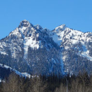
Cascade Mountains
The Mountains to Sound Greenway via I-90 is the quickest “escape” from the city into the nearby Cascade mountains.
North Bend (also out I-90) is the town where parts of the 1990 David Lynch TV series Twin Peaks were filmed, and has the Northwest Railway Museum.
The North Cascade Loop consists of a two-day minimum round trip over Stevens Pass and the North Cross-state Highway (US 2 and SR 20).
Mount Rainier National Park Just 2 hours south and east from Seattle, this magnificent mountain offers a mosaic of beautiful scenery such as blooming wildflowers, glaciers, crashing waterfalls and the mountain itself.
Roslyn is also out I-90 (not far past Snoqualmie Pass) and is where the TV series Northern Exposure was filmed and holds festivals of such theme in late July.
Mount St. Helens, 2.5 hours from Seattle, still lefts a breathtaking charm despite its 1980 eruption.
Snoqualmie Falls, (Snoqualmie, east of Seattle on I-90). A 300 ft high scenic waterfall, easily viewable from two viewpoints.
Skiing/snowboarding
An equivalent to Denver but far fewer in number, Seattle is the gateway to winter resorts on the Cascade mountains. Drive for one hour to the resorts to enjoy everything from leisure snowball fights to downhill skis, a perfect escape if you are bored with Seattle’s rain. Winter sports season is generally November–May, depending on how much snow there is. Generally, the highest ski resorts will open for the winter season longer.
Snoqualmie Pass – Summit and Alpental resorts an hour east on I-90. Elevation 3000 feet (more than 900m)
Stevens Pass (elevation 4500 feet)- A resort about two hours East of Seattle on Highway 2. Elevation 4000 feet (about 1300m)
Crystal Mountain at Mount Rainier. Opens in winter for skiing, in summer for hiking. Gondola to the Summit House restaurant operates year round as well. Elevation 4500 up to 6800 feet (1400 to 2100 meters above sea level)
Mount Baker North, near Bellingham.
Mission Ridge East of Steven’s Pass, near Wenatchee.
White Pass South of Seattle on Highway 12.
Whistler, British Columbia, Canada – North America’s top rated ski resort, about a four-hour drive north of Seattle past Vancouver on the Sea to Sky Highway.