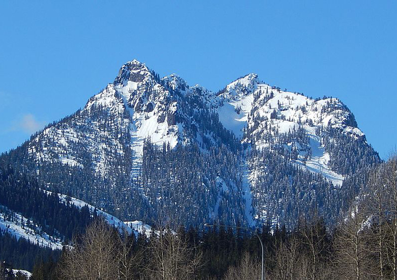
Snoqualmie Pass is a mountain pass that carries Interstate 90 (I-90) through the Cascade Range in the U.S. State of Washington.
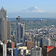
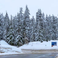
The pass summit is at an elevation of 3,015 feet (919 m), on the county line between Kittitas County and King County. Snoqualmie Pass has the lowest elevation of the three east–west mountain routes across Washington State that are kept open year-round, along with Stevens Pass (US 2) to the north, and White Pass (US 12) to the south. I-90 is the primary commercial artery between Seattle and points east, carrying an average of 29,000 vehicles through the pass per day. I-90 is the only divided highway crossing east-west through the state.
The pass lends its name to a census-designated place (CDP) located at the summit (see: Snoqualmie Pass, Washington). Both the CDP and Snoqualmie Pass are named after the Snoqualmie people of the valley to the west.
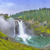
Recreation : The area around Snoqualmie Pass consists of mountain chalets that are mainly seasonally occupied by residents of the Seattle metropolitan area, with approximately 150 year-round residents. Winter sports are the main draw, but outdoor recreation is available year-round.
The Pacific Crest Trail crosses through Snoqualmie Pass and a variety of other trails are also available for hiking and climbing in the summer, cross-country skiing and snowshoeing during the winter months.
Snoqualmie Pass is also the site of the Summit at Snoqualmie, a group of alpine ski areas managed by Boyne USA Resorts. The Summit consists of four ski areas: Alpental, Summit West (formerly named Snoqualmie Summit), Summit Central (formerly Ski Acres), and Summit East (formerly Hyak). The Summit at Snoqualmie is the closest ski area to Seattle.
Snowmobiling just east of the pass is also popular during the winter months. Also in the summer and fall, paragliders and hang gliders may be seen flying above the valley, along the ridge and landing at Lake Keechelus.
Access : Coordinates: 47.423, -121.411 / Snoqualmie Pass is on Interstate 90 with easy access to Spokane in the east and Seattle in the west
Get around : Interstate 90 is the only road access to and through the pass, about 55 miles from both Seattle to the west and Ellensburg to the east. The traffic is usually not a problem once you pass the edges of Seattle’s suburban sprawl outside Issaquah, except during major holiday weekends. Weather conditions can be a different story, particularly during the winter months when heavy fog, rain, and snow are all commonplace. During ski season, traffic is often delayed or temporarily stopped near the summit for avalanche control work. Weather conditions on either side of the pass can differ sharply check the pass conditions before setting out. During particularly heavy snowstorms, the pass may close entirely for a day or two.
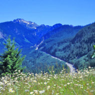
Summer driving is usually pleasant, with good conditions and sweeping forest views on the west side of the pass. The east side is undergoing road construction and widening through 2016, with routine hour-long closures in both directions on summer weekday evenings for rock blasting.

Activities:
Mountains to Sound Greenway
The corridor of I-90 over Snoqualmie Pass is known as the Mountains To Sound Greenway, and offers many sightseeing and exploration opportunities, only a short distance from Seattle. You can print out and take along a PDF “Geo-Tour” of the MTSG .
Summit At Snoqualmie
With four alpine base areas summit ski slopes that vary from beginner to advanced. Nights skiing is also available
Summit Central Has a large terrain park and a halfpipe.
Summit East
Summit West
Alpental Offers everything from beginner to deadly (quite literally) terrain. The in-bounds area at Alpental contains a several-hundred foot tall cliff that’s pretty great to ski off of, but check the landing for plenty of snow first, and do this only if you’re an expert skier. Pay attention to, and believe the double black diamond signs. The Alpental backcountry is quite impressive and readily accessible; make sure to obtain a Backcountry Pass from the Ski Patrol (at their Shack atop Chair 2) before exploring. Drive east on Interstate 90 from Seattle, approximately 1 hour. The road is an active interstate highway, and is therefore plowed and sanded all winter long, but snow tires or chains may be required.
Hiking
There are numerous hiking opportunities around the Snoqualmie Pass area. This is not an area that much solitude will be found on the hike.
Snow Lake A good hike from July to early October. A moderately strenuous hike, trailhead can be reached parking at the Alpental ski resort parking lot (A Northwest Forest Pass may be necessary). Traverses through forest, reaches an Alpine Lake. Stay and relax, consider a swim. Continue along the trail, go to Gem Lake, and beyond.
Iron Horse State Park. Covers over one hundred miles of trail through the Snoqualmie Forest and surrounding area, including a repurposed old railroad tunnel that cuts under the pass! Open May–October only, the 2.3-mile tunnel rarely climbs over 50°F (10°C), making it a welcome respite from summer heat. Bring a headlamp – or even two, just in case, as the tunnel is completely unlit. Trailhead parking available from I-90 exit 56 (Hyak), immediately east of the summit.
Go next : west : Seattle < North Bend / East : > Cle Elum > Spokane