
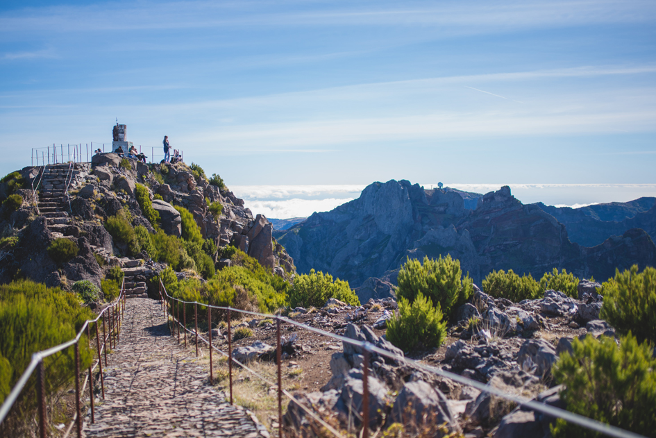
Pico Ruivo is a peak located in the municipality of Santana, in the Autonomous Region of Madeira, Portugal.
With 1,862 meters of altitude, it is the highest mountain in the Madeira archipelago, it is also the third highest mountain in Portugal, surpassed only by the Montanha do Pico in the Azores, and the Serra da Estrela in mainland Portugal. To access the peak, you must walk from Pico do Arieiro (the third highest on the island) or from Achada do Teixeira. The view from the top embraces a large part of the island at 360°.
Access : Coordinates: 32.758611, -16.942222 / The Pico Ruivo is located in the central-eastern part of the island of Madeira.
Highlights :
- Thanks to well-developed paths, the Pico Ruivo can also be walked by inexperienced hikers, but the route requires good physical condition and sure-footedness. The Pico Ruivo can be traveled by car up to an altitude of 1818 meters.
- Trails : Its summit can only be reached on foot, either from Achada do Texeira (to the northeast, 1,592 meters above sea level) by a paved path, or from the third peak of the island, Pico do Arieiro ( to the south-east) by a path 10 kilometers long and 1,000 meters of elevation covered in about 3 hours, or again by the west, in particular from Curral das Freiras.
Go next : Pico do Arieiro , a 1,818-meter mountain on the Portuguese island of Madeira. It is the third highest peak on the island, after Pico Ruivo and Pico das Torres. / Santana , a small village on the northeastern coast.


