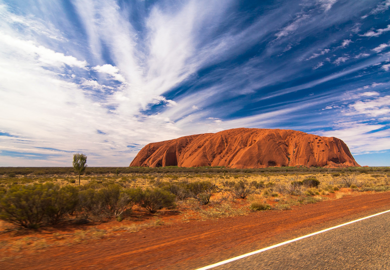
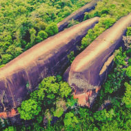
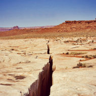
Uluru or “big red rock”, is a massive orange-brown oval-shaped rock formation, Located in Central Australia, Uluru, the “navel of the world”, is one of the largest monoliths on the planet, measuring 9 km in outline.
The Uluru rock in Australia was “discovered” relatively recently in 1892 by Ernest Giles, who spent most of his life traveling across the Australian continent.
The Uluru rock arose about 700-100 million years ago. Geologists claim that the legendary Australian monolith (or non-monolith) arose from sedimentary rocks at the bottom of the almost dried up Lake Amadius.
Uluru is about 2 km long, 1.7 km wide, and its circumference is 10 km. The summit is 869 meters above sea level, rising 350 meters above the ground of Central Australia. It has an oval triangle shape on one side.
In addition to the Sydney Opera House and kangaroos, Mount Uluru is Australia’s most recognizable landmarks.The rock is part of the “Uluru – Kata Tjuta National Park”, which covers 1300 square kilometers and is included in the UNESCO World Heritage List.
– the top of the mountain and some of the surrounding areas are considered sacred. They cannot be photographed or painted, and special permission is required for commercial photography. In addition, it is forbidden to use drones here: special warning signs are placed around the perimeter.
Access : Coordinates: -25.345, 131.036111 / The best way is to get to Yulara, the only “town” in the surroundings and where Ayers Rock Resort is located, the base of accommodation in the area. Uluru is about 15 km away.
Highlights :
- Legends : The aborigines believe that there is a huge cavity under the surface of Uluru, where there is an energy source, which they call Tjukurpa (“Dream Time”). They believe that during the whole tour around the rock one dreams. The place is revered as sacred by the Anangu, who believe that their ancestors inhabited the land around it. They have left their history in the form of drawings carved into the surface rock layer in many places on the surface of the monolith. In several of the caves in Uluru there are many stories from the “Time of Dreams”. The paintings on the walls date back tens of thousands of years and have been updated many times over the generations. Thus the millennial history and legends associated with this majestic place are preserved and transmitted over time.
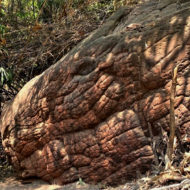
- rock art : At the foot of the monolith and in the caves, there are examples of ancient rock art / “The Brain”, a particularly large weathering phenomenon on the northeast flank
- Climbing to the top of Uluru is not prohibited, but as it is a sacred mountain it is understood as desecration. As a sign of respect for their ancestral customs, the Anangu ask visitors to refrain from stepping on it. Other voices demand it to prevent its erosion
- Hike : The hike can be started either from the Mala or Kunija parking lot, or can be reached on foot from the Cultural Center on the Liru Walk (4 km) to the Mala Walk. From the Mala parking lot, Uluru can be circled – usually clockwise: The path leads over the Mala Walk and Kantju Gorge (length: 2 km), Base Walk (length: 10.5 km), Kunija Walk (4 km) and Lungkata Walk (4 km).
- There is a Cultural Center in the park run by the Anangu people. There they inform about the legend of the mountain, the dream time and the social rules of their tribe (Tjukurpa). Traditional works of art and handicrafts are also exhibited, which can also be purchased.
- In the Anangu faith, certain sites along the Uluru Base Walk tell or embody stories that are only allowed to be seen in this place and nowhere else. Therefore, photo and video recordings are prohibited at the following locations (starting at the Mala parking lot in a clockwise direction): Mala Punta, Warajuki, Tjutatkapi, Taputji, Kunjia Piti and Pulari. If you violate this rule, you risk high fines. According to the tribal laws of the Anangu, some places are also taboo for a gender or an age group, but this does not apply to tourists. There are also several sacred sites that are not open to tourists.
Access to Uluru and other parts of the national park may be partially or completely closed to visitors during Anangu religious events. - Photo opportunities : There are two places where you can watch the sun rise or set, at the car sunset parking lot and at the Dune Lookout. In the latter, a view of both Uluru and Kata Tjuṯa is possible.
- In the tourist settlement of Yulara, which is about 15 km away, there is a hotel complex and a camping site; overnight stays are not allowed in the national park itself.
- Uluru is located in Uluru-Kata Tjuta National Park, near the Yulara settlement, about 390 km southwest of Alice Springs. The 1336 km² national park includes the neighboring Kata Tjuta as well as Uluru and has been declared by UNESCO as a World Cultural and World Natural Heritage.
- Climbing Uluru was allowed until October 2019 on a marked route beginning at the western end of the mountain- The ascent of Ayers Rock is a popular attraction. It follows a route of 1.6 kilometers. The climb is long (over an hour of climbing) and is not easy as the slope varies from 30 to 60 degrees in some places, the weather conditions can be difficult and the rock slippery. The handrail, a chain added in 1964 and extended in 1976, essential in places, allows easier ascent.
Hours, information: They vary according to the months of the year.
In summer they open at 5:00 a.m. and close at 9:00 p.m. In winter from 6:30 a.m. to 7:30 p.m./ The entrance fee to the national park (where Uluru and the Olgas are) is AU $ 25, ticket valid for 3 days.
Activities : sightseeing / trekking ,There are two daily walks on the Mala Walk, guided by park rangers / Photography, Ancient Culture Study, Hiking.
Go next : The resort town of Yulara with a recreation area and tourist services was built 15 km north of Uluru / Alice Springs.about 390 km southwest


