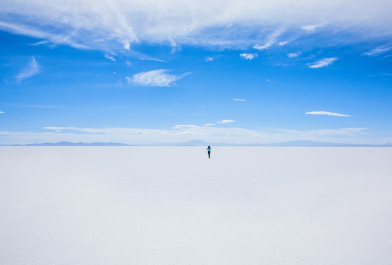
Salar de Uyuni -or Salar de Tunupa- is the world’s largest salt flat, measuring over 4,000 square miles was recently listed as one of the 25 wonders of the world, alongside better known attractions like the Taj Mahal, Grand Canyon and Great Wall of China. at 10,582 square kilometers (4,086 sq mi). It is in the Daniel Campos Province in Potosi in southwest Bolivia, near the crest of the Andes and is at an elevation of 3,656 meters (11,995 ft) above sea level. Between 50-70% of the world’s lithium reserves are located here.
Access : Coordinates: -20.133775, -67.489133 /
Highlights :
- Arbol de Piedra , (“stone tree”) is an isolated rock formation in the Eduardo Avaroa Andean Fauna National Reserve of Sur Lipez Province, Bolivia.
- Laguna Colorada : Laguna Colorada (Red Lagoon) is a shallow salt lake in the southwest of the altiplano of Bolivia, within Eduardo Avaroa Andean Fauna National Reserve.
- Laguna Hedionda. , Laguna Hedionda (Spanish for “stinking lake”) is a saline lake in the Nor Lipez Province, Potosi Department in Bolivia. It is notable for various migratory species of pink and white flamingos.
- Pulacayo , the main silver mine in Bolivia and the second largest in the world, which belonged to Aniceto Arce, former president of Bolivia.
- Isla del Pescado , Isla del Pescado is a piece of solid land surrounded by the Salar de Uyuni salt plains (22 km from its edge) in south-west Bolivia. It is covered with giant cactus, some reaching more than 10 m in height.
- Salt-Mining Area , Area with many salt piles, which are left there to dry
- Colchani, Bloques de Sal , Salt workers stack the salt in blocks to let it dry and then sell it.
- Train Graveyard. , The authentic ghost train With these trains the salt was transferred to the Pacific ports for export.Uyuni train cemetery is the place where the trains started to die. In the 1940s, when Bolivia’s mining industry collapsed, and trains began to pile up where they still remain today.
- Tunupa Volcano , Tunupa is a volcano in Bolivia located south of the department of Oruro, in the municipality of Salinas de Garci Mendoza, bordering the Salar de Uyuni, this volcano has a height of 5,432 meters above sea level.
- San Cristobal , town nearby the homonymous mine , The San Cristobal mine in Lipez, Potosi Department, Bolivia is an open-pit silver, lead and zinc mine near the town of San Cristobal, Potosi.
- Sillar , Giant columns of clay ,Located northwest of Tupiza (Bolivia), these formations can be visited with a specific tour .
- Valles de Rocas , Natural rock formations caused by volcanic activity with many interesting rocks formed by erosion.
- San Antonio ruins , The town of San Antonio de Lipez was born as an enclave for the exploitation of silver.Fifty years ago it was abandoned and today only its ruins remain.
- Laguna Amarilla , A yellow lake, colored by sulphur,/ Laguna Blanca , A borax-filled white lake.
- Laguna Celeste , The Celeste lagoon is a high Andean lagoon of Bolivia located in the department of Potosi in the south of the country.
- Laguna Verde , is a saltwater lagoon in the high Andes of Bolivia, located in the Eduardo Abaroa Andean Fauna National Reserve in the altiplano in the department of Potosi, near the border with Chile.
- Sol de Manana , The Sol de Manana is a desert area of approximately 2 km², located in the south of Bolivia, in the department of Potosi.
Go next : Oruro / Laguna Colorada / Potosi / Salvador Dali desert / Tupiza / Sucre / Yotala / Nucchu / Copacabana of Bolivia / Jujuy, Argentina


