Loppa Municipality · Finnmark County · 70°N · the only place on mainland Europe where a glacier calves into the sea
Most people who travel to Norway go south of where the country gets interesting.
This is not an insult to the Geirangerfjord or the Flåm railway or the Preikestolen rock. These are extraordinary places and they deserve their reputation. But Norway extends 2,500km from its southern border to its northern tip, and the section of it that sits above the Arctic Circle — specifically the section that sits above 70°N in Finnmark county, the northernmost county in Europe — operates on terms that the tourist infrastructure of the south has not yet fully colonised.
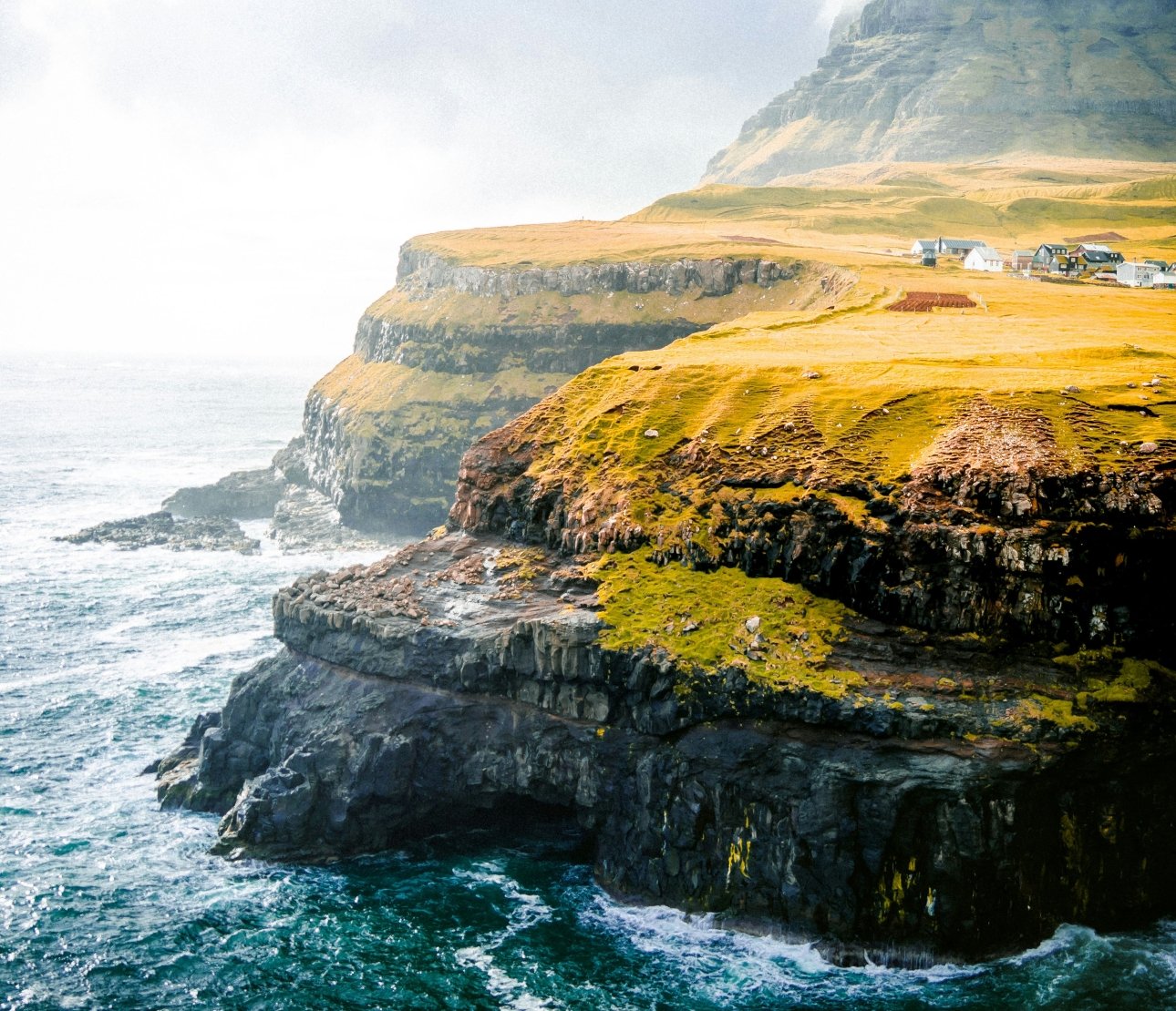
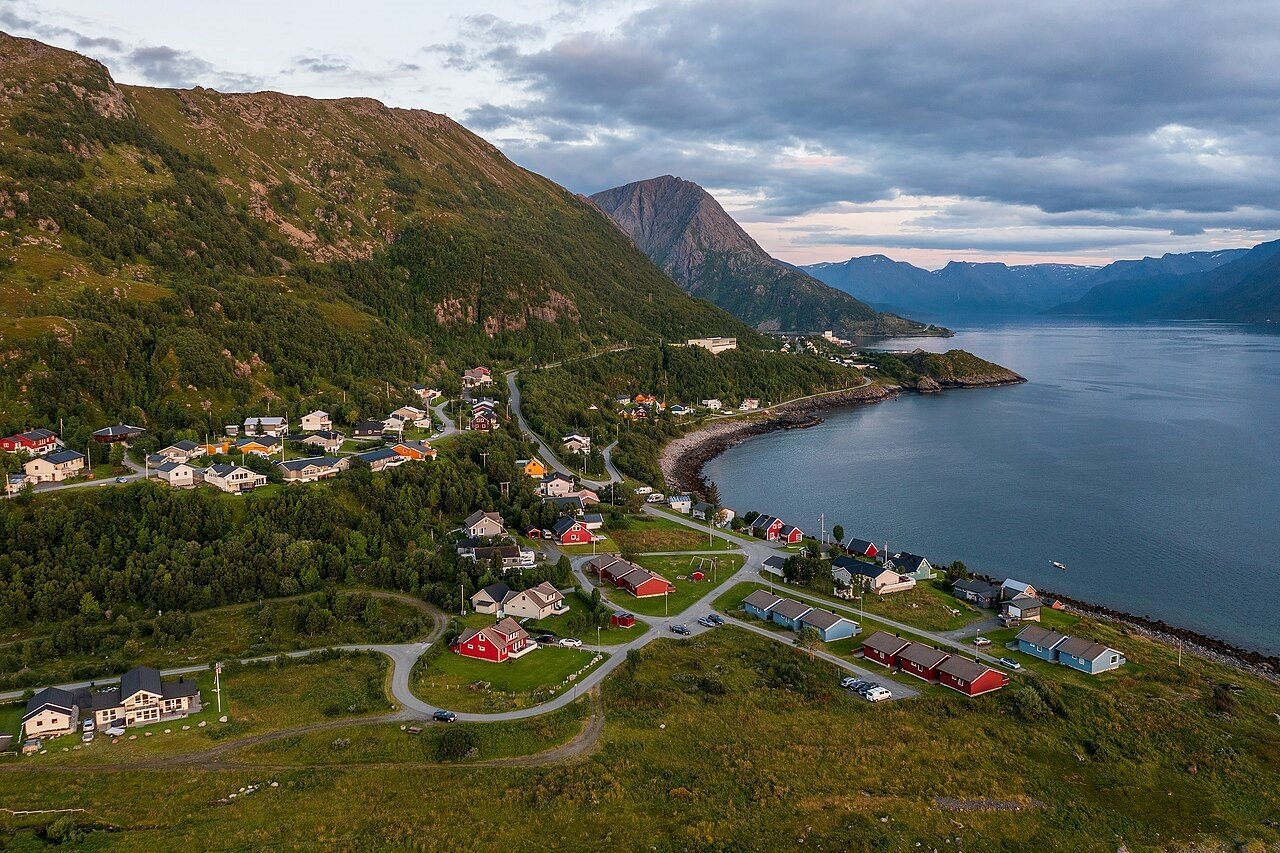
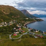
Øksfjord is in this territory. It is the administrative centre of Loppa Municipality, located on the east side of the Øksfjorden, just south of the mouth of the fjord. The population is approximately 400. The Øksfjordfjellet mountain looms behind the village. This tiny settlement with barely a handful of cafés barely blemishes the wild landscapes surrounding it — which include the only glacier in mainland Norway that calves directly into the ocean.
That last fact is the reason to go.
How to get there — and why the getting matters
Øksfjord is not on a road that goes anywhere else. The E6 — the main artery of northern Norway, the road that runs from Oslo to the North Cape — passes inland, through Alta, approximately 70km east. To reach Øksfjord you leave the E6 at Langfjordbotn and drive west on Road 882 along the southern shore of the Altafjord, then north onto the Øksfjord peninsula. The road ends at the village. There is no continuation.
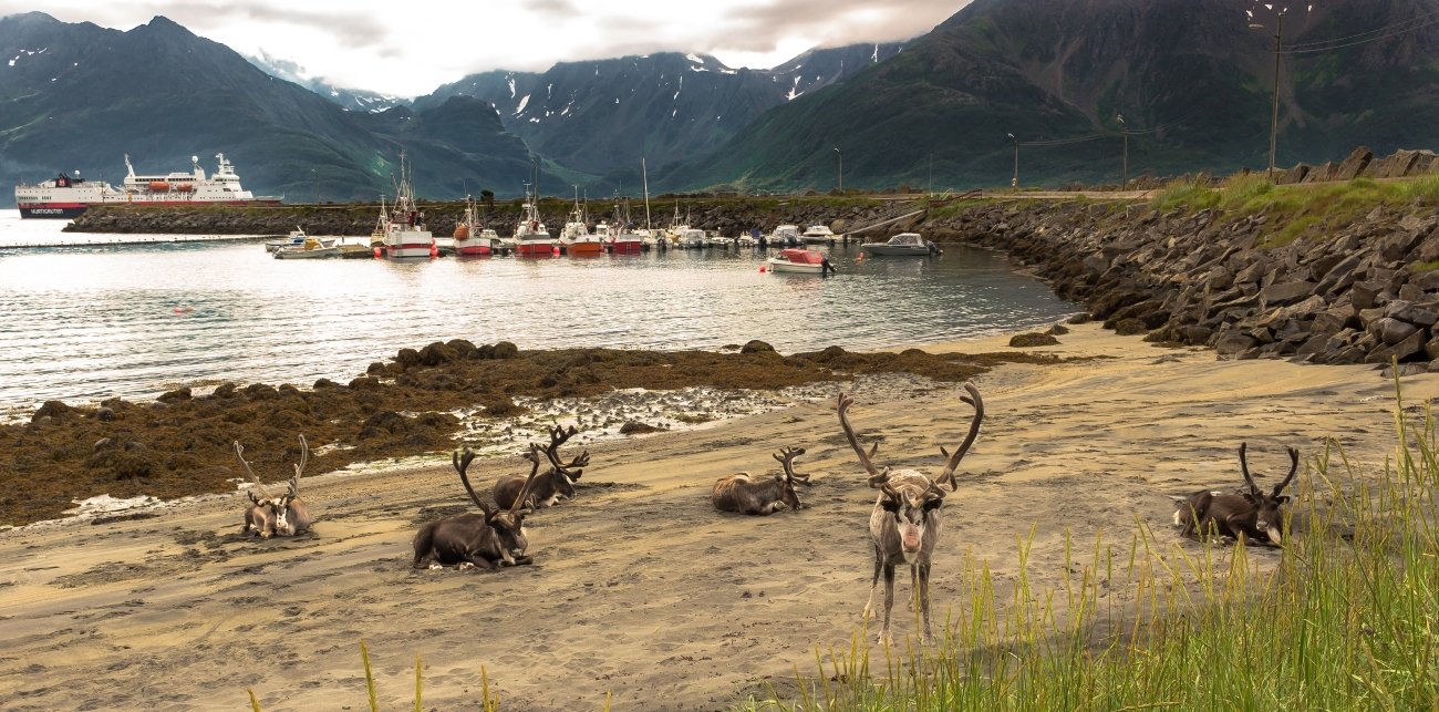
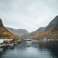
Alternatively, Øksfjord is visited by the Hurtigruten coastal ferry — the steamship route that has connected the isolated fishing villages of the Norwegian coast since 1893. Arriving by Hurtigruten is the correct approach if you have time: the ferry approaches from the south, rounds the Øksfjord peninsula, and delivers you to the quay with the Øksfjordfjellet already above you. The scale relationship between the village and the landscape — the houses small at the base of the mountain, the glacier beyond — is only fully visible from the water.
There is also a regular ferry connection from Øksfjord to the village of Hasvik on the neighbouring island of Sørøya. Sørøya — Norway’s fifth-largest island — is a destination in itself, large enough to spend two days exploring and almost entirely without international visitors.
GPS (Øksfjord harbour): 70.2394°N · 22.3507°E GPS (Øksfjord Church): 70.2378°N · 22.3489°E
What the village is — and what it always was
Signs of human life here stretch back around 10,000 years, when the coastal Komsa people hunted seals and fished along these shores. The Komsa culture — named after a mountain in Alta where their tools were first identified — occupied this coastline in the period immediately after the last ice age, when the glacier that now sits on the mountain above the village covered the entire peninsula. They hunted from boats and lived at the edge of a world that was still adjusting to the departure of the ice.
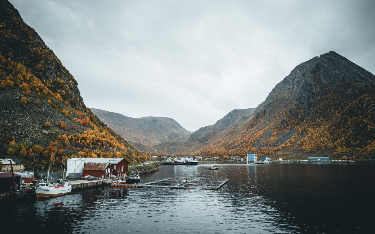
The Norse settlers came later. The fishing industry that built Øksfjord into a functioning settlement came later still — the 19th-century expansion of the dried fish trade that turned the entire Norwegian coast into a productive economic zone and gave villages like Øksfjord their harbour infrastructure, their wooden warehouses, their population of fishermen and their connection to Bergen and the south.
Local legend tells of an English hunter who, in a case of lost in translation, supposedly bought much of the Øksfjord peninsula in the mid-1800s when he only intended to lease hunting rights. The story has the quality of a folk tale that contains a truth: by the mid-19th century, the Norwegian far north was already visible enough to British sportsmen and adventurers that such misunderstandings were possible.
The Second World War arrived here as it arrived everywhere in northern Norway — with particular force. The German occupation of Norway from 1940 to 1945 included the systematic burning of Finnmark during the 1944 retreat: the scorched-earth policy that the German Army carried out as it withdrew before the advancing Soviet forces destroyed approximately 11,000 buildings across Finnmark and left the civilian population without shelter in an Arctic winter. The inhabitants of Jøkelfjord — the neighbouring village at the foot of the glacier — followed the encouragement of the Norwegian government in exile in London to escape the evacuation, and built gammer (traditional Sami turf huts) beneath the glacier itself to survive the winter. Much of what stands in Øksfjord today was built after 1945, in the reconstruction period that the Norwegian state funded across the entire county.
The glacier — what it is and why it matters
Øksfjordjøkelen is the ninth-largest glacier in mainland Norway. The 42-square-kilometre glacier lies on the border of Loppa Municipality in Finnmark and Kvænangen Municipality in Troms. It is a plateau glacier — sitting on the mountainous terrain like a flat lid rather than flowing down a valley in the alpine style — and its highest point, now at 1,191 metres due to glacier shrinkage, is the highest point in Finnmark county.
The specific distinction is this: Øksfjordjøkelen is Norway’s ninth-biggest glacier, and the glacier snout in Jøkelfjorden was once the only glacier on Scandinavia’s mainland reaching the sea. As the world warms, the Jøkelfjorden glacier arm is slowly disintegrating. The connection between the main glacier and the tongue that once descended to the fjord has broken. The glacier has retreated. What remains at sea level is the blue ice field called Nerisen — full of blue ice clumps from the main glacier, with big holes where foaming glacier rivers run beneath.
This is not the scale of Greenland or Svalbard. The glacier is accessible, the fjord is short, and the walk to the ice requires no specialist equipment. What it is — specifically — is the closest point on mainland Europe where you can stand beside sea-level glacier ice that has calved from a mountain glacier overhead. That is an unusual thing to be able to say about a place reachable by road in a standard car.
In the mountains north of the Jøkelfjord, one can wander among fossilised magma chambers from a supervulcano — one of only three locations on earth where this can be seen. This fact is almost entirely absent from the standard travel writing about the area. Three locations on earth. One of them is a forty-minute walk from a Norwegian fishing village of 400 people.
Getting to the glacier: two routes
By boat from Jøkelfjord village: There is a marked trail that goes into the Jøkelfjord almost to the glacier, and there is also the option of hiring a kayak and paddling in to the glacier, or joining a photo safari tour of Jøkelfjord. Operators Synatur and Bre og vandring offer glacier hikes. The RiB (rigid inflatable boat) tour from Skjervøy — operated by Explore 70 Degrees — takes 3–4 hours and approaches from the sea, entering the fjord between the rock walls with the glacier visible at the head. The boat slides quietly, engine turned off, making gentle waves on the calm water. Occasionally, the deafening silence is interrupted as the glacier calves — releasing pieces of ice into the fjord.
On foot from Jøkelfjord village: There is a marked trail that goes into the Jøkelfjord almost to the glacier. The trail runs along the fjord shore and requires a stream crossing — stepping stones in summer, less straightforward in spring snowmelt. The round trip from the Jøkelfjord car park is approximately 10–12km. The view of the glacier from the trail’s end is the closest land approach without a guided glacier hike.
GPS (Jøkelfjord car park, trail start): 70.1834°N · 22.2034°E GPS (Jøkelfjord village): 70.1956°N · 22.2189°E
The drive from Øksfjord to Jøkelfjord village takes approximately 45 minutes on Road 882 — the same road that brought you from the E6, continuing south past the junction to Øksfjord and then east toward the head of the fjord system.
When to go — and what each season offers
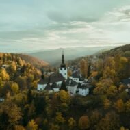
September (recommended): The birch trees on the slopes above the village turn butter-yellow in the last two weeks of September — the Norwegian birch autumn is one of the most concentrated colour events in northern Europe, compressed into ten days at altitude. The tourist boats that ran in summer have stopped. The village returns to itself. The aurora borealis begins appearing from mid-September onward when the nights are dark enough, and the dark sky conditions at 70°N — minimal light pollution, clear arctic air — produce displays that begin with a faint green curtain and can develop into the full overhead movement that photographs cannot accurately represent.
June–July (midnight sun): In summer, the Midnight Sun floods the mountains in golden light around the clock. The sun does not set at Øksfjord from approximately 20 May to 23 July. The light quality at midnight — horizontal, warm, the shadows long across the water — is the condition that makes the fjord photography extraordinary. The glacier is at its most accessible in summer when the approach trail is clear of snow.
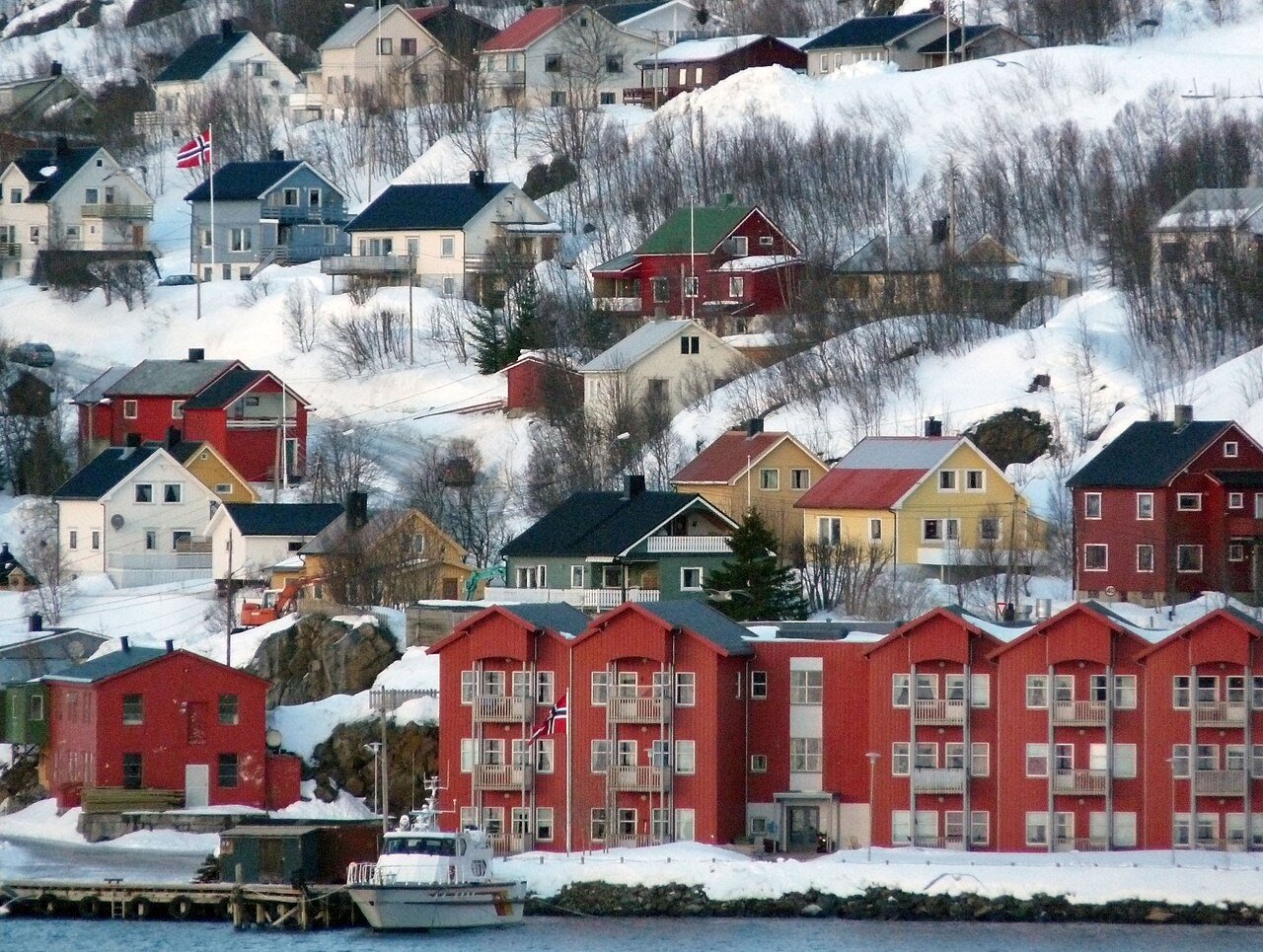
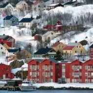
February–March (deep winter): At night, the village lights twinkle under snowy peaks in conditions that the aurora season makes worth considering. February is statistically the clearest month in Finnmark — the atmospheric pressure systems that dominate in midwinter tend to produce clear nights. The landscape is entirely white. The fjord may carry sea ice in the coldest years. The village is quiet in a way that only exists this far north in this season.
What the village has
One hotel. A supermarket. A petrol station. A church built in 1935 — the original would have been destroyed in the 1944 burning. A harbour where the fishing boats tie up and where the Hurtigruten calls twice daily on its northbound and southbound runs.
The functional infrastructure of a Norwegian municipality that happens to sit at 70°N beside the only ocean-calving glacier on mainland Europe.
What it does not have: a tourist apparatus. No visitor centre. No organised excursion desk in the village itself — the glacier tours operate from Skjervøy or Jøkelfjord, not from Øksfjord. No souvenir shop. The café situation is as the Hurtigruten description suggests: barely a handful.
This is not a complaint. It is the specific condition that makes Øksfjord the correct kind of destination for a certain traveller — the one who has been to the Norwegian fjords that everyone goes to and is looking for the version that has not yet been processed for consumption.
Practical information
GETTING THERE:
By car:      E6 → Langfjordbotn → Road 882 west
             Alta to Øksfjord: approx 90 min
             Tromsø to Øksfjord: approx 4h
             Alta airport (ALF) is the nearest airport

By ferry:    Hurtigruten calls twice daily
             Northbound: approx 05:10
             Southbound: approx 23:45
             Book at hurtigruten.com

By local ferry: Regular service Øksfjord ↔ Hasvik
                (Sørøya island)

ACCOMMODATION:
Øksfjord Hotel · Njordveien · 9550 Øksfjord
Very limited options — book ahead

GLACIER ACCESS:
Boat tour (RiB): Explore 70 Degrees · based Skjervøy
                 3–4 hour tour · seasonal
Glacier hike:    Synatur · Bre og vandring
                 guided hikes on Øksfjordjøkelen
Marked trail:    Jøkelfjord → glacier approach
                 approx 5–6km one way · no guide needed
                 Stream crossings · appropriate footwear

AURORA SEASON:   Mid-September to late March
MIDNIGHT SUN:    20 May to 23 July
POLAR NIGHT:     25 November to 17 January
                 (sun does not rise above horizon)

FUEL:            Petrol station in Øksfjord
                 Fill up before leaving the E6 corridor
                 (Alta) — distances are significant

CURRENCY:        Norwegian krone (NOK)
                 Card accepted everywhere in the village

EMERGENCY:       112
Øksfjord is the kind of place that does not explain itself easily to the traveller accustomed to destinations that have been pre-digested. The village exists because the fish were here and the glacier was here and the people who came for both stayed long enough to build something permanent. The glacier is retreating. The fish trade has changed. What remains is a village at the precise latitude where the Norway that most people visit stops and the Norway that rewards the traveller who has been paying attention begins.
The glacier is still calving. The supervulcano chambers are still in the mountain. The aurora is still there in September when the dark returns.
The village has 400 people and a petrol station and the most geologically specific landscape on the European mainland.
That is the correct trade.