Estonia · Latvia · Lithuania · 10 days · 1,400km · the road that runs between the standard tour and the extraordinary one
- Before you leave: the things that matter
- Day 1–2: Lahemaa National Park, Estonia
- Day 3–4: Saaremaa Island, Estonia
- Day 5: South through Estonia — the landscape between the sights
- Day 6–7: Gauja National Park, Latvia
- Day 8: The Latvian amber coast — what the guide books skip
- Day 9–10: Lithuania and the Curonian Spit
- The route in brief
- What this article gives you — and what the guide contains
Most people who drive the Baltics by campervan follow the same route. Tallinn to Riga to Vilnius. The three capitals connected by the Via Baltica motorway, a string of well-reviewed campsites, and an itinerary that every agency produces in some variation. It is a good route. The old towns are extraordinary. The history is dense and unforgettable. The food is underpriced.
It is also not what we are writing about.
This is a different road. One that begins on the northeastern coast of Estonia and works its way south through territory that the standard Baltic circuit barely acknowledges. It passes through a national park that was the first nature reserve established in the entire Soviet Union. It crosses to an island where juniper meadows run to a limestone coast and the only crowds are the migratory birds in September. It descends into a river valley in Latvia that locals call the Switzerland of the Baltics, then continues south through a landscape of amber coast, bog trails and a spit of dune that UNESCO protects so strictly that one section of it admits only registered vehicles.
The route ends in Lithuania. Whether you finish at the Curonian Spit or drive south to Vilnius depends entirely on time. Both ends are worth taking seriously.
Before you leave: the things that matter
The Baltic states are EU territory. Your standard EU driving licence and insurance are valid throughout. There are no border controls between the three countries. The currency is the euro across all three — Estonia and Latvia adopted it in 2011 and 2014 respectively, Lithuania in 2015.
Wild camping in Estonia is legal under the right of public access (every man’s right), with the condition that you move on after two nights and leave no trace. In Lahemaa National Park, camping is allowed at designated campsites and fires are permitted only in designated locations. Forests cover more than 50% of the land in Estonia, and free camping is also allowed as long as you abide by local regulations. The practical reality: the RMK (Estonian State Forest Management Centre) operates a network of free or very low-cost campsites throughout the country’s state forest land, bookable through their app and website at rmk.ee.
For campervans specifically, Saaremaa and Muhu are ideal places to explore by campervan — here you will find space and tranquillity, seaside views, juniper-lined roads and lovely places to stop and discover at your own pace.
Speed limits, fuel and one specific rule worth knowing: Estonia has a strict zero blood alcohol limit for drivers. Not 0.2, not 0.5. Zero.
Day 1–2: Lahemaa National Park, Estonia
You arrive in Tallinn from wherever you have come from — ferry from Helsinki, flight into the airport, drive up from Riga — and you resist the temptation to spend two days in the old town. The old town deserves time. Give it one evening and a morning, then drive northeast.
Lahemaa National Park sits within reach of Tallinn, where you will find guided tours through this unusual red and yellow sandstone river valley carved up with cliffs and caves. It is approximately 70km east of the capital, and it is the correct first destination for the campervan traveller precisely because it is easy to reach, extraordinarily varied and almost entirely without the crowds that the capital attracts.
Lahemaa is the oldest and largest national park in Estonia, founded in 1971. It covers 74,784 hectares, of this 47,910 hectares of land area. In Soviet terms it was the first national park created anywhere in the USSR — established not because the ideology particularly encouraged natural preservation but because the specific coastal landscape of northeastern Estonia had already attracted enough scientific and cultural attention that even the Soviet planning apparatus could not ignore it.
The landscape it protects is unusual. The coastline runs in a series of peninsulas — Käsmu, Pärispea, Viinistu, Altja — each one pointing north into the Gulf of Finland. Between them, bays open to the water. Behind them, the boreal forest runs inland to the great bogs that characterise northern Estonia: the raised bog at Viru has an elegantly constructed boardwalk that allows access into the heart of this otherwise difficult world, with three species of sundew flowering amongst ten species of sphagnum moss. The Viru bog walk is the most popular single trail in Lahemaa. It is popular for a reason.
Less visited are the fishing villages. Käsmu calls itself the Captain’s Village — a reference to the sailing and smuggling tradition that the settlement built its prosperity on in the 18th and 19th centuries. The wooden houses are from that era. The sea captain’s museum is in one of them. Altja is smaller and less visited, with restored net sheds from the fishing tradition still standing beside the water.
The campsite question: There is a campsite at Suurpea in Lahemaa National Park with its own beach and sea views. Well-maintained facilities including a sauna. The RMK operates several simpler overnight positions throughout the park — the app shows current availability. The simple Altja campsite beside the inn is the most atmospheric overnight in the park: the restored fishing village, the sound of the sea, and in September, the migrating birds moving south overhead at night.
What this section gives you: the bog in the morning mist. The captain’s village at dusk. The Gulf of Finland coastline with Estonia’s forest behind you and Finland invisible on the other side of the water. A slow two days in a landscape that has been protected for longer than most travellers have been alive.
GPS (Viru bog boardwalk start): 59.5089°N · 25.6234°E GPS (Käsmu village harbour): 59.6123°N · 25.8934°E GPS (Altja fishing village): 59.6234°N · 25.6934°E
Day 3–4: Saaremaa Island, Estonia
The ferry from Virtsu to Muhu takes 25 minutes. You drive off onto an island connected by causeway to Saaremaa, and within an hour you are on Estonia’s largest island — a place that operates at a rhythm entirely different from the mainland.
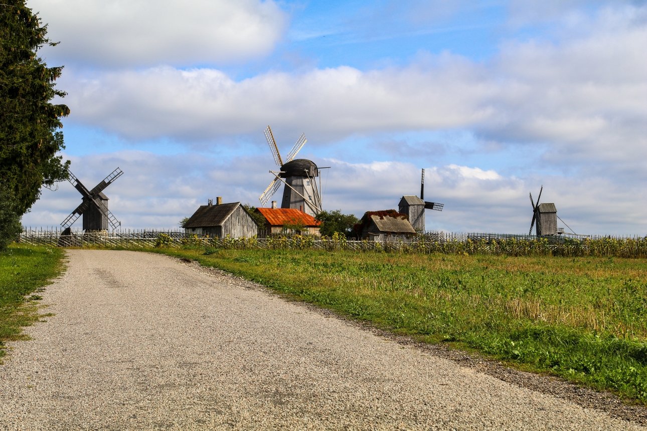
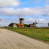
Saaremaa is Estonia’s largest island, a retreat with its own timescale. Camping on the island is defined by sparse juniper meadows, historic windmills and a rugged coastline. The remoteness from the mainland creates a deep quiet and an original feeling of travel.
The juniper meadows are the specific thing. The western coast of Saaremaa is an alvar landscape — limestone pavement covered by juniper scrub, a habitat so rare in Europe that most travellers have never seen it before and cannot immediately name what they are looking at. The junipers are hundreds of years old in some cases, their growth constrained by the shallow soil over the limestone beneath. The meadows between them are full of orchids in early summer and extraordinary in autumn when the coastal light comes in low over the flat ground.
Kuressaare, the island’s main town, is worth a half-day: the 13th-century Livonian Order castle is the best-preserved castle in the Baltic states, its walls intact, the moat unaltered. The island’s other essential stop is the Kaali meteorite crater — a field of nine impact craters left by a meteorite strike approximately 4,000 years ago. The largest crater, 110m across, holds a lake. It is, without question, the most unexpected landscape feature in Estonia.
On Saaremaa you have the opportunity for a bog hike around a large moor lake, the Koigi järv. Nearly no other people. The spot type is outdoor, best timing is all year round.
The campervan logistics: There are stopping places on Saaremaa and Muhu where various services are available for campervan travellers — from toilets, showers and drinking water to electricity, parking and waste disposal. Several harbours on Saaremaa offer useful services and make convenient stopping places along a seaside route. RMK sites on the island are basic by design — dry toilet and barbecue area — which is exactly the right level for an island that does not want to become a festival site.
GPS (Kuressaare castle): 58.2523°N · 22.4845°E GPS (Kaali meteorite crater): 58.3712°N · 22.6689°E GPS (Koigi bog lake walk): 58.4234°N · 22.5934°E
Day 5: South through Estonia — the landscape between the sights
The drive south from Saaremaa — ferry back to the mainland, then southeast toward the Latvian border — passes through the least-visited part of Estonia. This is intentional. The route crosses the Pärnu River, passes Soomaa National Park (the flood-plain forest that the Estonians call the fifth season — the period in spring when the entire park floods and only canoes can navigate it), and descends toward the border.
Stop at Pärnu briefly. The resort town is quiet outside the Estonian summer season and completely unknown to non-Scandinavian tourists. The beach is long and white. The Art Nouveau and wooden architecture in the centre is unhurried.
Then drive south. The border crossing into Latvia is unmarked except by a change in road surface. The country begins.
Day 6–7: Gauja National Park, Latvia
Sigulda is situated on both banks of the ancient valley of the Gauja River and is known as Switzerland of Latvia. A great part of the Sigulda area includes Gauja National Park, established in 1973 to protect flora and fauna biodiversity.
The Gauja river valley is the most dramatic inland landscape in the Baltic states. The river has cut through red sandstone and dolomite, leaving cliffs, caves and forested slopes above it. You will find guided tours through this unusual red and yellow sandstone river valley carved up with cliffs and caves, including the famous Gutmanis Cave — a magical world under an hour from Riga.
Gutmanis Cave is the largest cave in the Baltic states — not large by cave standards anywhere else in Europe, but extraordinary for a landscape that is defined by flatness. The names carved into the cave walls by visitors go back to the 16th century. The oldest are in German. The more recent ones are in Latvian and Russian. The cave has been collecting signatures for 400 years.
The Turaida Castle above the valley — red brick, 13th century, Livonian Order — gives the most complete view of the valley from above. The Gauja at this point runs through a landscape that looks sculpted rather than geological: the cliffs are vertical, the forest is dense, and the river below is narrow enough that in summer the water is warm enough to swim in.
The route through the national park that most campervan travellers miss is the road along the valley floor from Sigulda to Cēsis. The main road runs above the valley on the plateau. The valley floor road follows the river through the sandstone terrain.Cēsis and its surroundings are one of Latvia’s most beautiful places to visit — you get to know much about Latvian nature, culture and history. The medieval town of Cēsis has a castle, a church tower and a square that has not been significantly altered since the 18th century.
GPS (Gutmanis Cave): 57.1778°N · 24.8423°E GPS (Turaida Castle): 57.1689°N · 24.8534°E GPS (Cēsis medieval square): 57.3123°N · 25.2734°E
Day 8: The Latvian amber coast — what the guide books skip
West of Riga, the coast road runs north through territory that Baltic travellers almost entirely ignore. The resort town of Jūrmala is the beginning of this section — well-known, busy in summer, extraordinary in autumn when the wooden summer houses stand empty among the pines. Drive through it rather than stopping.
North of Jūrmala, the coast becomes something different. The beach is the longest continuous stretch of sand on the eastern Baltic — 100km without a significant interruption. The dunes behind it are 20-30m high. The pine forest behind the dunes is the natural windbreak that protects the coastal farmland from the Baltic weather. In September and October this coast is where the migratory birds move south in numbers that can stop a walk dead: the Cape Kolka headland, where the Gulf of Riga meets the open Baltic, is one of the most significant bird migration points in northern Europe.
Most campervan guides to Latvia spend one paragraph on this coast and three pages on Riga. This guide inverts that proportion.
The cape at Kolka — the northernmost point of the Kurzeme peninsula — is a sandbar extending into the sea. The current where the two water bodies meet is visible from the shore. The village behind the cape has a single café and perhaps a dozen permanent residents. In September, the village is entirely without tourists. The birds, however, are numerous.
GPS (Cape Kolka): 57.7445°N · 22.5978°E
Day 9–10: Lithuania and the Curonian Spit
The Curonian Spit is a 98km dune peninsula — shared between Lithuania and Russia — that separates the Curonian Lagoon from the Baltic Sea. UNESCO protected it in 2000. The dunes at its widest point are 3.8km from sea to lagoon. Some of the dune formations reach 68m. The entire spit was forested after extensive sand encroachment nearly buried several villages in the 18th and 19th centuries — the planted pine forest is now the character of the place.
Entry to the Lithuanian section requires a fee for vehicles. The road runs the length of the spit on the lagoon side. Nida, at the southern end near the Russian border, is the main village — a cluster of traditional wooden houses, a Thomas Mann connection (he spent summers here in the 1930s, the house is now a museum), and the most complete view of the great wandering dune, the Parnidis.
For the campervan traveller, the spit is the most logistically specific stop on the entire route. There are designated campsites and parking areas. Wild camping is not permitted on the spit — the dune ecosystem is too fragile. The rule is enforced. Arrive with a booking.
GPS (Nida village): 55.3055°N · 21.0009°E GPS (Parnidis dune summit): 55.3012°N · 21.0023°E
The route in brief
DAY 1–2:   Lahemaa National Park, Estonia
           Viru bog · Käsmu · Altja
           GPS base: 59.5089°N · 25.6234°E

DAY 3–4:   Saaremaa Island, Estonia
           Kuressaare · Kaali crater · Koigi bog
           Ferry: Virtsu → Kuivastu (25 min)
           GPS base: 58.2523°N · 22.4845°E

DAY 5:     South Estonia transit
           Pärnu · Soomaa brief stop
           Border to Latvia (unmarked)

DAY 6–7:   Gauja National Park, Latvia
           Sigulda · Gutmanis Cave · Cēsis
           GPS base: 57.1778°N · 24.8423°E

DAY 8:     Latvian amber coast
           Jūrmala · Cape Kolka · Kurzeme
           GPS base: 57.7445°N · 22.5978°E

DAY 9–10:  Lithuania · Curonian Spit
           Nida · Parnidis dune
           GPS base: 55.3055°N · 21.0009°E

TOTAL:     Approx 1,400km · 10 days
COUNTRIES: Estonia · Latvia · Lithuania
SEASON:    May–October
           September recommended (birds · no crowds)
What this article gives you — and what the guide contains
This is a route overview. It covers the structure, the logic and the landmarks that make each stop worth taking seriously. It gives you GPS at the key entry points, the essential logistics and the honest editorial case for a circuit that most campervan guides to the Baltics have not yet written.
What it does not contain:
The 47 GPS coordinates at specific pull-off positions, viewpoints, RMK wild camp sites, service points and ferry terminals across all three countries. The specific campsite assessment — which RMK sites accept campervans and which are tent-only, which harbour sites have motorhome service facilities, where the LPG is available in each country. The Curonian Spit vehicle entry process, the booking system and the specific sites open in September. The Saaremaa campervan route in full — the island deserves two days and the article has given it half a page. The wild camping rules in Latvia and Lithuania, which differ from Estonia’s and from each other. The birds: what is at Cape Kolka in September, at what times, from which positions.
That intelligence is in the Beyond the Map Campervan Route Guide for the Baltics.
→ The Wanders · Beyond the Map Campervan Route Series
The Baltics guide is the second in the series. The first — Overland & Campervan in the Balkans — covers nine Balkan countries with 500 GPS coordinates, wild camping laws per country, five routes from 7 to 60 days and six scenic roads documented in full. €24.
The Baltics guide goes deeper into fewer kilometres: three countries, one 10-day circuit, and the specific operational intelligence that makes the difference between a pleasant drive and a route that you come back from knowing the territory.
47 GPS coordinates · wild camping laws for all three countries · Saaremaa campervan route in full · Curonian Spit vehicle logistics · Cape Kolka bird migration guide · 3 additional routes not in this article · ferry timetables · RMK campsite database
Coming 2026 · €19 · Join the Hidden Dispatch to be notified at launch.