
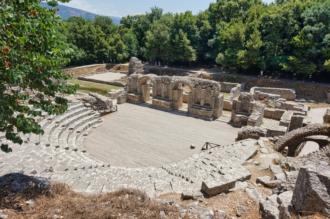
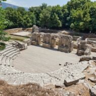
There is a moment at Butrint that no photograph prepares you for. You are standing in a Greek theatre built in the fourth century BC, looking at the limestone seats, and you notice that the walls around you are covered in writing. Not graffiti. Inscriptions. Formal, deliberate, carved deep into the stone by people who needed a record to last. They are manumission documents — legal records of the freeing of slaves, carved into the walls of this theatre under the protection of Asclepius, the god of healing, whose sanctuary the theatre served. In total, 597 freed slaves are recorded in the stones of Butrint. Most were women. Many were freed by the same families, which tells you something about the scale of landholding in this corner of ancient Epirus. The inscriptions date from the Hellenistic period — the 3rd and 2nd centuries BC — and they are still here, still legible to those who read ancient Greek, still in the exact positions in which they were carved.
While you are reading them, a turtle crosses the stage.
This is Butrint.
What Butrint is
GPS (main site entrance): 39.7423°N · 20.0212°E GPS (Lion Gate, Venetian fortification): 39.7445°N · 20.0234°E GPS (Baptistery): 39.7438°N · 20.0229°E Entry: approx 1,000 ALL (€10) · museum included Opening hours: 09:00–19:00 April–October · reduced hours November–March Getting there: Bus from Saranda (hourly, 30–40 min, 100 ALL) · taxi approx €15–20 one way Best season: April–June · September–October
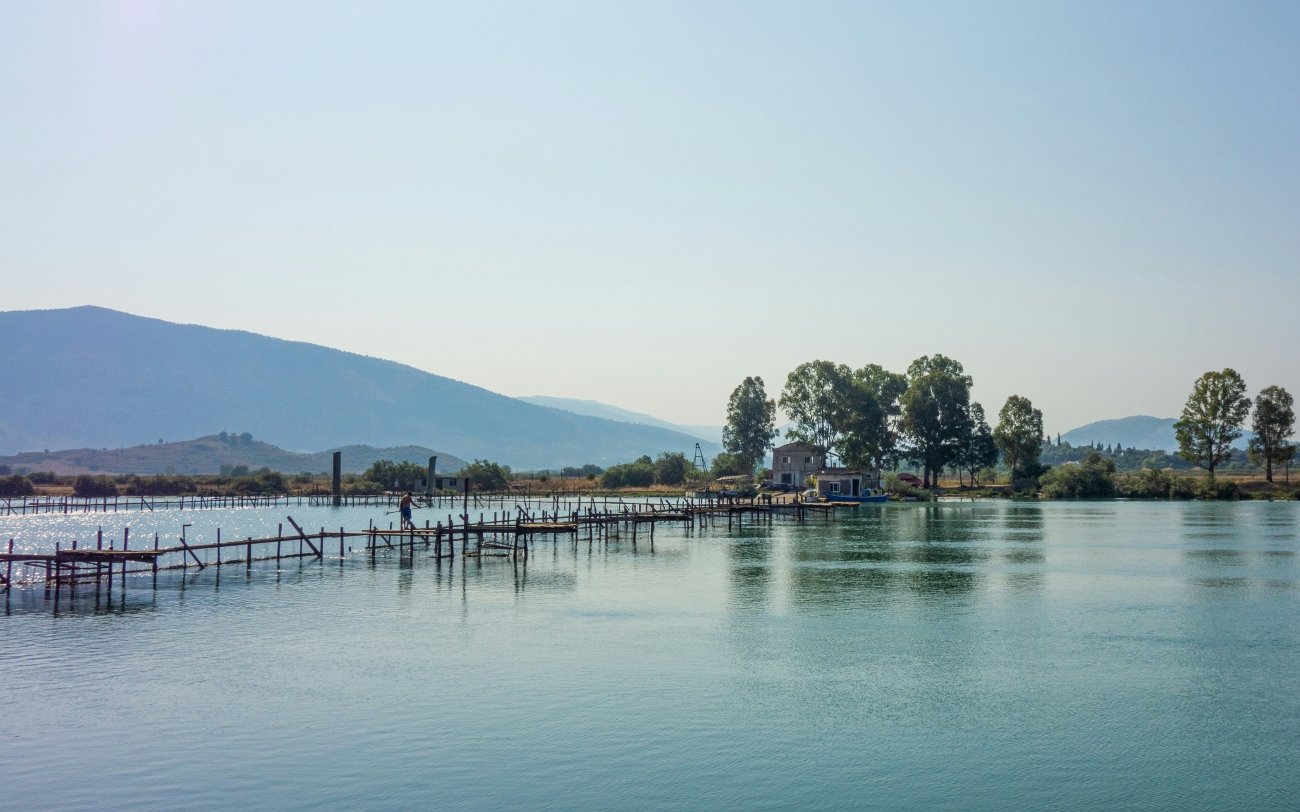
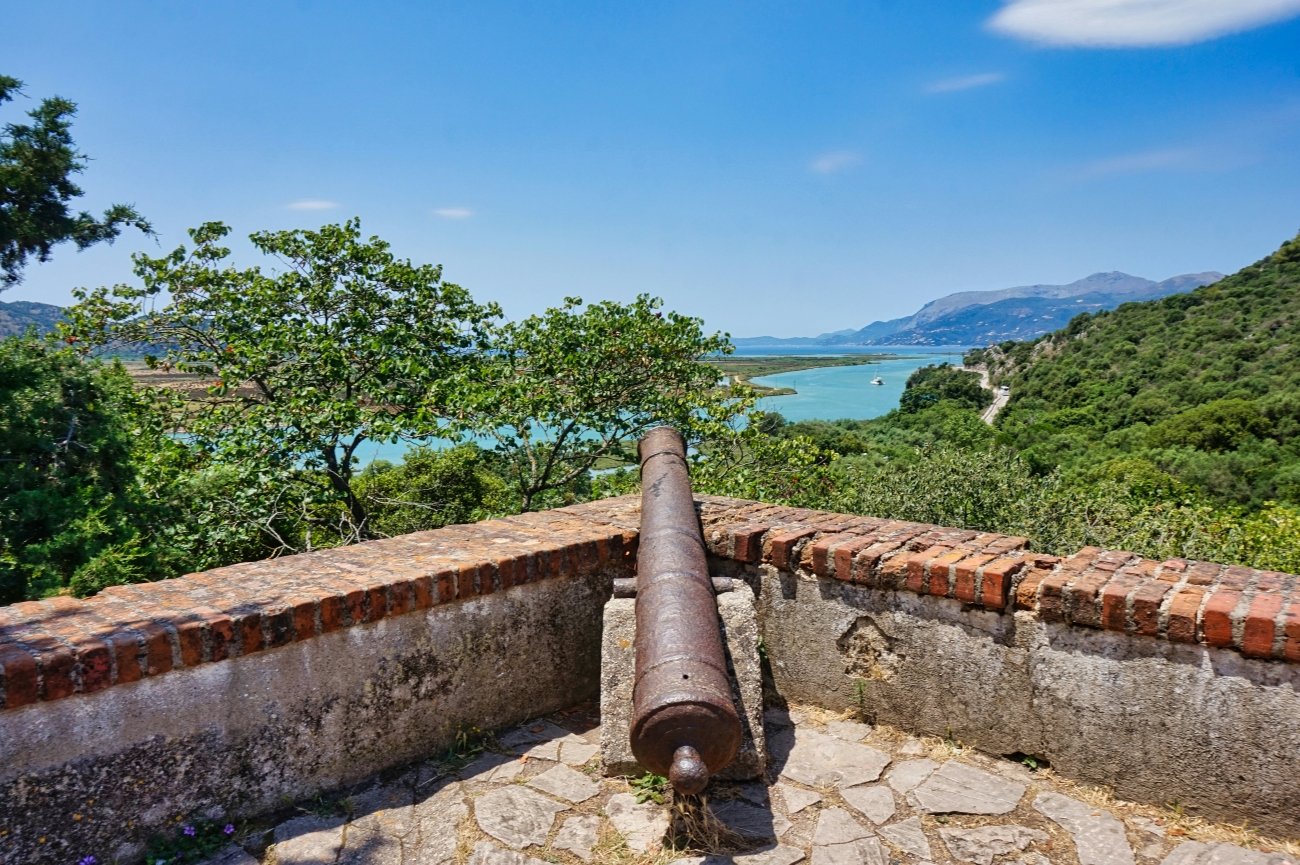
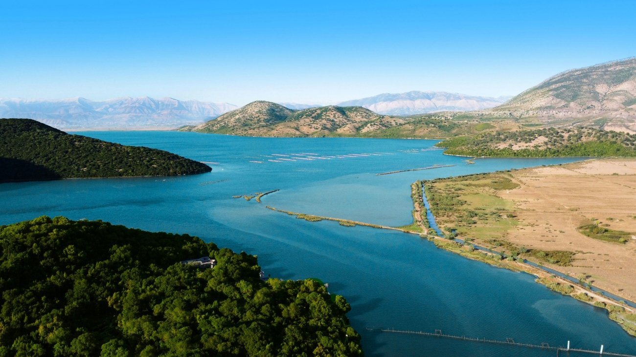
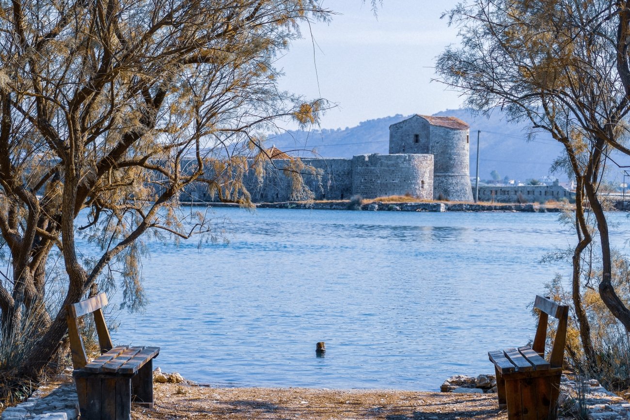
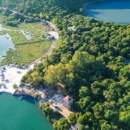
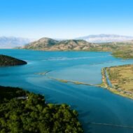
Butrint sits on a small peninsula at the southern tip of Albania, surrounded by a lake, a channel, and dense Mediterranean forest. It is approximately 20 kilometres south of Saranda and 25 kilometres across the water from Corfu, which is not coincidental — the view from the Venetian castle at the top of the hill takes in both the Albanian coast and the Greek island, and the strategic logic of the site is immediately clear. Whoever controlled this peninsula controlled the strait.
UNESCO inscribed Butrint as a World Heritage Site in 1992 — the same year Albania opened to the outside world after five decades of communist isolation. The timing matters. The site had been protected from mass tourism by accident rather than design, and what emerged when the gates opened was a monument in better condition than almost anywhere comparable in the Balkans. The communist government had maintained the archaeological park, if not always its scholarship. What had not been done was commercialised, managed, or made convenient. Butrint in the early 1990s was simply there, in its forest, intact.
It remains largely so.
The specific character of Butrint is layering — not the abstract layering that every ancient site claims, but physical, visible, walk-up-to-it layering. Greek walls with Roman repairs. Byzantine additions on top of Roman foundations. Venetian reinforcements built onto Byzantine masonry. All of it in the same stretch of wall, all of it datable, all of it standing. Albania’s most complete archaeological sequence, where five civilisations built their cities atop one another’s foundations without fully destroying what came before.
The Virgil connection
Before the archaeology, there is the myth.
In the third book of the Aeneid, Virgil has his hero Aeneas sail from Troy toward Italy and stop at Buthrotum — the ancient name for Butrint — where he finds Helenus, a Trojan prince, ruling a miniature Troy in exile on the Albanian coast. Helenus has rebuilt the towers of Pergamum. He has named a stream the Simois, after the river that ran through Troy. He has constructed a small simulacrum of the city his people lost. It is, Virgil writes, a pale shadow of the real thing — a copy made entirely from grief.
The Romans who came later and made Butrint a colony in 44 BC — ordered by Julius Caesar, confirmed by Augustus — were arriving at a place their founding epic had already made famous. They were, in a sense, occupying a site that Virgil had already occupied in the imagination of every educated person in the Roman world.
Whether Trojans actually came here after the fall of Troy is not the point. The point is that Butrint was significant enough, long enough before Rome, to be placed in the founding narrative of Roman civilisation. That significance is the reason the Greeks, the Romans, the Byzantines, and the Venetians all came. And all stayed.
The theatre and its 597 names
The Greek theatre was built in the late 4th century BC and expanded significantly by the Romans in the 2nd century AD — the stage was monumentalised, new seating was added, capacity grew to approximately 2,500. The theatre lay within the sanctuary of Asclepius, whose healing cult drew pilgrims from across the Adriatic. The inscriptions documenting the manumission of slaves were found when the theatre was excavated in 1928 by Luigi Maria Ugolini, director of the first Italian Archaeological Mission in Butrint.
The act of manumission — the formal freeing of a slave — was performed here under the protection of the god, witnessed by priests, and carved into the stone of the sanctuary wall so that the record could not be disputed or reversed. The legal formula was religious as much as civic. Asclepius was the witness. The stone was the guarantee.
597 freed slaves recorded. Most were women. The names are almost exclusively Greek, with a small number of Latin names carrying Greek family names — which maps the demographics of the enslaved population in Hellenistic Epirus with a precision that no other source provides. Standing in this theatre and reading those inscriptions — the specific names of people who were enslaved, then freed, in this specific place, 2,300 years ago — is an experience that no managed heritage site produces. The names are not in a museum. They are in the walls, at eye level, where they were put.
The baptistery and the mosaics of Ravenna
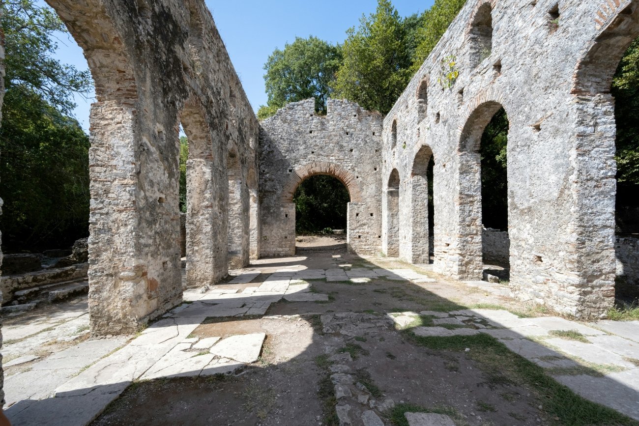
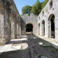
The Byzantine period at Butrint produced the site’s most visually extraordinary single element. The 6th-century baptistery — a circular building adjacent to the Great Basilica, built when Butrint was the seat of a bishopric under Constantinople — contains a mosaic floor whose quality rivals anything found in Ravenna or the great Byzantine churches of Constantinople.
The mosaic is an eight-ring design of extraordinary complexity: peacocks and stags, fish and hunting scenes, geometric borders in the small tesserae of late antique Byzantine craftsmanship. The peacock represents immortality in early Christian iconography. The stag represents the soul seeking Christ. The fish is the oldest Christian symbol. The hunting scenes in the outer rings are more theologically ambiguous — whether secular decoration or allegory has been debated since the floor was first excavated in the early 20th century.
The mosaics are covered with protective sand for most of the year to prevent degradation by foot traffic and weather. They are uncovered in certain scheduled periods — confirm with the site office on arrival whether they are visible during your visit. Even covered, the baptistery defines its space. The Bishop of Butrint baptised the Christians of this coast in this building, in the 6th century, in a room whose floor was as elaborately beautiful as anything the Byzantine Empire was producing in the same decade in its capital.
The Venetian Lion Gate and the castle
The Venetians arrived at Butrint in the 14th century and left the signature they left on every city they controlled: the winged lion of Saint Mark above a gate, marking their territory in carved stone.
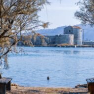
The Lion Gate is one of the most photographed elements of the site — the Venetian lion sitting above a much older arch, framing a view into the forested interior. The arch beneath the lion is significantly older than the lion itself. The Venetians built their fortification onto Greek and Byzantine foundations, as every other civilisation here did. The lion watches over a gate that was in use long before Venice existed as a republic.
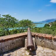
The Venetian castle at the top of the hill is now the site museum. The collection spans the full chronology of Butrint — Chaonian pottery from the earliest Greek period, Roman bronze votive offerings from the Asclepius sanctuary, Byzantine ecclesiastical objects, Venetian weaponry. The museum is modest in scale and significant in content. The view from the castle terrace over Butrint Lake and the Vivari Channel toward Corfu — visible on clear days, 25 kilometres across the water — is the specific view that explains, without the need for further explanation, why every Mediterranean power that passed through this corner of Albania decided to stay.
The forest, the water, the wildlife
The ruins at Butrint are not in a cleared, managed archaeological landscape. They are in a forest. The paths between the monuments pass under the canopy of Mediterranean oak, myrtle and wild olive. The Vivari Channel — the narrow waterway connecting Butrint Lake to the Ionian Sea — runs alongside the site boundary. In April, wildflowers grow in the grass between the Roman walls. In October, the forest turns and the site holds almost no visitors.
The wetland setting where Lake Butrint meets the Ionian Sea supports 246 bird species across marshes, channels, and Mediterranean forest. The loggerhead sea turtle nests in the lake and the channel. The turtle that crosses the theatre stage is not a figure of speech. It happens. The site is large enough, and quiet enough, that the fauna of the national park moves through it on its own terms.
Butrint in high summer — July and August — is manageable but compromised. The day-trip coaches from Saranda arrive mid-morning and leave mid-afternoon. Spring and autumn give you the site at the quality it deserves: the light at a lower angle, the forest in its best colour, the monuments without the crowd.
The practical visit
The route through the site follows a loop from the entrance — past the theatre, through the Roman baths and forum, along the ridge to the Great Basilica and baptistery, up to the Venetian castle and museum, then down past the Triconch Palace (a late Roman mansion built around 425 AD with a distinctive three-apsed dining hall that gives it its name) and the triangular Venetian fortress at the water’s edge. The full loop takes approximately two hours without stops. Allow three to four with the museum and the inscriptions.
The layered history at Butrint — Greek here, Roman there, Byzantine on top of both, Venetian reinforcing all of it — is genuinely difficult to parse without context. A local guide, available at the entrance for approximately €20–30 for a two-hour tour, transforms the visit from an interesting walk among ruins into a comprehensible historical narrative. The site without a guide is impressive. With one who can explain the sequencing — why the Byzantine wall runs through the Roman forum, why the Venetian gate sits on a Greek arch — it becomes something else.
FROM SARANDA:
Bus — departs from the roundabout near the port
      once per hour · 30–40 minutes · 100 ALL (€1)
      Last bus back departs Butrint late afternoon —
      confirm the time on arrival

Taxi — approx €15–20 one way
       Many drivers will wait at the site for a return

FROM CORFU:
Fast ferry Corfu town → Saranda: approx 1 hour
Then bus to Butrint
Total journey: 2 hours from Corfu
Most efficient approach for a single-day visit

ENTRY: approx 1,000 ALL (€10) · museum included
GUIDE: available at entrance · approx €20–30 · recommended
WHAT TO BRING: water · sun protection in summer ·
               walking shoes (uneven stone and earth paths)
Why it survived
Most of what the ancient Mediterranean built has been removed, built over, or destroyed by the weight of the centuries that followed. Butrint survived because it was abandoned. The city declined in the late Middle Ages — the marshes expanded, the population left, the forest returned. Trees grew through Roman walls. Soil covered the Byzantine mosaics. The process that made the site look ruined is the same process that preserved it. When Ugolini arrived in 1928 and began excavating, he found layers that had been sealed rather than erased — the 6th-century mosaic floor under 1,500 years of earth rather than under a car park, the manumission inscriptions in the walls rather than in fragments in a museum store.
The UNESCO citation is precise about this: the evolution of the natural environment of Butrint led to the abandonment of the city at the end of the Middle Ages, with the result that the archaeological site provides evidence of ancient and medieval civilisations that would otherwise not exist.
The 597 names in the theatre walls are still there because no one needed the stone for anything else. The mosaic floor is intact because the city that would have worn it away ceased to exist before it could. The Venetian lion above the gate is still watching because the people who might have taken it down went elsewhere.
Butrint was saved by being left alone. That is the most specific and most useful thing to understand before you arrive.
What this article gives you — and what the guide contains
Five GPS coordinates. The honest editorial case for what Butrint is — not a day trip from Saranda, not an easy tick on the Balkans route, but one of the most significant archaeological sites in the Mediterranean, preserved by accident, still largely as it was left.
What it does not contain: the secondary positions within the site that the standard tour misses, the light windows for photography at the theatre and the Lion Gate, the logistics of combining Butrint with the Albanian Riviera coast, the Blue Eye spring and the mountain interior of the Gjirokastra region on the same journey. The honest comparison to Apollonia and Berat — the two other UNESCO sites in southern Albania that together with Butrint define an ancient southern Albanian itinerary that almost no published guide has assembled. And the fifteen additional sites in the Western Balkans that the Beyond the Map Balkans guide covers in full.
That is in the guide.
→ Albanian Riviera: The Beyond the Map Field Guide
The coast that the standard itinerary describes in a paragraph.
Butrint in depth alongside Sarandë, the Blue Eye, Himara, Dhermi, the Llogara Pass and the villages of the Gjirokastra interior. GPS for every site, secondary positions the day-trip buses never reach, photography windows, and the honest logistics for slow independent travel down the Albanian coast.
Get the guide → thewanders.eu/product/albanian-riviera-field-guide/
→ Overland & Campervan in the Balkans — The Beyond the Map Road Guide
The guide that goes past the highway.
Albania covered in depth alongside Bosnia, Montenegro, North Macedonia, Kosovo, and the Serbian interior. 77 pages · GPS atlas · border crossings · road notes · what the standard itinerary misses.
The complete Balkans field guide for slow, independent and campervan travel.
Get the guide → thewanders.eu/product/overland-balkans/
→ Autumn in the Balkans — The Beyond the Map Seasonal Guide
The same territory in October light.
When the tourist season ends, the Balkans becomes a different place. 100 pages covering Albania, Bosnia, Montenegro, North Macedonia and beyond — the autumn villages, the mountain roads without traffic, the UNESCO sites without the coaches. The seasonal companion to the road guide.