Every atlas shows them. Most travel guides don’t bother. Europe’s islands are counted in the thousands — a few hundred are famous, a few dozen are infamous, and the rest exist in a cartographic silence that has nothing to do with their actual interest. They are not undiscovered. They simply fell out of the itinerary.
The five islands in this article share a specific quality: each one carries a history that the English-language travel industry has almost entirely ignored, yet each is reachable, navigable, and rewarding in ways that the famous islands beside them are not. One is the southernmost point of Europe. One was abandoned by its entire population in a single week in 1944. One was home to a Nobel laureate who chose to be buried there. One has been making wine the same way since before the Romans arrived. And one was, for nearly two thousand years, the prime meridian of the world — the zero point from which all longitude was measured — until a conference in Washington moved the line to Greenwich and the island lost its coordinates.
These are the coordinates you won’t find on the standard map.
Gavdos, Greece — The End of Europe
If you stand at Cape Trypiti on the southern tip of Gavdos and look south, the next significant land is Libya. You are further south than any point in Tunisia, further south than the northern coast of Morocco, further south than Crete by two hours on a ferry that may or may not run depending on what the Libyan Sea is doing that day. You are at the southernmost point of Europe.
Almost nobody in Europe knows this.
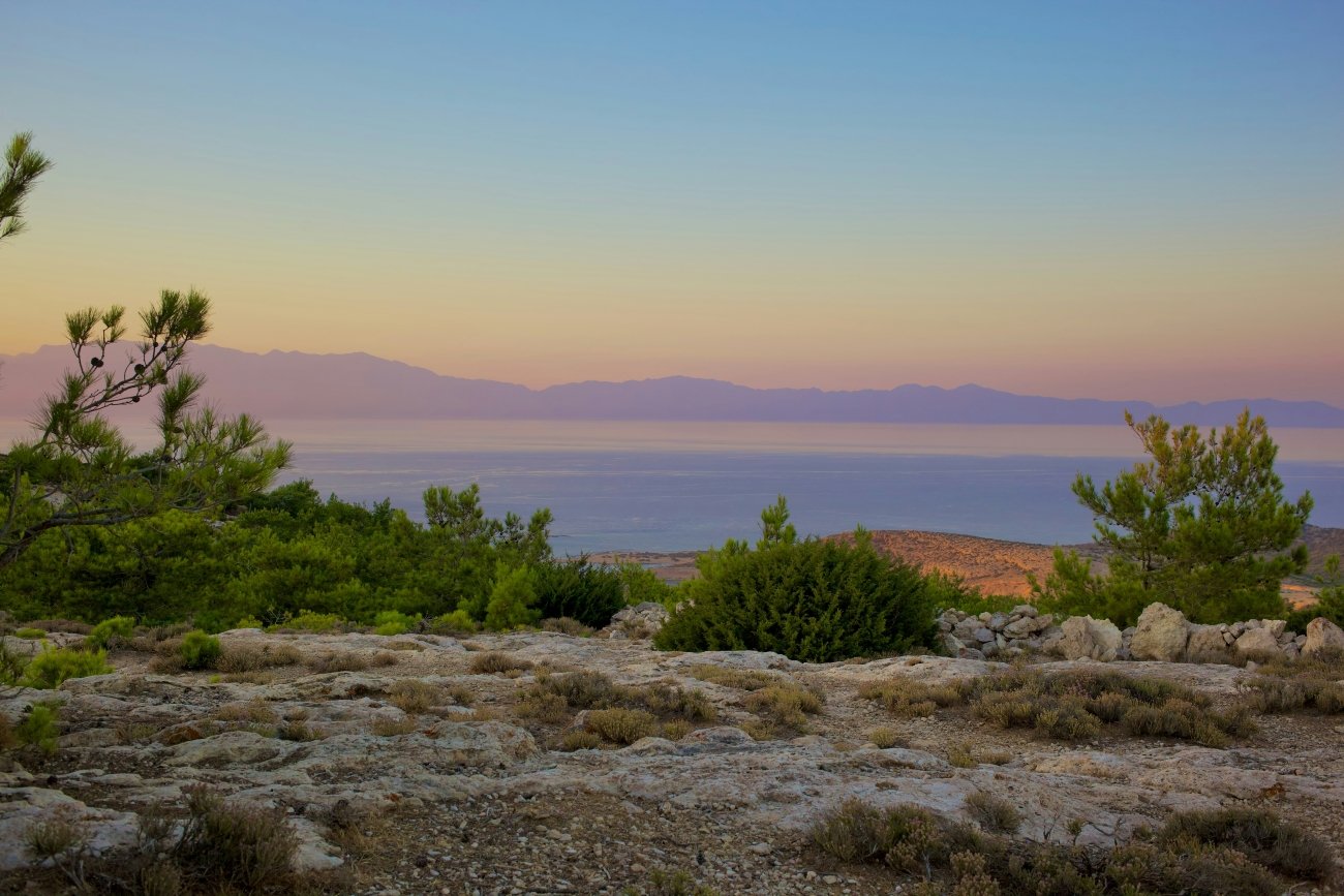
Gavdos sits 65 kilometres south of the Sfakia coast of Crete, an island of about 30 square kilometres with a year-round population of around 140. It has no airport, no bank, no petrol station in the conventional sense, and until recently, no reliable electricity beyond solar panels and generators. The single paved road connects the port at Karave to the village of Kastri. Everything else is dirt track, pine forest, and the particular silence of a place that has been continuously inhabited for at least three thousand years and has stopped trying to impress anyone.
The ancient world knew it as Cauda, or Gaudos. It appears in the Acts of the Apostles — Paul’s ship sheltered in its lee during a storm on the way to Rome. The Byzantines used it as an exile colony. The Ottomans held it from 1665 to 1895, during which time the population shrank from several thousand to a few hundred. Greek Communists were exiled here in the 1930s. In 1941 the Axis occupied it. In 1996 it was briefly the focus of a Greek-Turkish naval confrontation during a NATO exercise. In 2002, the leader of the terrorist organisation November 17th — who had evaded capture for decades while the Greek state conducted one of its most embarrassing manhunts — turned out to have been living here as a beekeeper.
The mythology is older than any of this. Scholars have proposed Gavdos as the island the ancient Greeks called Ogygia — the island of Calypso, where Odysseus was detained for seven years and offered immortality in exchange for never leaving. He chose to leave. The island is still there.
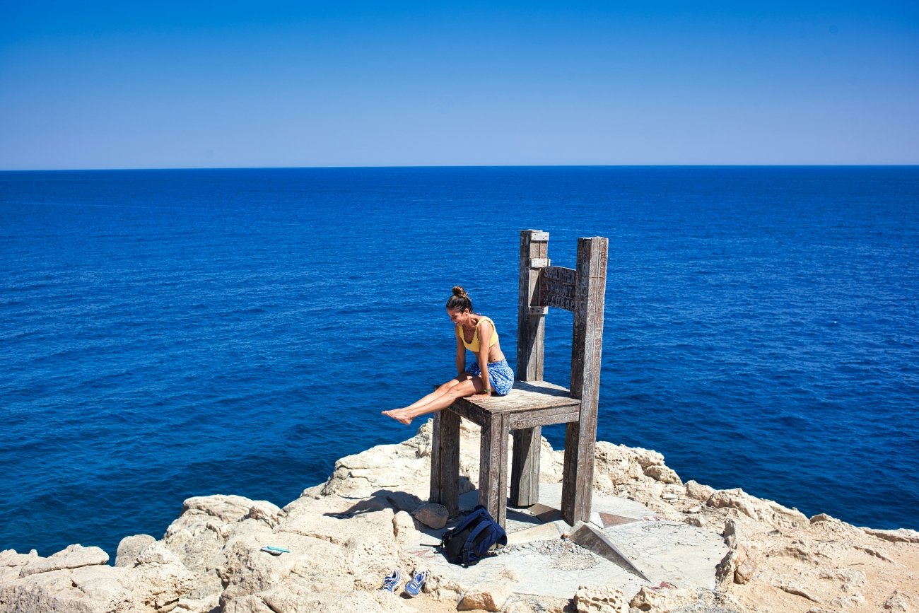
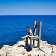
Cape Trypiti, where the concrete chair sculpture sits above a natural arch in the rock, is a four-kilometre walk from the nearest track. There is no café, no viewpoint car park, no plaque in four languages. The chair faces south across the Libyan Sea. You can sit in it.
GPS: Gavdos port (Karave) — 34.839°N, 24.082°E GPS: Cape Trypiti — 34.800°N, 24.098°E
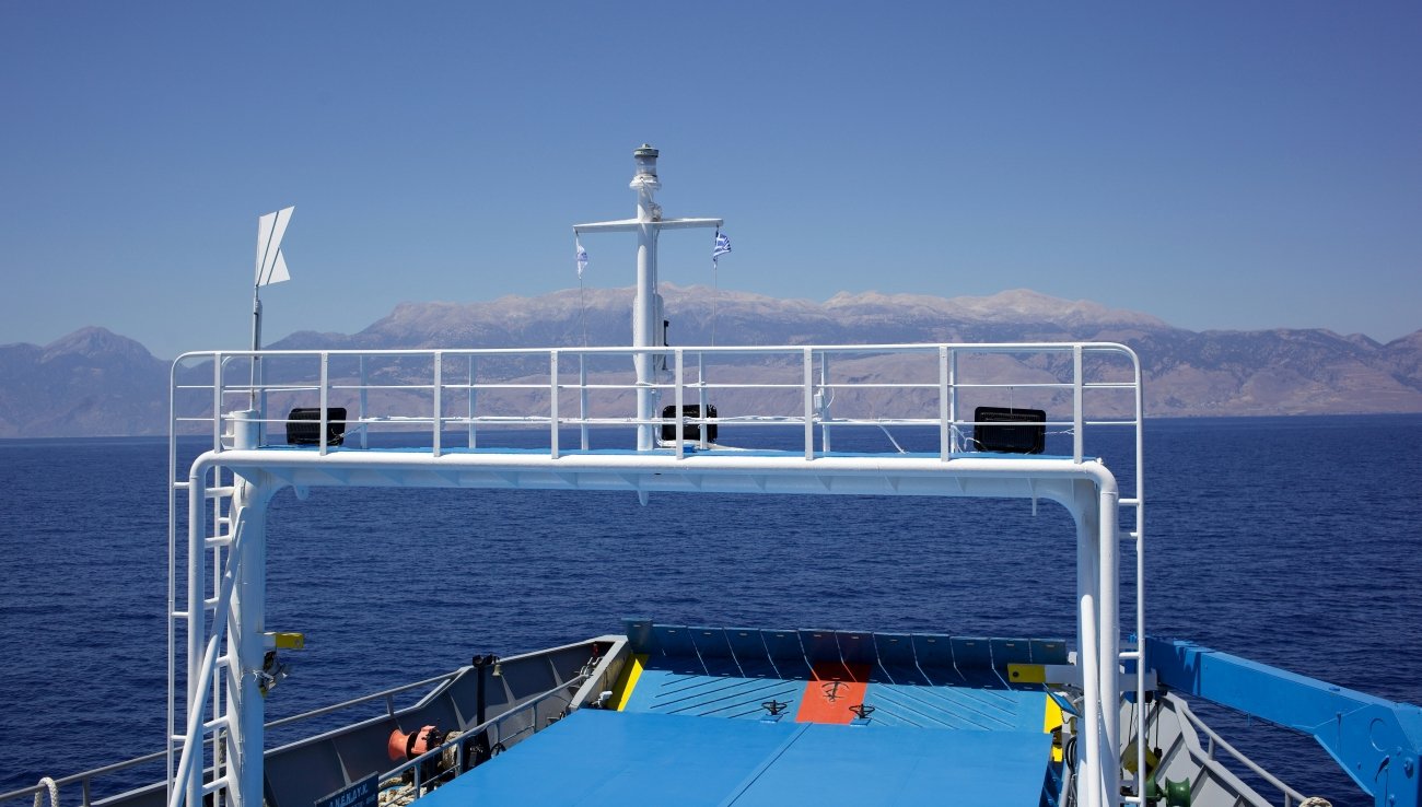
Getting there: Seasonal ferries from Hora Sfakion, Paleochora, and Sougia on the southern coast of Crete. Services run frequently in summer and irregularly or not at all between November and March. Check current schedules before planning — cancellations due to weather are common. The crossing takes approximately 1.5–3 hours depending on departure point.
Vormsi, Estonia — The Island That Emptied Itself
In September 1944, the entire Swedish-speaking population of Vormsi — an island in the West Estonian Archipelago that had been home to Swedish settlers since the thirteenth century — boarded boats and left. The Soviet advance was coming. Within days, an island of several thousand people was functionally empty. The Swedes who had fished these waters, farmed these fields, and filled the church at Hullo since the medieval period were gone. Most of them never came back.
Seven hundred years of continuous Swedish settlement, ended in a week.
The Estonians call them rannarootslased — the coastal Swedes. They had been on Vormsi, which the Swedes called Ormsö (Snake Island), since at least the 1200s, outlasting every political upheaval — Danish rule, Swedish rule, Russian Empire, the first Estonian Republic. They left only when the Soviet return made staying unthinkable. Today the island has about 400 registered inhabitants, many of them mainland Estonians who keep summer homes here and register as residents so their income tax flows to the island’s budget rather than Tallinn’s. The island is, by some measures, the wealthiest jurisdiction per capita in Estonia outside the capital metro.
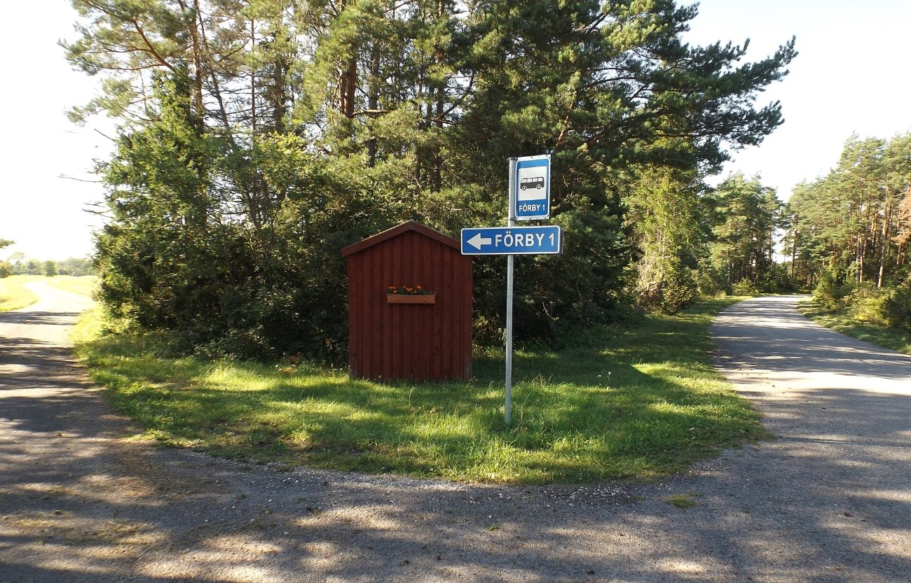
What the Swedes left behind is still here. The fifteenth-century St Olav’s Church in Hullo is Lutheran, built in the Swedish period, and its churchyard contains the grave markers of families who left in 1944 — the stones facing west, toward Sweden, as if they always knew the direction of exile. The church’s interior has barely changed. There are no tourists because there is no particular reason to come, by the logic of conventional travel. There is a car ferry from Rohuküla on the mainland, a handful of roads, and the kind of quiet that exists only on islands that the twentieth century passed through without pausing.
Vormsi is 93 square kilometres. The interior is mostly pine forest and meadow. The western shore looks across the Väinameri strait toward Hiiumaa. In spring, orchids flower in the limestone grasslands that the Swedes maintained for centuries and that have been designated a conservation zone precisely because grazing declined after 1944 and the habitat is being slowly lost.
GPS: Hullo church — 59.003°N, 23.213°E GPS: Vormsi ferry pier (Sviby) — 59.026°N, 23.292°E
Getting there: Car ferry MS Ormsö from Rohuküla harbour, approximately 30 minutes. Services run several times daily in summer, reduced in winter. Rohuküla is accessible by road from Haapsalu, which is 100 km from Tallinn.
El Hierro, Spain — The Island That Measured the World
For nearly two thousand years, the prime meridian — the line from which all longitude on earth was calculated — ran through El Hierro. The Greeks put it here. Ptolemy put it here. The cartographers of the Renaissance put it here. El Hierro was, for most of recorded Western geography, the western edge of the known world: the last island before the ocean consumed everything, the zero point from which distance was reckoned.
Then in 1884, the International Meridian Conference met in Washington and moved the meridian to Greenwich. El Hierro lost its coordinates.
The island is the smallest and youngest of the Canary Islands, 268 square kilometres of tilted volcanic plateau rising from the Atlantic. Its permanent population is around 11,000. It has no direct international flights. The ferry from Tenerife takes three hours. Most visitors to the Canaries never come here; most who do come for the diving, which is among the best in the Atlantic — the water is clear enough to see 50 metres in any direction, and the volcanic seabed is unlike anything in the Mediterranean.
What the travel industry has almost entirely ignored is what El Hierro actually is. In 2014, the island completed the construction of a hybrid wind-hydroelectric power system — a combination of wind turbines on the ridge above the caldera and a pumped-storage reservoir — that, for the first time in history, allowed a populated island to run on 100% renewable electricity for extended periods. The record runs have exceeded a hundred consecutive hours. The island has a stated goal of complete energy independence. It has come closer to achieving it than any other inhabited island in the world.
The ancient juniper forest in the El Sabinar area on the western plateau is older than the Spanish claim to the island. The trees grow horizontal, shaped by the prevailing northeast trade winds into forms that look less like trees than like topiary. The Guanche people — the indigenous Berber inhabitants of the Canaries before the Spanish conquest in 1405 — called the island Esero. The conquest of El Hierro was completed in a single campaign. Most of the Guanche population was enslaved and transported to the mainland. The island was repopulated by Castilian settlers.
A stone marker on the island’s western coast — the Meridian Monument — stands at 27.724°N, 17.999°W: the Ptolemaic prime meridian, the zero of the ancient world, now a tourist information panel in a car park above a cliff.
GPS: El Hierro (Valverde, capital) — 27.809°N, 17.915°W GPS: El Sabinar juniper forest — 27.734°N, 18.150°W GPS: Meridian Monument — 27.724°N, 17.999°W
Getting there: Flights from Gran Canaria, Tenerife, and Lanzarote (Binter Canarias, seasonal). Ferry from Los Christianos, Tenerife, approximately 3 hours. The island has one town (Valverde) and a small network of roads. Car rental is available on arrival; the island is small enough to drive across in 45 minutes.
Pantelleria, Italy — The Arab Island That Makes Italian Wine
Pantelleria is closer to Tunis than to Sicily. The crossing from the Tunisian coast is 70 kilometres. The crossing to Sicily is 110. For 245 years — from 827 to 1072 AD — it was an Arab island, ruled by the Aghlabid and Fatimid caliphates, and the architecture, the agriculture, and the landscape bear the mark of that period in ways that no other Italian island does.
The Romans called it Cossyra. They valued it as a staging post between Africa and Sicily. The Arabs understood it differently: as a place to live, to cultivate, to build in stone. The dammusi — the traditional cubic-shaped houses of Pantelleria, with thick basalt walls up to two metres deep and domed roofs designed to channel rainwater into underground cisterns — are an Arab building form. There is no other architecture like them in Italy. The word itself is Arabic. Pantelleria has more dammusi than any other kind of building.
The vine cultivation is older than the Arab period, but it was refined under it. The island receives almost no rain between May and October. The wind — the scirocco from Africa, the tramontana from the north — is nearly constant and strong enough to kill conventional vines. The farmers developed a response: the alberello pantesco, a system of growing each vine individually in a shallow circular pit dug into the volcanic soil, the walls protecting the plant from the wind, the stone retaining moisture. Each pit is dug and maintained by hand. The system has been used on Pantelleria for at least a thousand years. In 2014, UNESCO inscribed it on the Intangible Cultural Heritage list — the first viticultural practice in the world to receive this designation.
The grape is Zibibbo, a muscat variety brought from the Levant. The wine is Passito di Pantelleria: amber, dense, the flavour of apricots and dried figs, produced in small quantities from grapes that are partially dried on the volcanic rock before pressing. It is one of the great wines of the Mediterranean. Almost no one outside Italy has heard of it.
The island has no sand beaches. The coastline is black lava, sea caves, and thermal pools where volcanic vents heat the water to 40 degrees. The interior is terraced, volcanic, and very quiet.
GPS: Pantelleria town — 36.831°N, 11.957°E GPS: Lago di Venere (thermal lake) — 36.848°N, 11.982°E
Getting there: Flights from Palermo and Rome (Meridiana/seasonal operators), or ferry from Trapani in Sicily, approximately 5.5 hours. The ferry runs year-round; the island is busiest in July and August but genuinely accessible in spring and autumn.
Hiddensee, Germany — Where the Weimar Republic Went in Summer
In 1927, the island of Hiddensee banned private motor vehicles. The ban still stands. It is now the longest-running car prohibition in Germany. You arrive by ferry from Stralsund or Rügen, and everything after that is bicycle or horse cart or walking. The island is 17 kilometres long and at its narrowest point approximately 250 metres wide.
It is also, according to meteorological records from 2008, the sunniest place in Germany: 2,168 hours of sunshine per year, more than the Bavarian Alps, more than the Rhine Valley, more than anywhere else in the country. This is not mentioned in the handful of German-language travel articles that occasionally notice Hiddensee exists.
The island’s other distinction is less meteorological. In the 1920s and 1930s, Hiddensee was the summer colony of the Weimar Republic’s cultural elite. The painter Gustav Schönleber had discovered it in 1875 and word spread slowly through artistic circles until, by the 1920s, it had become what Capri was to the English and what Deauville was to the French: the place where the intelligentsia went when they needed to disappear. Gerhart Hauptmann, the Nobel laureate playwright, bought his house here in 1930 and summered on the island until 1943. The silent film actress Asta Nielsen’s family kept a house here from 1928, designed by the architect Max Taut. Einstein visited. Käthe Kollwitz visited. Thomas Mann visited.
When the GDR absorbed Hiddensee after 1945, the tradition continued in a different register: the island became a refuge for East German writers, actors, and scientists who needed a place that was technically inside the surveillance state but felt, with the water on both sides and the ferry as the only connection, slightly outside it. The Stasi watched them anyway. The files are now in the archives.
Hauptmann died in 1946 and was buried in the Kloster cemetery on the island, at his own request. His house is now a museum. The grave is in the churchyard of the medieval monastery — founded 1296, dissolved 1536 — whose ruins still stand among the trees above the village.
GPS: Kloster village — 54.573°N, 13.100°E GPS: Gerhart Hauptmann Museum — 54.572°N, 13.101°E
Getting there: Ferry from Stralsund (mainland) or from Schaprode on Rügen island. Crossing takes 35–90 minutes depending on departure point. No cars permitted on the island — leave your vehicle at the ferry terminal. Bicycles can be rented on arrival. The Dornbusch Lighthouse on the island’s northern headland is the natural orientation point — visible from the ferry approach and worth the climb for the view across the Baltic.
Five Islands, Five Gaps in the Map
What connects these five places is not geography — they span from the Baltic to the Libyan Sea, from the Atlantic to the edge of North Africa. What connects them is the specific kind of invisibility that comes from being just outside the orbit of a famous neighbour. Gavdos is below Crete. Vormsi is beside Hiiumaa. El Hierro is the smallest Canary. Pantelleria is west of Sicily. Hiddensee is behind Rügen.
Each one carries a history that the travel industry hasn’t found a convenient hook for. The eviction of a medieval Swedish community. An island that was the prime meridian of the ancient world, then wasn’t. A Nobel laureate’s chosen grave. A wine tradition older than the country that now produces it. The continent’s southern edge, reached by a ferry that cancels in rough weather.
These are the islands the atlas shows and the itineraries miss.
→ Hidden Europe Map · Overland & Campervan in the Balkans · Autumn Photography in Europe