

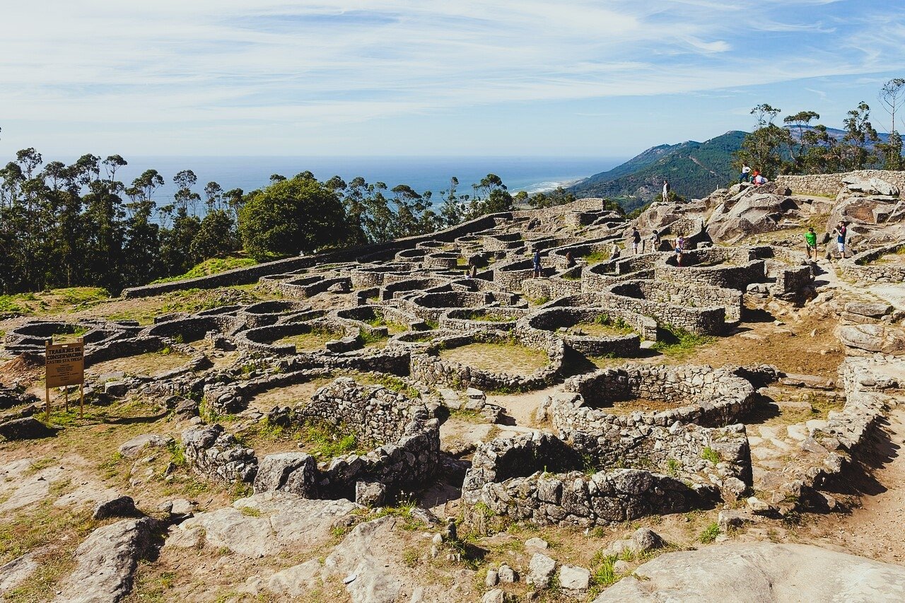
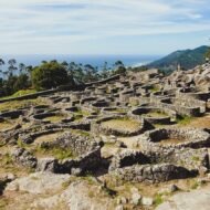
On a granite hill above the mouth of the Miño, where Spain looks across the river at Portugal, the round stone houses of an Iron Age town spill down the slope. Two thousand years ago, thousands of people lived here. Today you can walk their streets with the Atlantic at your back.
At the far south-western tip of Galicia, the river Miño ends its journey in a wide, sandy estuary. On one bank is the fishing town of A Guarda, in Spain; on the other, the Portuguese town of Caminha. Above them both rises Monte Santa Trega (Santa Tecla in Spanish), 341 metres high, and on its slopes lies one of the most impressive Iron Age settlements in the Iberian Peninsula: the Castro de Santa Trega.
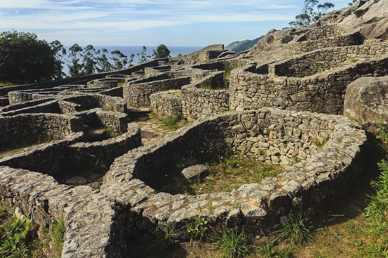
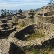
The castros were the hill towns of north-west Iberia, the home of the people the Romans met when they reached Galicia and northern Portugal. Many are now overgrown or reduced to foundations. Santa Trega is different: round and oval stone houses, walls and paths, laid out across the hillside, with views that sweep from the Atlantic to the mountains of Portugal.
At a glance
| Where | Monte Santa Trega, A Guarda, Pontevedra, Galicia, Spain |
| Coordinates | 41.89° N, 8.87° W |
| What | Iron Age hillfort (castro), inhabited around 100 BC – AD 100 |
| Height | 341 m (summit) |
| Status | National Historic-Artistic Monument since 1931, Bien de Interés Cultural |
| Also on the hill | The MASAT archaeological museum, the hermitage of Santa Trega, viewpoints |
| Time needed | Half a day |
A town on the hill
At its height, around the 1st century BC, Santa Trega was home to an estimated 5,000 people, making it one of the largest settlements in the north-west. Its walls enclosed a large part of the hill, and most of its houses were small and round, built of granite with stone foundations. Its people made pottery, jewellery, textiles and tools.
By then, the Romans were already arriving. Santa Trega is often called a “Castro-Roman” settlement, from the time when Roman goods and influence were beginning to reach the hillforts, although its buildings show very little Roman influence. By the end of the 1st century AD, the people had left the hill for the valleys below.
The hill itself was sacred long before the town. Petroglyphs carved into the rock, among them the large carved stone known as the Laxe do Mapa, show that people were coming here about 2,000 years earlier.
Only a small part of the settlement has been excavated. Work began in 1914, and systematic excavations started again in 1983. They still continue.
What to see
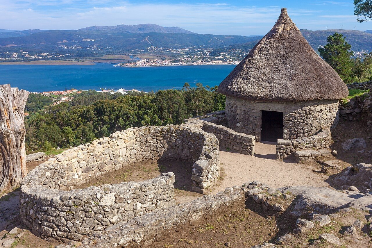
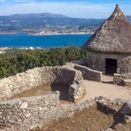
The castro. The excavated area lies along the road up the hill. Paths lead between the round houses, and one has been rebuilt with a thatched roof to show how they once looked. The route is not adapted for people with reduced mobility.
The MASAT museum. Near the summit, the Museo Arqueolóxico Monte Santa Trega displays finds from the castro and the area: pottery, jewellery, tools and carved stones. Its star is the Cabezón do Trega, a carved stone head found in 2015.
The hermitage. At the top stands the small chapel of Santa Trega, rebuilt in the 16th and 17th centuries on an older site. Every 23 September, the people of A Guarda climb the hill for the romería, with Mass, a procession and a long afternoon of food and music.
The view. From the summit, you look down on the Miño estuary and the sandbanks, out to the Atlantic, across the river to the coast of Portugal, and inland up the green valley of O Rosal. Few viewpoints in Spain take in two countries and an ocean at once.
When
Best: May to October, and especially on a clear day.
In summer, the town of A Guarda runs free guided tours of the castro: usually at weekends in June and September, and several times a day from Tuesday to Sunday in July and August. On 23 September, the romería fills the summit.
Winter brings Atlantic storms and low cloud that can hide the view completely. Check the weather before driving up.
Weather at Santa Trega: a mild, wet Atlantic climate. In nearby Vigo, average highs are about 12°C in January, 17°C in April and 25°C in July and August. Summers are dry and bright; from autumn to spring, rain is frequent and heavy, and the hilltop is often windy.
Getting there
- By car: the road climbs from the centre of A Guarda to the summit, about 4 km. A small access fee is charged per vehicle or per person at the entrance to the hill.
- On foot: the waymarked trail PR-G 122 Camiños do Trega climbs from the town through the woods, about 2 km to the summit.
- From Vigo: A Guarda is about 50 minutes by car, along the coast.
- From Portugal: Caminha is just across the river; by road, cross the Miño at the bridges further upstream (Tui–Valença is the main crossing).
Beyond the map
Most visitors to Galicia head north, to Santiago or the Costa da Morte. Santa Trega sits at the opposite end of the region, on the border, on a quiet road out of a fishing town. And yet it is one of the great Iron Age sites of Europe, a whole town on a hill, overlooking the place where a river, an ocean and two countries meet.
Read next: Where the Celts Were · Where the Celtic Gods Lived