


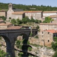

In the 13th century, a crusade was launched not against a distant enemy, but against Christians in the south of France. The “heretics” it hunted, the Cathars, sheltered in villages and castles on the edge of the sky. Beyond Carcassonne and Montségur, here is where their story can still be felt.
In the late 12th century, a different kind of Christianity spread through the Languedoc, the land between Toulouse, Carcassonne and the Pyrenees. Its followers believed the material world was evil and rejected the authority of the Catholic Church. Their holiest members, the Perfects, lived in poverty and preached in the language of the people. Their opponents called them Cathars, or Albigensians.
In 1209, the Pope launched a crusade against them, the Albigensian Crusade. For decades, northern French armies, led at first by Simon de Montfort, besieged the towns and castles of the south. Thousands were killed, and many who refused to renounce their faith were burned. In 1244, after the fall of Montségur, more than two hundred Cathars went to the flames. By the end of the century, the Inquisition had all but wiped them out.
Today, the region calls itself Pays Cathare, “Cathar Country”, and its castles are known as the “Cathar castles”. The name is a little misleading. The Cathars did not build castles: the fortresses belonged to the lords of the south, who sheltered the Cathars, fought the crusaders, and were often Cathar believers themselves. Many castles were later rebuilt by the French kings as royal fortresses. But the story of the Cathars is written in these places, and beyond the famous names, most of them are quiet.
| Place | Why go | |
|---|---|---|
| 1 | Minerve | A village in a gorge, and the first great burning of the crusade (1210) |
| 2 | Termes | A mountain castle that held out for four months |
| 3 | Lastours | Four castles on one ridge, the heart of Cathar resistance |
| 4 | Puilaurens | A fortress on a peak where Cathar nobles took refuge |
| 5 | Quéribus | The last Cathar stronghold, high above the vineyards (1255) |
1. Minerve
43.35° N, 2.75° E · Minervois, Hérault
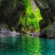
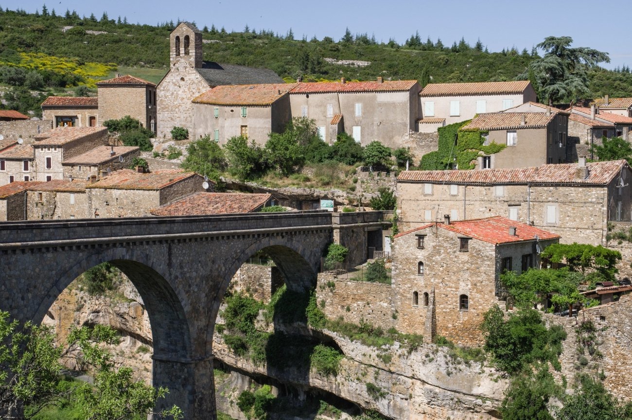
The village of Minerve stands on a rock between deep gorges, where the river Cesse disappears underground through a great natural tunnel. Today, fewer than a hundred people live here, among stone houses and vineyards, in one of Les Plus Beaux Villages de France. It gave its name to the Minervois, one of the wine regions of the Languedoc.
In 1210, Cathars took refuge here, and in early June, Simon de Montfort arrived to besiege the village. The gorges made an assault impossible, so he bombarded it with a great trebuchet the defenders called mala vazina, “the bad neighbour”. After about seven weeks, short of water, Minerve surrendered on 22 July 1210. 140 Cathars who refused to convert were burned at the stake; three women who renounced their faith were spared. It was the first great burning of the crusade.
In the Field Guide: the walk through the gorges and the natural tunnels, the remains of the siege, and the wine villages of the Minervois.
When: April to June and September to October, July and August are hot in the gorges. Weather in Minerve: a Mediterranean climate. In nearby Carcassonne, average highs are about 29°C in July and August, 25°C in September and 20°C in October, and about 10°C in January. Summer is the driest season, and the cers, a strong west-north-west wind, blows often. Getting there: about 45 minutes by car from Carcassonne.
2. Termes
42.99° N, 2.56° E · Corbières, Aude
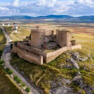
In the wild hills of the Corbières, the ruins of the Château de Termes stand on a rocky spur above a deep valley. In 1210, its lord, Raimon de Termes, a protector of the Cathars, refused to submit, and Simon de Montfort laid siege to the castle in early August.
The siege lasted nearly four months. In late October, the defenders’ water ran out, and Raimon offered to negotiate. That night, heavy rain refilled the cisterns, and the talks broke off. But the rain may have filled contaminated barrels, and, according to one chronicler, the garrison was struck by dysentery. On the night of 22 November 1210, the defenders tried to escape. Raimon was captured and died years later in a prison in Carcassonne.
The story of Termes did not end there. Raimon’s son, Olivier de Termes, fought for the Cathar cause for years, then changed sides. Forty-five years later, he would lead the army against the last Cathar castle, Quéribus.
In the Field Guide: the path from the village of Termes to the castle, the Gorges du Terminet, and a route through the castles of the Corbières.
When: April to June and September to October. Weather at Termes: like the rest of the Aude: warm, dry summers (highs around 29°C in Carcassonne) and mild winters, but the castle’s exposed site is often windier and cooler. Getting there: about 1 hour by car from Carcassonne.
3. Lastours
43.33° N, 2.38° E · Cabardès, Montagne Noire, Aude
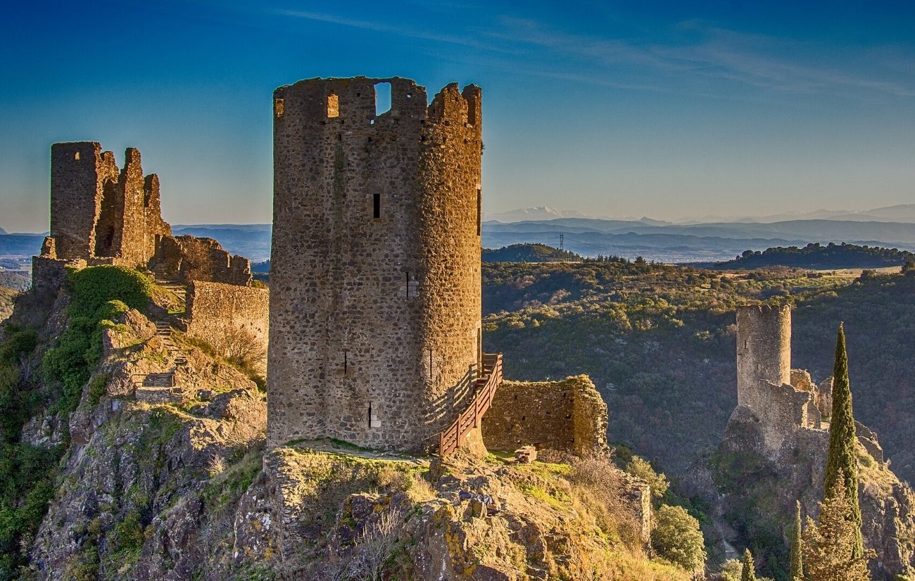
North of Carcassonne, on the edge of the Montagne Noire, a single rocky ridge carries four castles: Cabaret, Tour Régine, Surdespine and Quertinheux. Together they are the Châteaux de Lastours, and in the early 13th century they were the heart of Cathar resistance in the Languedoc. The lords of Cabaret were closely linked to the Cathars, Cathar bishops stayed here, and the villages around sheltered many believers.
In 1209, the castles held out against Simon de Montfort. Unable to take them by force, he tried terror: he had prisoners from the village of Bram blinded and mutilated, and sent them to Lastours, led by one man left with a single eye. The castles still held. Their lord, Pierre-Roger de Cabaret, captured a crusader leader, Bouchard de Marly, and later exchanged him for the surrender of Cabaret in 1211. In 1229, the castles became the centre of a new Cathar rising.
In the Field Guide: the walk up to the four castles, the viewpoint opposite the ridge, and the Cathar villages of the Cabardès.
When: April to October. Weather at Lastours: close to Carcassonne’s climate: warm summers (highs around 29°C in July and August) and mild winters, with more rain in spring and autumn. Getting there: about 20 minutes by car north of Carcassonne.
4. Puilaurens
42.80° N, 2.30° E · Fenouillèdes, upper Aude valley
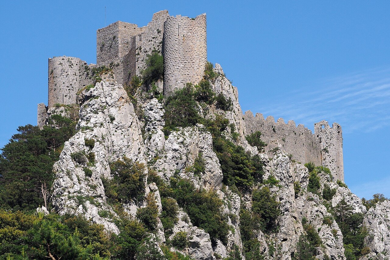
On top of Mont Ardu, at 697 metres, the walls of Puilaurens wrap around a rocky summit above the forests of the upper Aude valley. The castle guarded the old border with the Kingdom of Aragon, and during the crusade it gave shelter to dispossessed Cathars and to nobles such as Guillaume de Peyrepertuse. Later, it became a French royal fortress on the frontier.
A steep, zigzagging path climbs to the walls, with a barbican, murder holes, round towers and a great keep. One tower is said to be haunted by a White Lady, the granddaughter of King Philip the Fair, murdered by her husband, Peter the Cruel of Castile.
In the Field Guide: the climb to the castle, the 2-hour path from Axat, and the gorges of the upper Aude.
When: April to October, the path can be icy in winter. Weather at Puilaurens: cooler and wetter than the plain, with mountain weather at the summit. Summers are pleasant for walking; winters bring cold winds and occasional snow. Getting there: about 1 hour 30 minutes by car from Carcassonne. A car park lies at the foot of the steps; wear good shoes.
5. Quéribus
42.84° N, 2.62° E · Cucugnan, Corbières, Aude
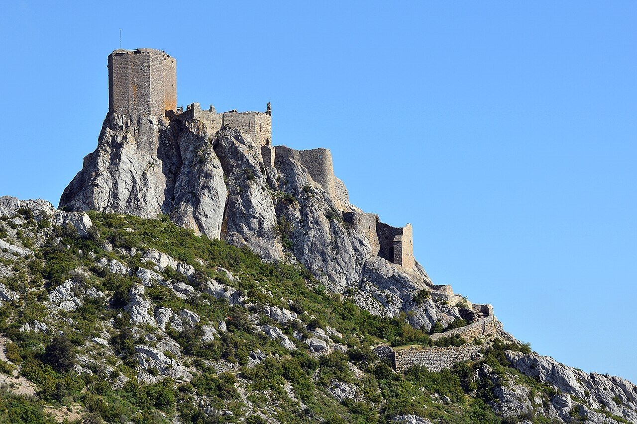
On the highest peak for miles around, at 728 metres, the castle of Quéribus rises from a limestone ridge above the vineyards of the Corbières and the Roussillon. After Montségur fell in 1244, it is sometimes called the last Cathar stronghold.
Its end, in 1255, was strange and quiet. A French army came against it, led by Olivier de Termes, the son of the lord of Termes, once a Cathar knight himself. The castle’s defender, Chabert de Barbaira, had been his friend. Quéribus surrendered without a fight, in circumstances that are still unclear: Chabert may have been tricked, or he may have made a deal. Either way, the last Cathar castle fell, and the long war was over.
In the Field Guide: the castle’s great hall, the walk along the ridge, the village of Cucugnan below, and the Corbières wines grown around it.
When: April to October. On windy days, the ridge can be closed for safety. Weather at Quéribus: a Mediterranean climate with strong winds. Summer days are hot in the vineyards below, but the summit is exposed and often very windy all year. Getting there: about 45 minutes by car from Perpignan, or about 1 hour 30 minutes from Carcassonne.
Beyond the map
The Cathars left no cathedrals, no tombs and very few books. Their story was written by the crusaders and the Inquisition who destroyed them. What remains are the places: a village in a gorge where 140 people chose the fire, a mountain castle that held out until the rain, four towers on a single ridge, a fortress where the hunted found shelter, and a castle in the sky where it all ended. Walk up to them on a windy morning, and the Languedoc’s long, painful memory feels very close.
Cathar Country — a Beyond the Map Field Guide
[Cathar Country — The Beyond the Map Field Guide]
The five places in this article are only the beginning. The Field Guide takes you through the whole of Cathar Country:
- The five sites in detail, with paths, opening times and the best times to visit
- Peyrepertuse and Aguilar: two more of the “five sons of Carcassonne”, the royal frontier fortresses, with other castles of the Corbières
- Montségur and Roquefixade, on their cliffs in the Ariège
- Fanjeaux and Montréal, where the preaching against the Cathars began
- Béziers and Carcassonne, 1209: where the crusade began
- The Cathar Way (Sentier Cathare), the long-distance trail between the castles
- A 5-day route from Carcassonne to Quéribus and the Ariège
- Offline maps and GPS points for every site
→ [Get the Field Guide]
Read next: Where the Templars Were · Where the Hospitallers Were · Europe’s Landscapes of Legend
Explore more: Trails · Military Heritage · Europe’s Most Beautiful, Beyond the Map