Until 2004, the village of Gásadalur on the western edge of Vágar Island in the Faroe Islands had no road connection to anywhere. The path over the mountain — a 3km trail across an exposed 400-metre pass above the North Atlantic — was the only route in or out. Three times a week, in every weather the Faroe Islands produces, the postman crossed that mountain with the mail. He was, in practical terms, the village’s only thread to the outside world.
- The geography — a village at the edge of everything
- The postman’s route — the walk that connected a village to the world
- Múlafossur: The Waterfall That Falls Directly Into the Atlantic → — the waterfall that falls off the edge of Europe
- The village — 16 people and what that means
- Getting there — the two ways
- How long to spend
- The adjacent destinations
- The practical foundation
- The editorial case
- The Faroe Islands collection in The Wanders
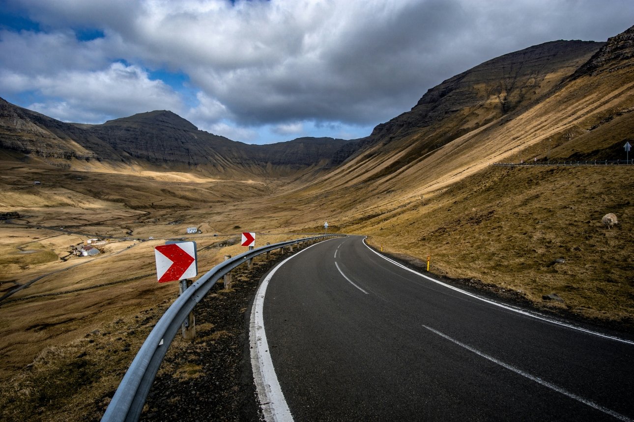
In 2004 the Faroese Parliament funded a tunnel through the mountain. The postman’s route became a hiking trail. Gásadalur — 16 permanent inhabitants, one waterfall, one café, a cluster of turf-roofed houses on a clifftop above the Atlantic — became reachable by car in fifteen minutes from the island’s main road.
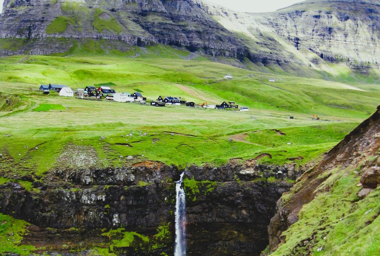
What the tunnel did not change: the waterfall still falls directly from the cliff into the ocean. The turf roofs are still green. The sheep still graze the same slopes the postman crossed three times a week for generations. The village is still, in every meaningful sense, the most extraordinary small settlement on an archipelago of extraordinary small settlements. The tunnel made it accessible. It did not make it ordinary.
The geography — a village at the edge of everything
Vágar is the westernmost inhabited island of the Faroe Islands, and Gásadalur is on the westernmost edge of Vágar — as far west as you can go in the Faroese archipelago before the next land is Canada. The village sits on a narrow shelf of green land above the sea cliffs of Mykinesfjørður, surrounded on three sides by the highest mountains on Vágar, the fourth side open to the Atlantic and the island of Mykines visible across the water.
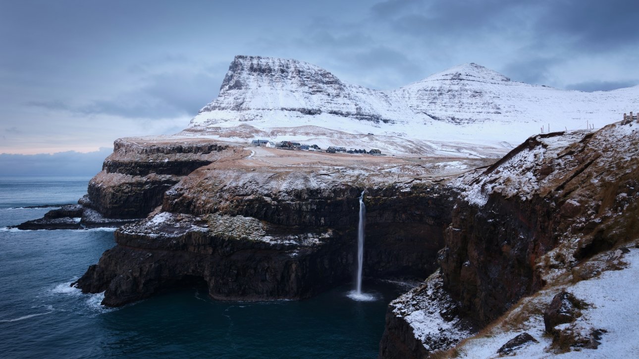
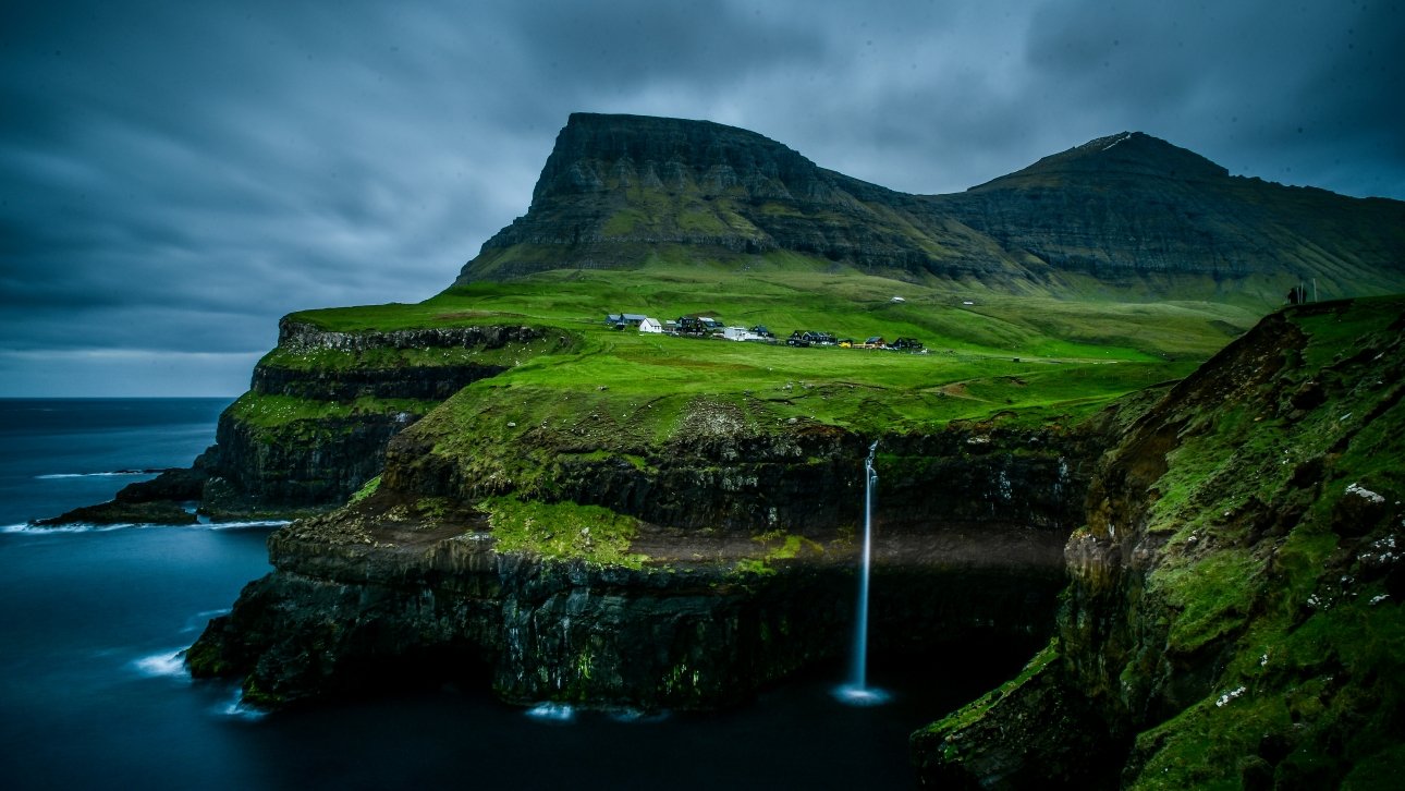
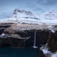
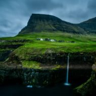
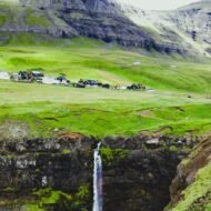
The Múlafossur Waterfall — the most extraordinary single natural feature in Gásadalur — drops from the cliff edge directly into the sea below the village, the water falling 40 metres from the plateau above before disappearing into the Atlantic in a single uninterrupted column. The combination of the waterfall, the cliff, the village and the ocean in a single frame is the most photographed image in the Faroe Islands and one of the most photographed natural compositions in Scandinavia.
But the photograph captures the scene without the context. The context is that 16 people live here, have always lived here, and that their connection to the rest of the archipelago — a tunnel that has existed for 22 years — is newer than many of the people using it to arrive.
The postman’s route — the walk that connected a village to the world
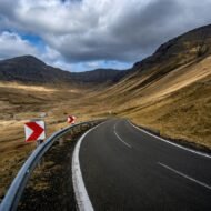
The old Bøur–Gásadalur trail crosses the mountain at approximately 400 metres above sea level. It is 3km long. It is steep, exposed and, in the weather the Faroe Islands produces with consistency — horizontal rain, wind that removes hats with conviction, cloud that settles on the pass for days without lifting — it is a serious proposition even in summer.
The postman crossed this trail three times a week. Not in summer only. In February. In November. In the extraordinary Faroese winter when the wind from the Atlantic reaches speeds that make standing upright a form of optimism.
The trail still exists. It is rated difficult by the Faroese hiking authorities — steep, exposed, with sections that require care in wet conditions. It covers the same 3km the postman covered. It takes approximately 1.5-2 hours one way for a fit walker in good conditions.
Walking it now is not a historical exercise. It is the most direct way of understanding what Gásadalur’s isolation actually meant — what it felt like to be on the village side of the mountain, looking across at the path disappearing into the cloud, knowing that everything that was not here already had to come over that pass.
The trail in practice:
Start:          Bøur village · 15 minutes drive from
                the tunnel entrance on the Vágar side
Trailhead:      Marked from the upper end of Bøur
Distance:       3km one way · 6km return
Elevation:      Approximately 400m gain from Bøur
Duration:       1.5-2 hours to Gásadalur
                · 1-1.5 hours return
Difficulty:     Rated difficult · exposed ridge section
                · steep descent to Gásadalur
Season:         Best June-August · possible May and
                September in good conditions
                · avoid in poor visibility or strong wind
Equipment:      Waterproof layers essential · walking
                boots · trekking poles recommended
                on the descent · do not attempt in fog
Return:         Return same way OR drive through tunnel
                (leave a car at each end)
The postman, for context, did this in the dark in February. In ordinary clothes. With the mail.
Múlafossur: The Waterfall That Falls Directly Into the Atlantic → — the waterfall that falls off the edge of Europe
Múlafossur is simultaneously the most photographed and most misrepresented natural feature in the Faroe Islands. Every article about the Faroe Islands leads with the photograph. Almost no article explains what actually makes it extraordinary.
The waterfall is not particularly large. At 40 metres it is modest by Faroese standards — the islands have waterfalls of greater height and greater volume. What makes Múlafossur extraordinary is its relationship to its setting: the water comes from the plateau above, crosses the village level, and falls directly off the cliff into the Atlantic without any intermediate landing. There is no beach below. No pool. No ledge. The water leaves the cliff and enters the ocean.
The visual result — waterfall, cliff, village, ocean, the island of Mykines on the horizon — in a single frame produces the specific quality of the most extraordinary landscape photographs: the feeling that the world has been arranged precisely for this moment.
The practical reality: the viewpoint is 3-4 minutes’ walk from the parking area. The path is clear. The best light is morning — the waterfall faces west-northwest, and morning light from the east catches the cliff face and the village without silhouetting the water. Afternoon is backlit. The standard photograph is taken from the same marked viewpoint. The less standard photograph requires walking five minutes further along the cliff path to the north — the angle from there shows the full cliff drop with the Atlantic beyond it in a composition that almost no published image has used.
Puffins from May to August: The cliff face to the left of the waterfall as you face it — the northern cliff section — has puffin colonies active from May to August. In the evening, when the puffins return from the sea, the birds are most visible and most active. Binoculars or a long lens are needed for close observation; the colony is on the cliff rather than at path level.
The village — 16 people and what that means
Gásadalur has 16 permanent inhabitants according to the 2025 population register. This figure has been declining steadily for decades — the tunnel that connected the village to Vágar has not reversed the population trend that isolation produced. The young leave for Tórshavn: Europe’s Smallest Capital With a Viking Parliament → or further. The old remain.
The houses are traditional Faroese construction — timber frames, corrugated iron or painted wood cladding, turf roofs that turn green in spring and brown at the edge of winter. The turf roof is not an aesthetic choice. It is the most effective insulation available in an archipelago where the wind carries rain horizontally for significant portions of the year. The houses face away from the prevailing Atlantic wind in angles that the builders understood intuitively across generations.
The village has one café — Gásadalsgarður — serving locally sourced food and Faroese coffee in a building that also functions as a guesthouse. It is the only commercial establishment in Gásadalur. It was described in a recent Tripadvisor review as genuinely good, particularly the locally sourced menu. It is not open every day. Check before arriving.
The cemetery above the village contains stones that show the family continuity of Gásadalur across several generations — the same surnames, the same family lines, the weather-worn lettering that marks the graves of people for whom the postman’s trail was not a hiking experience but the practical connection between their life and the rest of the world.
Getting there — the two ways
By tunnel (the easy way):
From Vágar Airport:   15-20 minutes by car
                      Drive west through Sørvágur and Bøur
                      Follow signs to Gásadalur tunnel
                      The tunnel is narrow — follow
                      priority, lighting and passing-place
                      signs carefully
                      Final approach through the mountain
                      takes approximately 3 minutes

Parking:              Small parking area at the village
                      entrance · fills quickly in summer
                      Arrive before 10 AM or after 5 PM
                      to find space reliably

By bus (limited):     Route 350 from Sørvágur in 2026
                      has limited weekday service
                      listed only through August 28
                      Check current timetable at
                      ssl.fo before travelling
                      Car hire or taxi strongly recommended

Taxi from airport:    Approximately 15-20 minutes ·
                      arrange in advance at Vágar Airport
By trail (the postman’s way):
From Bøur village:    Park in Bøur · walk the old
                      mountain trail over the pass ·
                      arrange collection by car from
                      Gásadalur OR return same way
                      The trail is the more rewarding
                      approach in good conditions
                      The tunnel is the only option
                      in poor weather
How long to spend
Minimum:    45-90 minutes for the viewpoint and
            village walk — enough for the photograph
            and a brief sense of the place

Recommended: Half a day — the viewpoint in morning
             light, the village lanes, lunch at
             Gásadalsgarður, the cemetery walk,
             the beginning of the postman's trail
             above the village

Full day:    Add the complete postman's trail from
             Bøur (3 hours return) or the boat to
             Mykines from Sørvágur (the adjacent
             island with the most extraordinary
             puffin colony in the Faroe Islands)

With accommodation: Stay at Múlafossur Cottages
                    adjacent to the waterfall
                    The village in the evening after
                    day visitors have left — the most
                    extraordinary version of Gásadalur
                    available — is worth the extra night
The adjacent destinations
Bøur: The Faroese Village Above the Floating Lake → The village at the start of the postman’s trail — extraordinary Faroese traditional architecture, the most photographed view of the Sorvágsvatn lake from above (the optical illusion that makes the lake appear to float above the ocean — one of the most extraordinary landscape illusions in the North Atlantic), and the departure point for the Gásadalur trail. 15 minutes from Gásadalur by car.
Sørvágur: The main settlement on western Vágar — the departure point for the Mykines ferry (seasonal, pre-booking essential), the nearest shops and services to Gásadalur. 15-20 minutes by car.
Sørvágsvatn / Leitisvatn: The largest lake in the Faroe Islands, 5km from Gásadalur — the famous cliff-edge view where the lake appears to float above the sea is the most visited single viewpoint in the archipelago. The walk from the road to the viewpoint takes 40-50 minutes. The extraordinary optical illusion is real and extraordinary from the correct angle.
Mykines: The westernmost inhabited island of the Faroe Islands — a boat journey of approximately 45 minutes from Sørvágur in season, the most important puffin nesting site in the archipelago, with extraordinary lighthouse at the end of an extraordinary suspension bridge above the sea. Accessible only by boat (seasonal) or helicopter. Pre-booking essential — the island limits daily visitors. For the most remote lighthouse experience in the archipelago, Kallur Lighthouse: The Most Remote Headland in the Faroe Islands → on Kalsoy island is a separate extraordinary day from Gásadalur.
The practical foundation
Best season:   June-August for the waterfall at
               maximum flow and puffin activity
               September for extraordinary light
               and the beginning of autumn colour
               on the surrounding mountains

Weather:       The Faroe Islands produces weather
               with no seasonal guarantee
               Rain and wind are possible in every
               month including July
               The waterfall is more spectacular
               after rainfall
               Dress for the worst and appreciate
               the best

Accommodation: Múlafossur Cottages — by the
               waterfall · the most extraordinary
               position of any accommodation
               in western Vágar · book months
               ahead for summer
               Gásadalsgarður guesthouse — in
               the village centre · limited rooms

Getting to     Copenhagen or Reykjavik → Vágar
the Faroes:    Airport (Atlantic Airways)
               Edinburgh, Oslo, Bergen direct
               seasonal connections
               The Faroes require a specific
               decision to visit — they reward it

Currency:      Danish Krone (DKK)
               Cards accepted everywhere
               No need for cash in Gásadalur

Language:      Faroese · Danish widely understood
               English spoken by most Faroese
               under 50
The editorial case
Gásadalur appears in the 2026 European Best Destinations ranking and in the most recent Travel and Tour World hidden village list. This means the editorial window — the period during which The Wanders can be the definitive English source before the standard travel press arrives — is approximately twelve months.
The photographs exist everywhere. The extraordinary waterfall image has been published ten thousand times. What has not been published is the specific story: the postman crossing the mountain three times a week until 2004, the 16 permanent inhabitants of a village where the isolation ended in living memory, the turf roofs facing away from the Atlantic in positions the builders understood without instruction, the cemetery stones of the families who never left.
That is the Wanders article. Not the waterfall. The village.
The Faroe Islands collection in The Wanders
Bøur: The Faroese Village Above the Floating Lake → — the optical illusion lake · the departure point for the postman’s trail Gjógv: The Faroe Islands Village With a Gorge for a Harbour → — the most dramatically positioned village gorge in the archipelago Múlafossur: The Waterfall That Falls Directly Into the Atlantic → — the complete photography guide to the most photographed waterfall in the Faroes Enniberg: Where the Faroe Islands Drop 754 Metres Into the Sea → — the highest sea cliff in the archipelago Kallur Lighthouse: The Most Remote Headland in the Faroe Islands → — the 90-minute walk to Kalsoy’s northern tip Eysturoy: The Faroe Islands Island With an Underwater Roundabout → — the second largest island · Gjógv · the world’s first undersea roundabout junction Tórshavn: Europe’s Smallest Capital With a Viking Parliament → — the capital · the Løgting · the most compact capital city in Europe
Gásadalur is a destination in The Wanders Wild Europe collection and The Village Collection — extraordinary European communities documented beyond the standard travel itinerary.