

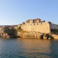
Five Mediterranean places few travellers know, where pirates once ruled the sea lanes: a river gorge on the Dalmatian coast, an island that defied Venice, the most feared pirate town of the Adriatic, the tower villages of the Mani, and a fortress island above a turquoise lagoon in Crete.
For most of its history, the Mediterranean was not a peaceful holiday sea. Merchant ships carried silk, wine, grain and silver along its coasts, and wherever there were ships, there were men waiting to take them. Some were outlaws. Some were local lords who called it a toll. Some were rebels with nowhere else to turn. Venice, Dubrovnik, the Pope and the Ottoman sultans all tried to stop them, and for centuries, all of them failed.
The pirates chose their bases carefully: a river mouth that big ships could not enter, a remote island, a rocky peninsula with no roads, a fortress on a cliff. Many of those places are still hard to reach, and that is why they are still quiet.
- Omiš, Croatia: the river fortress of the Kačić pirates
- Lastovo, Croatia: the island that still burns a pirate’s messenger every Shrove Tuesday
- Ulcinj, Montenegro: the pirate capital of the Adriatic
- The Mani, Greece: pirates, priests and tower houses
- Gramvousa, Greece: a pirate fortress above Balos lagoon
1. Omiš, Croatia
43.44° N, 16.69° E · Central Dalmatia, at the mouth of the Cetina
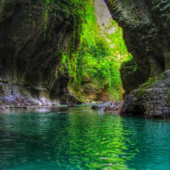
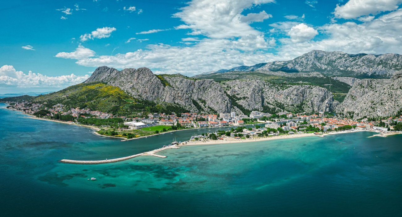
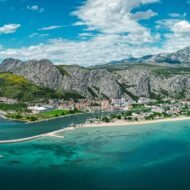
Between Split and Makarska, the river Cetina breaks through a wall of limestone and reaches the sea. At its mouth, wedged between the cliffs and the water, lies the small town of Omiš. In the 12th and 13th centuries, this was one of the most feared places on the Adriatic.
The pirates of Omiš, led by the Kačić family, controlled much of the sea between Omiš and Dubrovnik. They raided merchant ships from Split, Kotor, Dubrovnik and Venice, and even papal galleys. Their secret was the river: their fast, shallow boats, the “arrows of Omiš”, could escape up the Cetina, where heavier warships could not follow. It is said that the pirates built an underwater wall across the river with a single passage, so that any enemy who followed would wreck his ship. Venice is believed to have paid for safe passage, and when the pirates attacked ships carrying Crusaders, the Pope turned against them too.
They were finally defeated by Venice in 1287. High above the town, the Mirabella fortress, built by the Kačić family in the 13th century, still watches the river mouth, and the Starigrad fortress (also known as Fortica) stands on the ridge above, about an hour’s climb.
Missing Coordinates Highlights
- Mirabella fortress, the pirates’ lookout above the river mouth
- The climb to Starigrad for views over the Cetina and the islands
- The Cetina canyon, for rafting, kayaking and swimming
- A re-enactment of the battle for Omiš, staged each August
When: May to October; June and September for warm sea without the August crowds. Weather in Omiš: summers are hot, with average highs of about 30°C in July and a sea temperature of around 24°C. In September, it is about 25°C with the sea still at 22°C. October brings more rain; November is the wettest month. Getting there: about 30 minutes by car from Split, along the coastal road. Buses run between Split and Makarska.
2. Lastovo, Croatia
42.77° N, 16.90° E · Lastovo Islands Nature Park, southern Dalmatia
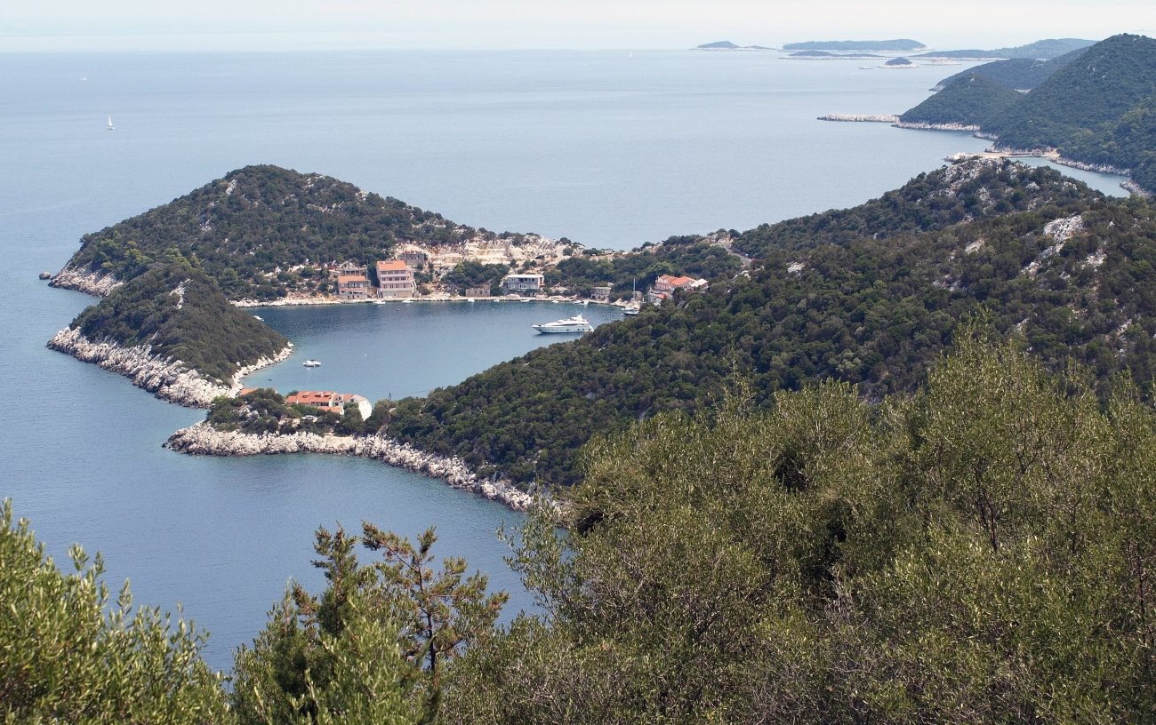
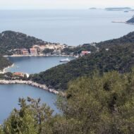
Lastovo is one of the most remote inhabited islands in Croatia, far out in the Adriatic beyond Korčula. Its isolation has always been its strength, and in the year 1000, it made it a target.
That spring, the Venetian doge Pietro II Orseolo sailed down the Dalmatian coast to take control of its cities and of the lands of the Narentines, whose sailors had long preyed on Venetian shipping. Lastovo refused to surrender. Its people waited behind their walls until the Venetians broke in and seized the tower with the town’s water cistern. The doge spared their lives, but he destroyed the walls and burned the town, and the islanders moved to the other side of the island, where Lastovo village stands today.
Pirates still live in Lastovo’s memory. Every year, the island celebrates the Poklad, its carnival, based on a legend of Catalan pirates who sent a messenger to demand the island’s surrender. A storm destroyed the pirates’ fleet, and the islanders captured the messenger. On Shrove Tuesday, a straw figure of him, dressed in red, slides three times down a rope more than 300 metres long above the village, before it is burned in front of the parish church.
→ Read more: Lastovo: The Croatian Island That Chose Not to Be Found · Dalmatia: The Route Beyond Hvar
Missing Coordinates Highlights
- The Poklad carnival, with its rope ride and sword dance
- Lastovo village, with its unusual tall chimneys, the fumari
- The Lastovo Islands Nature Park, one of the youngest in Croatia
- Clear water and quiet bays, far from the busy islands
When: May to October for swimming and walking; the end of Carnival (February or early March) for the Poklad. Weather in Lastovo: one of the sunniest islands in Croatia, with up to 2,700 hours of sunshine a year. August averages about 25°C over day and night, with summer highs close to 28°C and the sea at around 25–26°C. Winters are mild, and most rain falls in winter. Getting there: by ferry or catamaran from Split, stopping at Hvar or Vela Luka on Korčula, to the port of Ubli; the catamaran takes about three hours. Check the current Jadrolinija timetable. Lastovo also makes a natural last stop on a Dalmatian island-hopping route.
3. Ulcinj, Montenegro
41.92° N, 19.20° E · Southern Montenegro, near the Albanian border
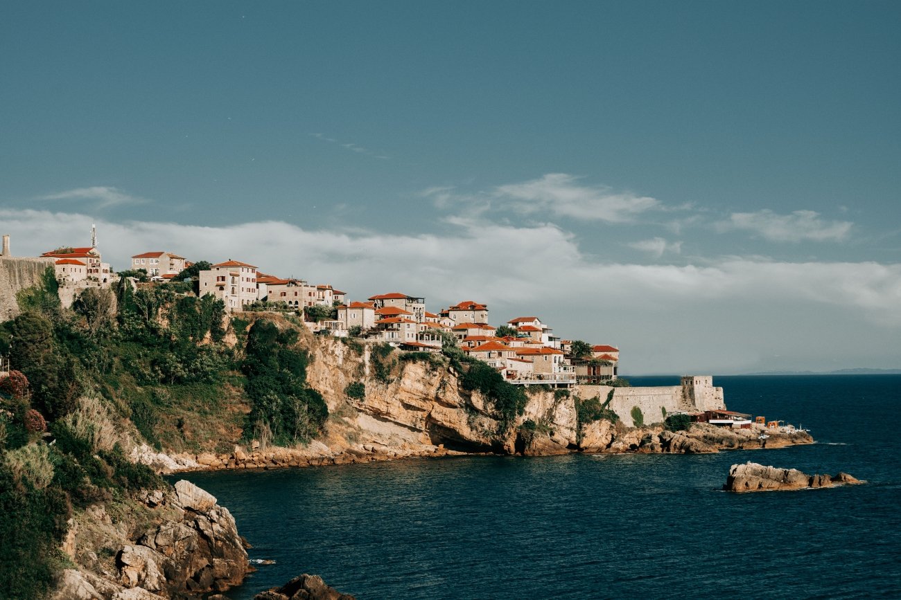
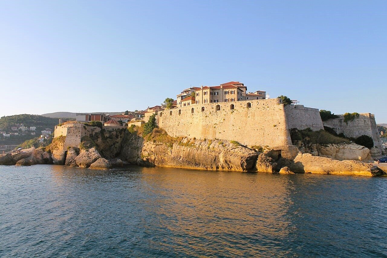
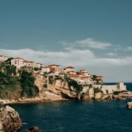
At the southern end of Montenegro’s coast, an old walled town stands on a rocky headland above the sea. For three centuries, Ulcinj was the pirate capital of the Adriatic.
The Ottomans took the town in 1571, but it remained a haven for pirates, Albanian, North African and others, who raided Venetian and other Christian ships across the Adriatic and beyond. By the end of the 16th century, around 400 pirates from Malta, Tunisia and Algeria were based here. Venice sent fleets against them again and again; in 1696, a Venetian attack on the town was driven off. The pirates often held captives for ransom or sold them into slavery, and their raids continued into the 19th century.
The town’s favourite story is about Miguel de Cervantes. In 1575, pirates captured the Spanish galley on which the future author of Don Quixote was sailing. Local legend says he was held in Ulcinj; most historians place his five years of captivity in Algiers. Either way, Ulcinj has never let go of the story.
Missing Coordinates Highlights
- The old town (Stari Grad) on its headland above the sea
- Sunset from the walls over the Adriatic
- Velika Plaža, the long sandy beach south of the town
- A mix of cultures: Montenegrin, Albanian, Ottoman and Venetian
When: May to October; June and September for warm water and fewer people. Weather in Ulcinj: one of the warmest corners of the Adriatic. Average highs are around 31°C in August and 27°C in September, with the sea at about 25°C in August and 23°C in September. October turns wetter, and November and December are the rainiest months. Getting there: by car from Podgorica or Tivat airports, or along the coast from Bar. Ulcinj is also a short drive from the Albanian border.
4. The Mani, Greece
36.67° N, 22.38° E · Areopoli and Inner Mani, Peloponnese
The middle finger of the Peloponnese, the Mani, is a peninsula of bare mountains, stone villages and tall stone towers. Its people, the Maniots, claimed descent from the ancient Spartans, and they boasted that no invader, Frankish or Ottoman, had ever truly conquered them.
They lived from the sea in a harder way, too. Into at least the 18th century, piracy was one of the main sources of income in the Mani, especially in the barren Inner Mani. Travellers described how ships anchored off the coast were lured to land, their crews seized and held for ransom. It was said that priests blessed the raiding boats before they set out, and sometimes sailed with them.
At home, Maniot families fought long blood feuds, and built the tower houses that still stand in villages like Vathia: tall, narrow fortresses where a family could lock itself in for months. Below them, small harbours such as Limeni and Gerolimenas hide in coves that once suited boats which did not want to be seen. All feuds stopped when the Turks threatened, and in March 1821, the Maniot clans under the Mavromichalis family declared war on the Ottoman Empire, at the start of the Greek War of Independence.
→ Read more: Limeni: The Mani Village Built at the Waterline · Gerolimenas: The Mani Peninsula’s Hidden Fishing Village · Cape Matapan
Missing Coordinates Highlights
- The tower village of Vathia, above the sea
- Areopoli, the stone-built capital of the Mani
- Limeni, a tiny harbour of stone houses and clear water
- Gerolimenas, a hidden fishing village below the cliffs of Inner Mani
- Cape Matapan, the southern tip of mainland Greece, at the end of the peninsula
- The Diros caves, explored by boat on an underground river
- Byzantine churches hidden in the hills
When: April to June, and September to October, for walking, swimming and wildflowers; July and August are very hot. Weather in the Mani: dry, hot summers, with average highs of about 31°C in July and August, and the sea at around 26°C in August. September is still about 28°C with a 24°C sea, and October stays warm at around 24°C, with the first autumn rain. Getting there: about four hours by car from Athens, or around an hour and a half from Kalamata airport.
5. Gramvousa, Greece
35.62° N, 23.58° E · Gramvousa peninsula, north-west Crete
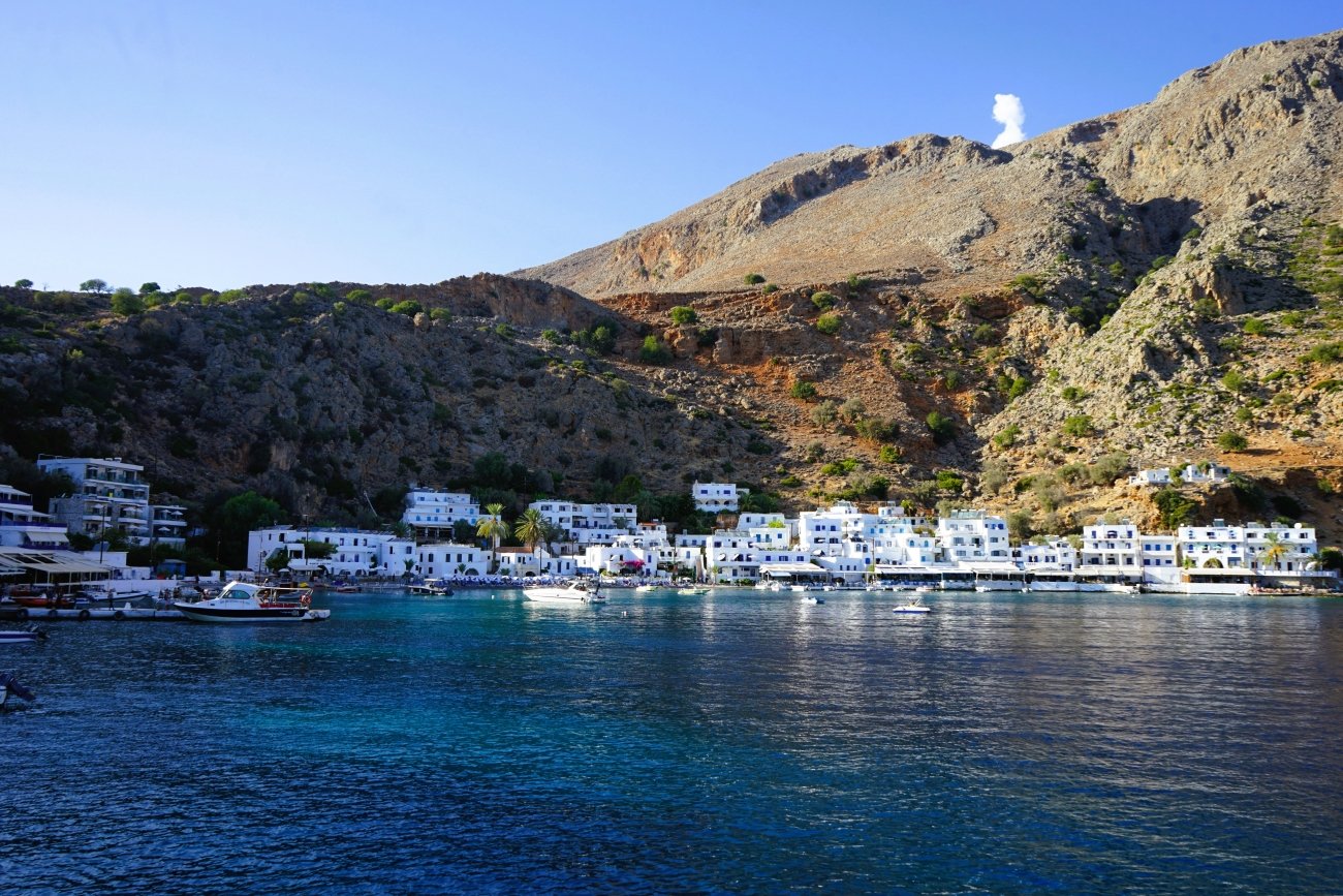
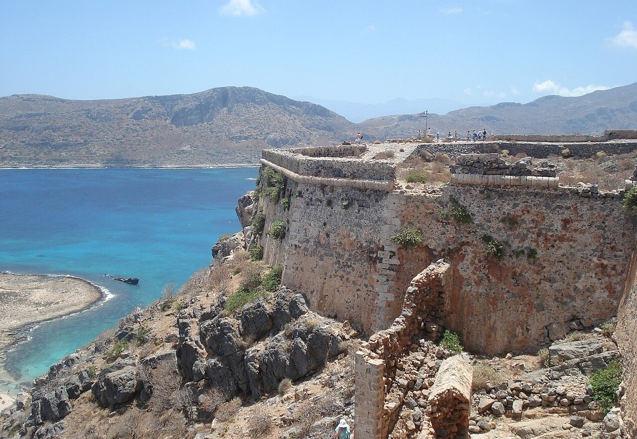
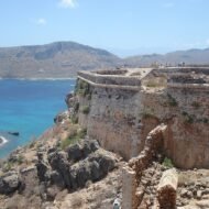
At the far north-western tip of Crete, the Gramvousa peninsula ends in two small islands. On the cliffs of one of them, Imeri Gramvousa, stands a Venetian fortress, built between 1579 and 1584 to guard the sea route around Crete. Below it lies one of the most photographed places in Greece: the turquoise lagoon of Balos.
In 1691, the fortress was betrayed to the Ottomans. Then, on 9 August 1825, during the Greek War of Independence, Cretan rebels disguised as Turks slipped inside and took it. Trapped on their island and short of food, the rebels turned to piracy, and Gramvousa became one of the most notorious pirate bases in the eastern Mediterranean. In 1828, a Greek expedition with British and French ships destroyed the pirate fleet, and the fortress came under British control.
Today, the boats that reach Gramvousa carry visitors, not pirates. Most people go for Balos. Few climb the path to the fortress, where the walls still look out over the same sea the pirates once watched.
Missing Coordinates Highlights
- The climb to the Venetian fortress, with views over Balos
- The shipwreck in the bay below the island
- Balos lagoon, best in the early morning or late afternoon
- The wild, roadless Gramvousa peninsula
When: May to October, when the boats run; June and September for warm water and calmer crowds. Weather in Gramvousa: hot and dry summers, with highs of about 30°C in July and August and a sea of 25–27°C. September is still around 27°C with a 26°C sea. This corner of Crete is often windy, so the sea can be rough, and boat trips may be cancelled. Getting there: daily boat trips run in season from the port of Kissamos, about 40 minutes by car from Chania. Balos can also be reached on foot by a dirt road and path, but Gramvousa island only by boat.
Beyond the map
The pirates of the Mediterranean are often told as adventure stories, but their history is more complicated. Some were bandits, some were lords collecting tolls, some were rebels fighting a war. What they shared was geography: a river gorge, a far island, a roadless peninsula, a fortress on a cliff. Those places kept them safe for centuries.
They still keep something. In Omiš, the Mirabella fortress watches the river mouth. On Lastovo, the pirate’s messenger rides the rope every Shrove Tuesday. In Ulcinj, the old town still stands on its headland. In the Mani, the towers still rise above the sea. And on Gramvousa, the fortress still guards a lagoon that is now famous for very different reasons.
Read next: Europe’s Forgotten Harbours · Where Europe Is Still Warm in November · Getting Around Greece (update with the published URLs)
Carry the journey with you: Beyond the Map Field Guides
Overland & Campervan in the Balkans — The Beyond the Map Road Guide For travellers driving the Adriatic coast, from Dalmatia to Montenegro and Albania.
Hidden Europe — The Beyond the Map Map Every pirate hideout in this article, and hundreds more places, on one map of the Europe most travellers never see.
Explore more: Europe’s Missing Coordinates · Military Heritage · Terra Incognita