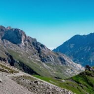
The Picos de Europa were named by sailors. The limestone peaks of the Cantabrian coast were the first European land visible to ships crossing the Atlantic from America — the Peaks of Europe appearing on the horizon before the sailors could see Spain, before they could see Asturias or Cantabria, before any administrative boundary was relevant. The mountains named themselves after the experience of arrival rather than the political territory they occupied.
- The geography — three massifs above the Atlantic
- The national park
- The Cares Trail — the Divine Gorge
- The villages
- Bulnes — the underground approach
- Cangas de Onís — the western gateway
- Sotres — the highest village
- Arenas de Cabrales — the cheese capital
- The history — Covadonga and the Reconquista
- The eastern approach — Potes and the Liébana valley
- The cave systems
- The church of Santa María de Lebeña
- How to reach the Picos de Europa
- The Picos de Europa collection in The Wanders
- The Beyond the Map Field Guide
- Also in the Beyond the Map Regional Series
That naming logic is still the most accurate description of the Picos de Europa as a regional entity. The mountains occupy three Spanish autonomous communities — Asturias to the north, Cantabria to the northeast and Castile and León to the south — and the three communities approach the same extraordinary limestone massif from completely different directions, with completely different landscapes, completely different cultures and completely different practical access routes. But the mountains are one territory. The Picos de Europa National Park — the first national park established in Spain, designated on the Asturian side in 1918, expanded to its current 64,000 hectares crossing all three regions in 1995 — recognises this unity explicitly. The administration of three regions covers one extraordinary landscape.
The Picos are not famous internationally in the way that the Pyrenees are famous. They receive a fraction of the international visitors that the more photogenic Spanish mountain ranges attract. This is the most commercially exploitable editorial gap in the Spanish mountain landscape — an extraordinary range of three massifs, 300 caves, the most dramatic gorge walk in Spain, the most extraordinary traditional blue cheese in Europe and one of the most historically significant sites of the medieval Christian world, covered almost entirely in Spanish-language walking guides and almost not at all in quality English-language travel editorial.
The geography — three massifs above the Atlantic
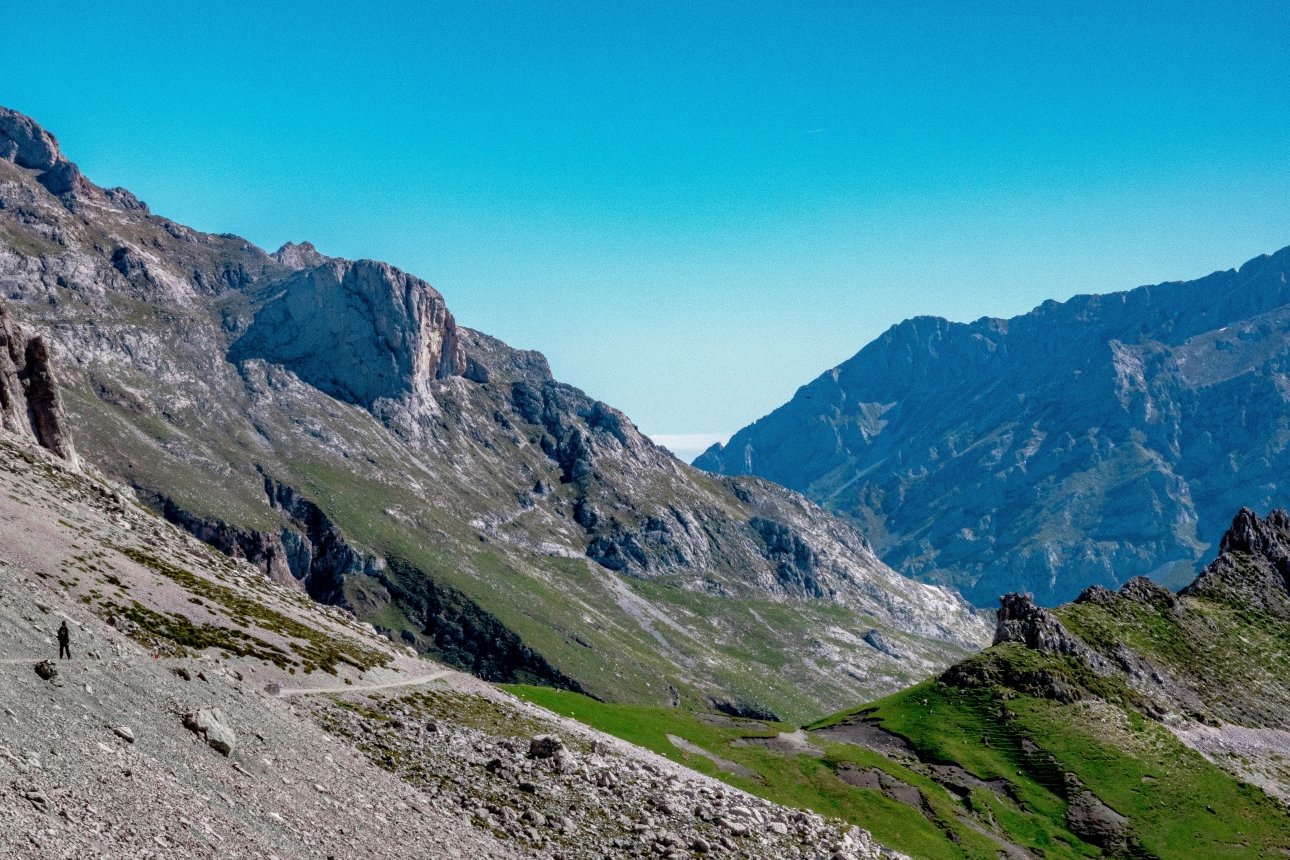
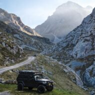
The Picos de Europa extend approximately 40km east to west and 25km north to south in the Cantabrian Mountains — a compact territory of extraordinary vertical drama, the limestone peaks rising to 2,648 metres at the Torre de Cerredo within 15km of the Cantabrian Sea coast. No mountain range in Europe of comparable altitude sits so close to a coastline — the extraordinary proximity of the high peaks to the Atlantic produces the extraordinary weather that shapes the Picos character: the extraordinary humidity, the extraordinary mist that descends on the peaks within hours of clear weather, the extraordinary green of the lower valleys fed by the extraordinary rainfall that the Atlantic depression systems deliver.
The three massifs:
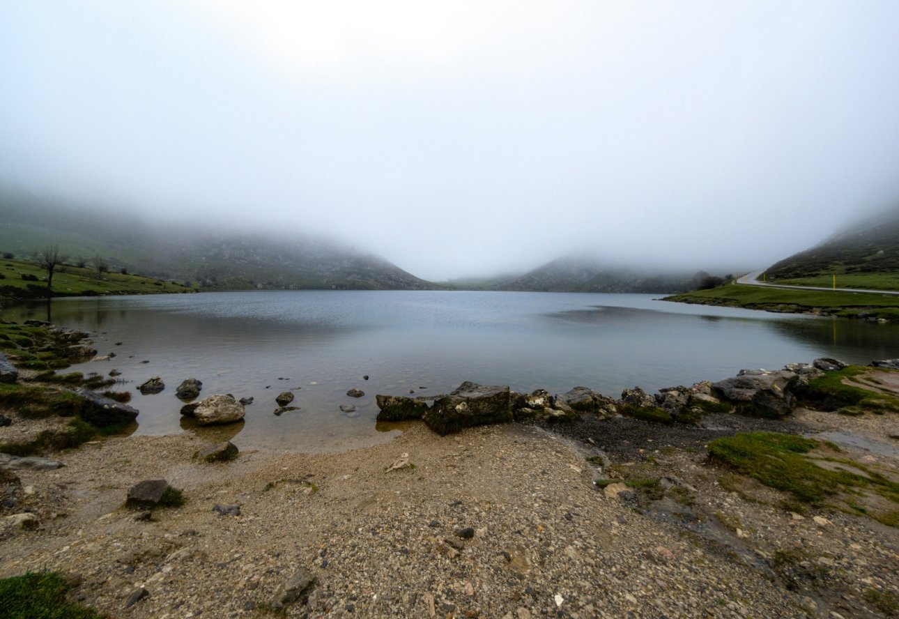
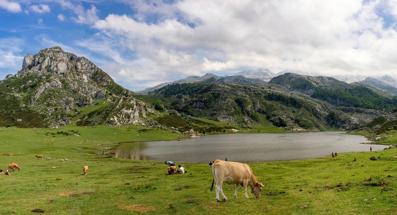
The Western Massif — El Cornión — the most accessible from Cangas de Onís and the Covadonga approach. The extraordinary Lagos de Covadonga — the Enol and Ercina lakes — sit in this massif at 1,070 metres, the most visited single destination in the Picos. The extraordinary karst landscape of the western plateau.
The Central Massif — Los Urrieles — the most dramatic. The Torre de Cerredo at 2,648 metres, the highest peak in the Picos. The extraordinary Naranjo de Bulnes — Picu Urriellu — at 2,519 metres, the most iconic peak in the Picos, its extraordinary vertical south face one of the most important rock climbing challenges in Spain. The Cares Gorge on the northern boundary.
The Eastern Massif — Andara — the least visited and most remote. The approach from Potes and the Liébana valley in Cantabria. The extraordinary cave systems — the composite of the Sima de la Cornisa and Torca Magali caves reaching 1,507 metres depth, one of the deepest cave systems in Spain.
The national park
Picos de Europa: The Mountains First Seen From the Atlantic →
The Picos de Europa National Park covers 64,660 hectares across Asturias, Cantabria and Castile and León — the most complete mountain national park in northern Spain and the first national park in Spain by designation. The extraordinary diversity of the protected territory: the extraordinary beech and oak forest of the lower slopes, the extraordinary alpine meadows of the middle elevations, the extraordinary limestone karst of the high plateau, the extraordinary rock faces of the three massifs and the extraordinary cave systems beneath the limestone. Brown bears and wolves live in the park — the most significant populations in the Cantabrian Mountains and the most important for the long-term recovery of both species in Spain.
The Cares Trail — the Divine Gorge
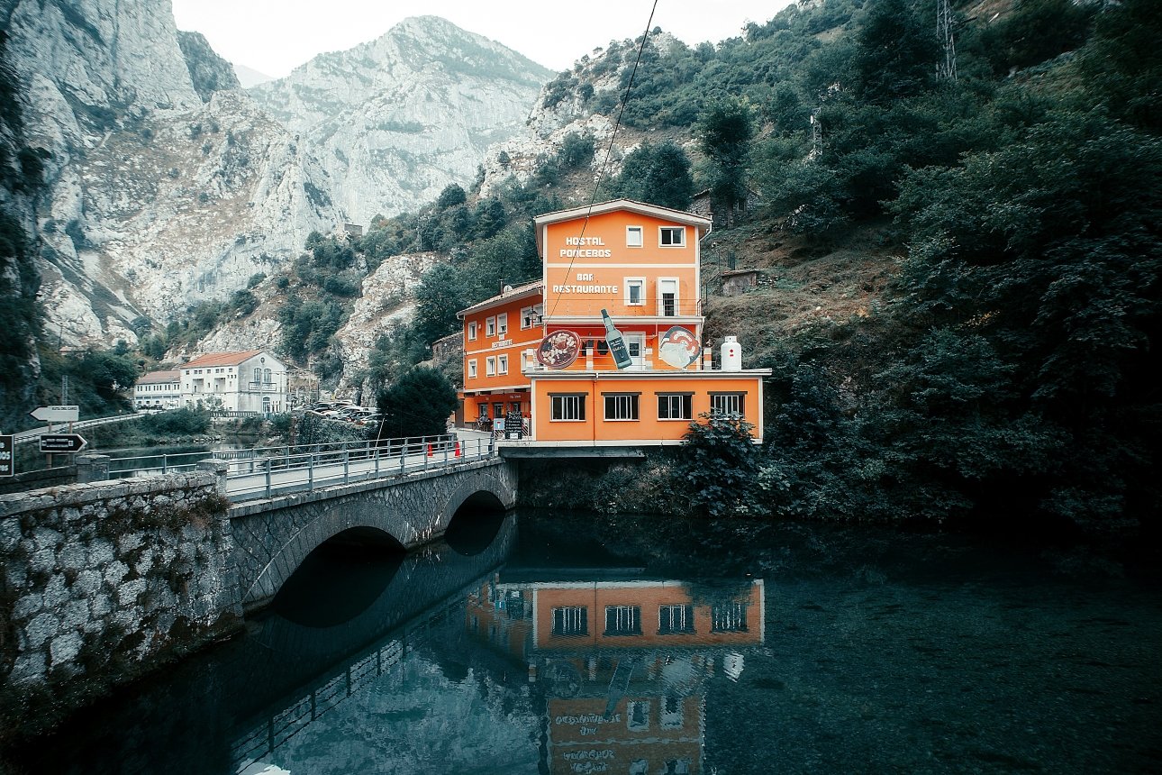
The Ruta del Cares — the Cares Trail — is the most famous walk in northern Spain and one of the most extraordinary gorge walks in Europe. The path runs for 12km along the Cares River through the extraordinary gorge called La Garganta Divina — the Divine Gorge — where the limestone walls rise 1,000 metres above the river in a passage of extraordinary geological drama. The path was built as a maintenance road for the Cares Canal irrigation system between 1916 and 1921, carved into the cliff face with extraordinary engineering determination, crossing the gorge on extraordinary bridges and passing through extraordinary tunnels cut directly through the limestone where the cliff face was impassable.
The walk runs between Caín in the south (Castile and León side) and Poncebos in the north (Asturias side) — 12km each way on a path that never rises above 450 metres despite the extraordinary 1,000-metre walls above. The most extraordinary single walk in the Cantabrian Mountains and the most completely extraordinary gorge experience in Spain.
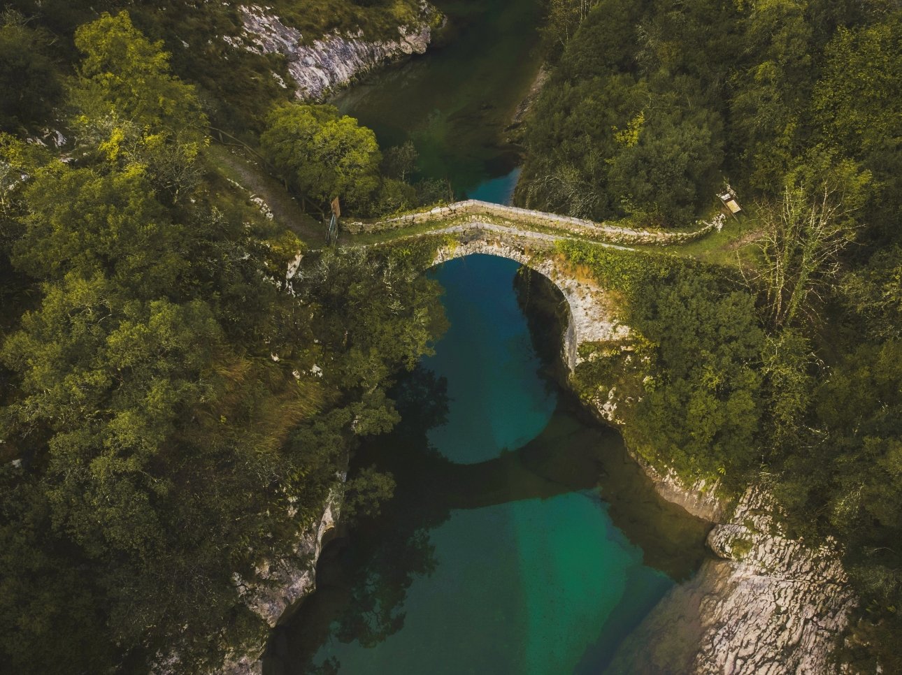
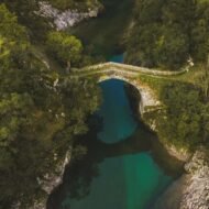
Puente de la Jaya: The Stone Bridge That Guards the Divine Gorge →
The medieval stone bridge over the Cares River at the southern entrance to the gorge — the most extraordinarily positioned medieval structure in the Picos territory and the threshold marker between the open Valdéon valley and the extraordinary enclosed world of the Divine Gorge beyond.
The villages
Bulnes — the underground approach
Bulnes: The Picos Village You Can Only Reach Underground →
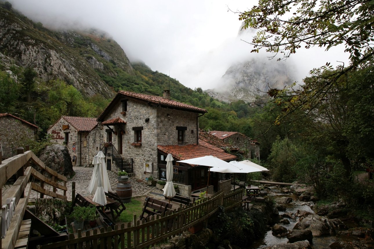
Bulnes is the most extraordinary isolated village in the Picos — a settlement of 40 permanent inhabitants in the heart of the Central Massif, accessible only by a 2.3km underground funicular tunnel from Poncebos bored through the mountain, or by a 1.5 hour footpath ascending 650 metres from the same starting point. No road reaches Bulnes. The village sits at 650 metres in the extraordinary shadow of the Naranjo de Bulnes — the most iconic peak in the Picos, whose extraordinary 550-metre vertical south face rises directly above the village in one of the most dramatic mountain relationships between human settlement and limestone peak anywhere in the Cantabrian range.
The village is extraordinary in its completeness — the traditional Asturian stone architecture, the extraordinary mountain pastoral culture, the extraordinary silence of a community that has remained car-free not by choice but by geography. The funicular that now connects it to Poncebos was completed in 2001 — before that the footpath was the only access and the village was genuinely one of the most isolated inhabited communities in Spain.
Cangas de Onís — the western gateway
Cangas de Onís: The Town With a Roman Bridge That Isn’t Roman →
The main gateway town to the western Picos — a small city of extraordinary position at the confluence of the Sella and Güeña rivers, the first capital of the Kingdom of Asturias after the Reconquista began at Covadonga 12km to the southeast. The extraordinary Puente Romano — the Roman Bridge — is medieval rather than Roman despite its name, its extraordinary single arch spanning the Sella in a form of extraordinary precision that the medieval builders achieved without Roman engineering support. The most important practical base for the western Picos with the most complete infrastructure and the most straightforward access to Covadonga and the Lagos.
Sotres — the highest village
Sotres is the highest permanently inhabited village in the Picos de Europa at 1,050 metres — an extraordinary mountain community in the municipality of Cabrales on the Asturian side, accessible by road through extraordinary mountain scenery from Arenas de Cabrales. The most completely alpine experience available in the Picos — extraordinary stone architecture, extraordinary mountain views, extraordinary walking territory in every direction from the village. The most authentic base for the high mountain experience of the Central Massif.
Arenas de Cabrales — the cheese capital
Arenas de Cabrales is the principal village of the Cabrales municipality and the capital of the most extraordinary blue cheese tradition in Europe. Cabrales cheese — Queso de Cabrales — is a raw milk blue cheese aged in the natural limestone caves of the Picos de Europa, the extraordinary humidity and the extraordinary fungal culture of the cave air producing a cheese of extraordinary pungency, extraordinary complexity and extraordinary commercial value. The cheese is produced by a small number of traditional farmhouse producers using milk from cattle, sheep and goats grazed on the extraordinary mountain pastures, matured in the caves for two to four months before sale.
The extraordinary Cueva del Queso — the cheese cave museum near Arenas de Cabrales — allows visitors to experience the extraordinary cave aging environment and understand the extraordinary microbiological complexity of the Cabrales production tradition.
The history — Covadonga and the Reconquista
Covadonga: Where the Reconquista Began in 722 AD →
Covadonga is the most historically significant site in the Picos de Europa and one of the most important in Spanish history — the valley 12km southeast of Cangas de Onís where the Asturian leader Pelayo defeated a Moorish force in 722 AD in the battle that established the Kingdom of Asturias and began the 700-year process of the Reconquista — the Christian recovery of the Iberian Peninsula from Moorish rule.
The extraordinary Santa Cueva — the Holy Cave — is the physical site of the battle’s commemoration, a natural cave in the extraordinary limestone cliff above the Deva River containing the revered image of the Virgin of Covadonga, the patron of Asturias. The extraordinary neo-Romanesque Basilica of Covadonga above the cave — built between 1877 and 1901 in a pink granite of extraordinary colour against the green of the Picos landscape — is visible from extraordinary distances across the valley, its two towers dominating the extraordinary mountain approach road.
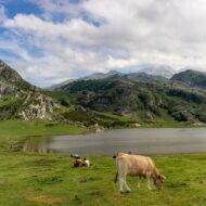
The Lagos de Covadonga — the Enol and Ercina lakes 12km above the sanctuary — are the most visited natural sites in the western Picos, their extraordinary position in the high karst plateau above the treeline creating a landscape of remarkable openness above the extraordinary enclosed world of the mountain valleys below.
The eastern approach — Potes and the Liébana valley
Potes is the most important town on the eastern side of the Picos — the capital of the Comarca Liébana in Cantabria, at the confluence of four valleys at 291 metres altitude in the most sheltered and most climatically extraordinary position in the Cantabrian Mountains. The extraordinary Mediterranean microclimate of the Liébana valley — produced by the extraordinary rain shadow of the Picos massif to the north — allows the production of wine, cherries and walnuts in a mountain territory surrounded by the most Atlantic-facing landscape in northern Spain. The extraordinary Monastery of Santo Toribio de Liébana — claiming to possess the largest fragment of the True Cross in existence — gives Potes an extraordinary religious heritage dimension alongside its extraordinary landscape position.
Fuente Dé — 25km west of Potes at the head of the Liébana valley — is the most dramatic approach to the high Picos from the Cantabrian side. The extraordinary cable car from Fuente Dé at 1,070 metres rises 753 metres in 4 minutes to the extraordinary plateau at 1,823 metres — the most dramatic single mechanical ascent in the Picos and the most complete introduction to the extraordinary high karst landscape of the Central Massif.
The cave systems
The Picos de Europa limestone contains approximately 300 mapped caves — the most significant cave system concentration in northern Spain. The composite of the Sima de la Cornisa and Torca Magali caves reaches 1,507 metres depth — one of the deepest cave systems in Spain, its entrance only 2km from the Fuente Dé cable car station. The extraordinary Karst Museum in Santillán documents the extraordinary cave archaeology of the Picos — the flint axes, the animal remains and the extraordinary evidence of prehistoric human habitation in the cave systems of the limestone massif.
The church of Santa María de Lebeña
The Church of Santa María de Lebeña in the Liébana valley — 15km west of Potes — is the most extraordinary pre-Romanesque church in northern Spain and one of the most important surviving examples of Mozarabic architecture in Europe. Built in the 10th century by Mozarabic craftsmen — Christians who had lived under Moorish rule and absorbed the extraordinary Islamic architectural vocabulary of Al-Andalus — the church combines the Visigothic column capitals, the extraordinary horseshoe arches and the extraordinary geometric decoration of the Mozarabic tradition in a small rural church of remarkable completeness. Declared a National Monument in 1893. The most extraordinary single building in the Picos de Europa territory.
How to reach the Picos de Europa
By air:    Asturias Airport (Oviedo) — 1.5 hours to Cangas
           Santander Airport — 1.5 hours to Potes
           Bilbao Airport — 2.5 hours to Potes

By train:  Madrid → Oviedo: 4.5 hours (Alvia)
           Best for the Asturian western approach

By car:    The recommended approach for all three sides
           Cangas de Onís: via A-8 from Santander or
           N-634 from Oviedo
           Potes: via N-621 from Santander
           Posada de Valdeón (Caín): via León and
           the extraordinary Puerto de Panderrueda pass

Best seasons:
June-July  Best walking weather · extraordinary wildflowers
           · Cares Trail at optimal conditions
September  Extraordinary light · reduced summer crowds
           · Cabrales cheese season beginning
October    Extraordinary autumn colour in the beech forests
           · extraordinary light · uncrowded
Spring     Extraordinary wildflowers in the lower valleys
           · snow still on the high peaks
The Picos de Europa collection in The Wanders
| Destination | Approach | Character | Article |
|---|---|---|---|
| Picos National Park | All three sides | Complete overview · first Atlantic mountains | Published |
| Covadonga | Western · Asturias | Reconquista 722 AD · sanctuary · lakes | Published |
| Cangas de Onís | Western · Asturias | Gateway town · Roman bridge that isn’t | Published |
| Bulnes | Central · Asturias | Underground funicular · 40 inhabitants · Naranjo | Published |
| Puente de la Jaya | Central · Cares | Medieval bridge · Divine Gorge entrance | Published |
| Cares Trail | Central | Most dramatic gorge walk in Spain | Commissioning |
| Potes | Eastern · Cantabria | Liébana valley · Mediterranean microclimate | Commissioning |
| Fuente Dé cable car | Eastern · Cantabria | 753m ascent · high karst plateau | Commissioning |
| Arenas de Cabrales | Central · Asturias | Extraordinary blue cheese · cave aging | Commissioning |
| Santa María de Lebeña | Eastern · Cantabria | Most extraordinary pre-Romanesque church | Commissioning |
| Sotres | Central · Asturias | Highest village · 1,050m · alpine | Commissioning |
The Beyond the Map Field Guide
The Picos de Europa: The Complete Beyond the Map Guide — €14
Three autonomous communities, one extraordinary limestone massif. The Cares Gorge, the Bulnes funicular, the Covadonga sanctuary, the Cabrales cheese caves, the Naranjo de Bulnes and the most extraordinary pre-Romanesque church in Spain. The complete editorial guide to the mountains that sailors named before they could see the shore.
Beyond the Map Regional Series →
Also in the Beyond the Map Regional Series
Transylvania: The Region That Dracula Overshadowed → Istria: Three Countries, One Venetian Coast → Bohemia: The Kingdom at the Heart of Europe → The Camargue: France’s Wild South →
The Picos de Europa are part of The Wanders Beyond the Map Regional Series — extraordinary European regions documented beyond the nation state boundaries that contain them.